The Photography of D L Ennis, and more!


Sunday, July 30, 2006

Visit the Claude Moore Colonial Farm


Time travel back to the 1700’s to see what life was really like for working farmers. Visit the Claude Moore Colonial Farm at Turkey Run in Northern Virginia where you will step into a living history museum that portrays family life on a small, low-income farm just prior to the Revolutionary War.

This from the National Park Service:


Claude Moore Colonial Farm is a living history site that demonstrates the life of a poor farm family living on a small farm in northern Virginia just prior to the American Revolutionary War. Today, agricultural and household activities seen on the Farm represent an earlier era when small farms were dispersed throughout the countryside; and, most Americans engaged in activities of an agricultural nature.

The farmer's property includes twelve acres planted with corn, tobacco, wheat, flax, rye, barley, a kitchen garden and an orchard. The fields are tilled, planted and cultivated by hand, applying basic principles of hoe agriculture. The farmer allows his livestock to roam freely, protecting valuable crops with split rail fencing. The small log house is used as the family dwelling, where meals are prepared over the hearth fire using food raised on the Farm. Clothing, furniture, tools, and equipment used by the Farm family are reproductions of 18th-century artifacts.

Staff and volunteers dressed in reproduction period clothes, work the farm, and answer your questions about the farm, livestock, and family, as if you were actually an 18th century visitor. The Farm is managed and operated by the Friends of Claude Moore Colonial Farm, at Turkey Run, Inc. through a cooperative agreement with the National Park Service, George Washington Memorial Parkway.


The Claude Moore Colonial Farm
6310 Georgetown Pike
McLean, VA 22101
703-442-7557

Park Open April through mid-December

Farm Hours: Wednesday - Sunday10:00 a.m. - 4:30 p.m
GateHouse Shop Hours: Wednesday - Sunday10:00 a.m. - 5 p.m.
(Farm and Shop both closed Monday and Tuesday)

Regular Admission:$3 for adults;
$2.00 for children (3-12 years old) and senior citizens

No pets are allowed on the Farm property.

Directions:
Just off the Capital Beltway (I-495) at the intersection of
Georgetown Pike (Rte. 193) and Dolly Madison Blvd. (Rte. 123).
About 20 minutes from Washington, D.C. or downtown Alexandria.

For more information click here.

Images from: http://www.1771.org/


Technorati Tags:

Saturday, July 29, 2006

Out of the Blue Zone—Trying to Protect a Mountain

Occasionally I encounter an issue that I feel very strongly about, usually an environmental issue, and I present it here; I call it “Out of the Blue Zone.” (An issue that is not in the Blue Ridge Mountains)

This time it’s about American Indian tribes trying to protect their sacred, Bear Butte, in the Black Hills historic site outside of Sturgis, South Dakota.

This issue should be important to all of us because, once you destroy the cultural value of an area like this, then a part of our countries history is lost forever!

American Indians Try to Protect Mountain


AP Photo/M. Spencer Green
Sacred GroundTobacco pouches and prayer flags hang from trees along a path leading to the top of Bear Butte outside Sturgis, S.D. The butte, a rocky mound on the northeast edge of the Black Hills is a sacred American Indian site where tribe members have been coming for centuries to fast and hold ceremonies. For over twenty years tribes nation wide have been buying up parcels of land around the 3,100 foot butte to protect it from being developed.


For a week every August, the sound of the South Dakota wind is replaced in the hills by the Sturgis Motorcycle Rally. This year's rally is Aug. 7-13, and Indians from several tribes are camping out near the butte in protest of bars and other entertainment venues they feel violate the sanctity of the 3,100-foot mountain.

"The mountain is sacred to us," said George Whipple, executive director of Tribal Land Enterprise, an arm of the Rosebud Sioux Tribe. "Therefore, the cultural and spiritual value of the land was what was significant to us. By keeping with that tradition, we're also keeping it from being developed into a beer garden."

The butte — an ancient volcano that never erupted — and the land immediately around it are in a state park, but surrounding areas are open for commercial development. That development has been driven in part by the road rally, which attracted 525,000 bikers last year.


Please read the entirety of the article here.

Friday, July 28, 2006

"Aunt" Orelena Hawks Puckett


Image: by D L Ennis, The Puckett cabin at Groundhog Mountain on the Blue Ridge Parkway in Virginia.

There are many stories along the nearly 500 mile expanse of the Blue Ridge Parkway that breath testimony to the hardiness and determination of early mountain folk, but none more amazing or interesting than the story of "Aunt" Orelena Hawks Puckett.

Born in 1837, "Aunt" Orelena Hawks Puckett lived here during the latter of her 102 years. She was often heard to say, "The forest was green when I was a-born and I'm still green yet." A bride at 16, Mrs. Puckett and her husband first farmed below nearby Groundhog Mountain.

Mrs. Puckett was past age 50 when she began a long career of midwifery. She assisted at the births of more than 1,000 babies, delivering the last in 1939, the year she died. It has been said she never lost a child or mother through her own fault. Ironically, none of Mrs. Puckett's own 24 children lived beyond infancy.

Regardless of weather, "Aunt" Orelena went wherever and whenever called. Sometimes on horseback, often walking, the midwife brought assurance and kindness to all she visited. When she began her practice, around 1890, her fee was one dollar, and "when times was good", six dollars. Often receiving food or other goods in lieu of money, she generously shared all she had with neighbors or those in need. Today, Orelena Puckett is remembered in this area for her witty, cheerful personality, as well as for her unselfish and skillful practice as a midwife.

The Puckett cabin is located on Groundhog Mountain. The cabin is easily viewed from the Parkway. John and Aunt Orelena Puckett lived in the one room cabin beginning in 1874. Today, the cabin is a standing monument for Aunt Orelena Puckett. People would come from many miles away for Aunt Orelena to help with their child's birth and to stay with the mother and infant after the birth.

Thursday, July 27, 2006

Birds of the Mid-Atlantic #17: Ovenbird

When we think of warblers, we tend to think of small, brightly-colored birds like the Yellow Warbler or American Redstart. Even most of the drab warblers have some sign of bright yellow or green about them. Yet there are some warblers that are almost all brown, almost looking like thrushes. Several of these are in the genus Seiurus: Louisiana Waterthrush, Northern Waterthrush, and Ovenbird. For today's post, by subject will be the last of these.

I saw my first ovenbird a little more than two years ago, during my first real spring migration. I was walking the trail from the Nature Center down to the picnic areas when I heard a loud, two-syllable song coming from the left side of the trail - teacher! teacher! teacher!. At the time I was just starting to learn bird songs, and I recognized this as a possible ovenbird song. Knowing that ovenbirds tend to forage on the ground, I searched for it there. Well, my search of the ground turned up no ovenbird. As I was going to leave in frustration, some movement caught my eye, and I spotted a small, brown bird perched on a bare branch at about eye-level.

Ovenbird / Photo by Steve Maslowski (USFWS)

Sure enough, it matched my ovenbird illustrations: brown back, white breast spotted with brown, big white eye-ring, and orange crown. (This last is the "aurocapillus" of its species name.) The eye-ring and lack of white eyebrows will distinguish an ovenbird from both waterthrushes. Having played hard-to-get, it then obliged with several renditions of its song while I watched through my binoculars at reasonably close range. (Slow movement and standing perfectly still has its benefits.)

Ovenbirds are fairly common in the Mid-Atlantic from the middle of spring through early fall. In Maryland they have been found breeding in all counties and geological provinces. Their nest is a small "oven" of twigs and leaves built on the ground. (See nest illustrations here and here.) While widespread, the ovenbird is confined to forests with sufficient understory to hide a nest. Forest size is important as well, since ovenbirds prefer larger tracts where they are less likely to fall victim to brown-headed cowbirds and various nest predators.

I will leave with the thoughts of Robert Frost, who wrote a poem on The Oven Bird:

THERE is a singer everyone has heard,
Loud, a mid-summer and a mid-wood bird,
Who makes the solid tree trunks sound again.
He says that leaves are old and that for flowers
Mid-summer is to spring as one to ten. 5
He says the early petal-fall is past
When pear and cherry bloom went down in showers
On sunny days a moment overcast;
And comes that other fall we name the fall.
He says the highway dust is over all. 10
The bird would cease and be as other birds
But that he knows in singing not to sing.
The question that he frames in all but words
Is what to make of a diminished thing.

(Thanks to NY State Bird Songs for the link.)

Note: Ovenbirds in North America are wood warblers. They are not related to the ovenbird family of Central and South America.

Crossposted at A DC Birding Blog and Blue Ridge Gazette.

Labels:

Wednesday, July 26, 2006

Accessible Waterfalls from the Blue Ridge Parkway


Image: Crabtree Falls. 2.5 Mile Loop, Moderate. Found on Blue Ridge Parkway Milepost 339.5, Crabtree Falls Campground. Take the road into the campground and stop at the campground information building to pick up a map. Parking area next to information building.

Do you love watching waterfalls and the experience of the majestic forces of nature behind them? There are 12 waterfalls accessible from the Blue Ridge Parkway, 4 in Virginia and 8 in North Carolina. Below is a list of these waterfalls starting at milepost 0 in Northern Virginia.

White Rock Falls. 1.8 Mile Round Trip, Moderate. Found on Blue Ridge Parkway Milepost 19.9, Slacks Overlook. To find the trail, go across the road and walk north. Wooden sign marks the trailhead.

Wigwam Falls. 0.4 Mile Loop, Easy. Found on Blue Ridge Parkway Milepost 34.4, Yankee Horse Ridge Parking Area. Trailhead is obvious at parking area.

Apple Orchard Falls. 2.4 Miles Round Trip, Strenuous. Found on Blue Ridge Parkway Milepost 78.4, Sunset Fields Overlook. Trailhead is obvious in middle of parking area.

Fallingwater Cascades. 1.6 Mile Loop, Moderate. Found on the Blue Ridge Parkway Milepost 83.1, Fallingwater Cascades Overlook. Cascades. 1.2 Mile Loop, Moderate. Found on the Blue Ridge Parkway Milepost 271.9, Jeffress Park. Self-guiding trail is near the rest rooms.

Boone Fork Falls. 5.0 Mile Loop, Strenuous. Found on the Blue Ridge Parkway Milepost 296.4, Julian Price Park Picnic Area. Cross the bridge near the restrooms. Big brown sign will have map and marks trailhead.

Linville Falls. 1.0 to 1.6 Mile Round Trip, Easy to Strenuous. Found on Blue Ridge Parkway Milepost 316.4, Linville Falls Park. Easy to find... several maps and a vistors center.

Duggers Creek Falls. 0.3 Mile Loop, Easy. Found on Blue Ridge Parkway Milepost 316.4, Linville Falls Park. Trailhead found along parking lot sidewalk. Smaller version of Linville Falls found in same area.

Glassmine Falls. 0.0 Mile, No Hike. Found on Blue Ridge Parkway Milepost 361.2, Glassmine Falls Overlook.

Douglas Falls. 6.0 Miles Round Trip, Strenuous. Found on Blue Ridge Parkway Milepost 364.6, Craggy Gardens Visitor Center. Find trail information at visitor center.

Waterfalls in Graveyard Fields. 0.8 to 3.2 Miles Round Trip, Easy to Strenuous. Found on Blue Ridge Parkway Milepost 419, Graveyard Fields Overlook. Narrow stairway at parking area marks trailhead.

In the Black Mountains, Celo Knob


Image: by, Bob Smith, Gibbs Mountain and Celo Knob (most prominent) from Winter Star.

Located in the Black Mountains area of Pisgah National Forest, just north of Mount Mitchell State Park, North Carolina, Celo Knob is a great example of a high-elevation mountain forest. Elevations vary from 3,200 feet to 6,327-foot Celo Knob, a local landmark. Because of its rugged topography, much of Celo Knob is inaccessible. This area contains old-growth boreal forest, northern hardwood and cove hardwood forest, dry ridges and heath balds, and one of the most extensive examples of red spruce/Fraser fir forest in the southern Appalachians. If you visit Celo Knob, you will notice that some of the spruce-fir forest has been damaged by the deadly duo of air pollution and the balsam woolly adelgid, an exotic invasive pest.

This range is home to many plant species that are endangered or rare in the state, including mountain paper birch, fir clubmoss (Threatened and Endangered), Carolina saxifrage, Core’s starwort, red raspberry, and roseroot. Some of the uncommon fauna that inhabit the area are the Carolina northern flying squirrel, northern saw-whet owl, brown creeper, common raven, golden-crowned kinglet, red-breasted nuthatch, and New England cottontail. Several rugged trails run through the area. While hiking you may see remnants of mica mines in various stages of recovery.

The Nature Conservancy purchased this tract from the Briggs family in 1978 and transferred it to the U.S. Forest Service.

DIRECTIONS:

Head south from Burnsville on Low Gap Road (SR 1109) about two miles. Forest Road 5578 turns left at Bowlens Creek. This rough road leads up to an approximately 5-mile trail to Celo Knob. This trail continues by following the ridgetop south to Horse Rock Ridge and Mount Mitchell, about 12 miles from the Bowlens Creek parking area.


Technorati Tags:

Monday, July 24, 2006

Visit Hopewell Furnace National Historic Site


Image: NPS

Hopewell Furnace National Historic Site (Located on the border between Berks and Chester Counties near Elverson Borough in, Pennsylvania) is one of the finest examples of a rural American 19th century iron plantation. The buildings include a blast furnace, the ironmaster's mansion, and auxiliary structures. Hopewell Furnace was founded in 1771 by Ironmaster Mark Bird. The furnace operated until 1883. Hopewell Furnace preserves an industry and lifestyle once common, but now nearly forgotten. It is the finest example of an early American "iron plantation," forerunner of today's iron and steel industries.

Image: NPS

Mark Bird chose the site because of its proximity to roads which linked the furnace to nearby markets and to the raw materials of iron ore, limestone, and trees to make into charcoal. The charcoal fueled furnace produced pig iron and finished castings from 1771 until 1883, making Hopewell one of Pennsylvania's most important furnace operations.

During the Revolutionary War, Hopewell workers cast cannon, shot, and shell for the patriot forces. Reaching its peak of prosperity from 1820 to 1844, the furnace workers produced pots, kettles, machinery, and grates. From 1826 to 1827, doors and door frames were made for the new Eastern State Penitentiary in Philadelphia. Though Hopewell cast many items, the most profitable were coal and wood burning stoves.

At Hopewell Furnace National Historic Site, you can experience a 19th century iron community, its lifestyle and operations. The restored furnace, water wheel, blast machinery, ironmaster's mansion, and numerous other structures are now quiet reminders of a thriving industry which once flourished in rural Pennsylvania.

Primarily an area that is significant for its cultural resources, Hopewell Furnace consists of 14 restored structures in the core historic area, 52 features on the List of Classified Structures, and a total of 848 mostly wooded acres. Hopewell Furnace National Historic Site is surrounded by French Creek State Park which preserves the lands the furnace utilized for its natural resources.


Image: NPS, Today, with water from French Creek still flowing over it, the waterwheel continues to provide a blast of air into the bottom of the furnace.

All early ironworks used water to power huge bellows which blew air into the furnace. At Hopewell Furnace, a dam was built on French Creek to create a small lake. A ditch or race allows the water to run to the waterwheel. As the water fills each bucket of the wheel, the weight of the water turns the wheel. As it turns, the water pours out and runs back into the creek. The race which brings the water to the wheel is called the headrace and the one that carries the water back to the creek is the tailrace.

Image: NPS, A side view of the Wheel House. The race, leading from French Creek, can be seen coming in on the left.

For a long time, when the 30-foot-diameter wood waterwheel turned at Hopewell Furnace National Historic Site, it filled the entire valley with a great shuddering noise as aging parts struggled to hold together. Now, a renewed wheel is being assembled piece by piece, signaling a revitalized park on the far western edge of Chester County, at a place that the director of the National Park Service, Fran Mainella, has admitted was 'long forgotten' by the agency. When the wheel starts turning in August, visitors should hear only a quiet creak of wood and the fast-flowing stream powering the demonstration of 18th-century iron-making technology.

HOURS:
Open daily 9 a.m. to 5 p.m.; closed on some federal holidays, please call ahead. Allow 2 hours minimum for your visit.

ADMISSION:
$4, ages 17 and over; 16 and under free. Additional fees are charged for educational and interpretive programs. Family Rates and Golden Age, Golden Access, and Golden Eagle Passports are available. Dogs are welcome at Hopewell Furnace NHS, but must remain on a leash and attended at all times. Dogs are not permitted in any of the park's buildings. The domestic animals on the farm can be easily startled by dogs and a safe distance is recommended.

DIRECTIONS:
From the North: Take PA Rt. 422 to PA Rt. 82 South for 1.0 mi., turn left onto PA Rt. 724 East for 0.6 mi., turn right onto PA Rt. 345 South. The park entrance will be on your right in 5.0 miles.
From the East: Take the PA Turnpike (I 76) Westbound to Exit 23, take PA Rt. 100 North for 9.1 mi., turn left onto PA Rt. 23 West for 7.1 mi., turn right onto PA Rt. 345 North. The park entrance will be on your left in 3.9 miles.
From the West: Take the PA Turnpike (I 76) Eastbound to Exit 22, take PA Rt.10 South for 0.9 mi., turn left onto PA Rt. 23 East for 5.3 mi., turn left onto PA Rt. 345 North. The park entrance will be on your left in 3.9 miles.

INFORMATION:
Hopewell Furnace National Historic Site
2 Mark Bird Lane, Elverson, PA 19520
(610) 582 8773 (voice) or (610) 582 2093 (TDD)

Take a Virtual Tour of Hopewell Furnace NHS

Hopewell Furnace NHS: Calendar of Events for 2006


Technorati Tags:

Saturday, July 22, 2006

Visit Big Meadows, in the Shenandoah National Park


Image: Visitors Enjoying a Field Seminar in Big Meadows

Big Meadows is located on the Skyline Drive at Milepost 51 in the Shenandoah National Park in Madison County, Virginia. The Park's Harry F. Byrd Visitor Center is located there, as is a lodge, camp store, and camping area.

Rapidan Camp, the restored historic (circa 1931) presidential fishing retreat of Herbert Hoover on the Rapidan River is nearby. It is accessed by a 4.1-mile round-trip hike on Mill Prong Trail, which begins on the Skyline Drive at Milam Gap (Mile 52.8). The National Park Service also offers guided van trips that leave from the Byrd Center at Big Meadows.

In 1935, President Franklin Delano Roosevelt dedicated the new park and the Skyline Drive at a ceremony at Big Meadows.

Image left: The Brown House at Rapidan Camp. Hidden in the trees is the original Brown House, which was frequented by President Hoover. Public domain.

Archaeological work has uncovered evidence of prehistoric periods of human habitation as long ago as 2000 B.C. Big Meadows was added to the National Register of Historic Places in 1985.
Just before dusk, deer appear from the surrounding woods in the meadow to browse while park visitors wander the meadows and watch the nearly tame deer. In the open meadow there thrive some 270 species of plants, including several varieties of ferns and the park's largest compilation of wildflowers. Among the flower varieties are northern evening primrose (Oenothera biennis), Turk's cap lily (Lilium superbum), beardtongue (Penstemon), and stiff gentian (Gentiana quinquefolia) with its lovely lilac-blue open petals. The gentian grows about 1 to 2 feet tall and has a whorl of leaves just below the flower cluster.

Scientists say that Big Meadows was once much bigger—extending 1.5 miles north and south of its present 150 acres. But they can only speculate about its reason for the meadows existence. Possibly Indians set fire to the land regularly to keep it clear for hunting and growing. The park service now burns and mows the land to preserve its open character for nesting birds, deer, and other wildlife and for its historical significance since the meadow has existed for several hundred years.

Big Meadows campground has 227 sites and is the only campground in the Shenandoah National Park where you can make reservations, either at the gate or by calling (800) 365-CAMP and using SHEN as four-letter designator when asked. There are three other campgrounds in the Park and all of the campgrounds have spacious, shaded sites which operate from May through October. These campgrounds include Mathews Arm (mile 22.2, 186 sites), Lewis Mountain (mile 57.5, 32 sites), and Loft Mountain (mile 79.5, 221 sites). A fee is charged. Handicapped-accessible sites are available at each campground.

There are also motel-type units and rustic cabins available from early April through November at Skyland (mile 41.7) and Big Meadows (mile 51.2). A few rental housekeeping cabins are available from early May to late October at Lewis Mountain (mile 57.5). Make reservations well in advance.

Reservations or Information: ARAMARK Virginia Sky-line Company, Inc., PO Box 727, Luray, VA 22835. Phone (800) 999-4714.

Images: from the National Park Service

The Early Settlers of Appalachia - Part IV

Image by, D L Ennis
Part IV – Communities and Status
The absence of highly structured communities and formal social institutions contributed to the evolution of a comparatively open and democratic social order in the mountains. It was not until the latter part of the nineteenth century did significant economic differences begin to create conscious class distinctions among mountain residents.

In the rural areas of Appalachia the lack of overt class consciousness was reflected in fervent democratic attitudes. Status, rather than class distinctions, was the most significant social division in traditional mountain society. These status distinctions were functions, not of economics-wealth, land ownership, or access to natural resources-but of the value system of the community itself. In these remote mountain communities, where economic differences were minimal, the measure of social prestige and privilege was based on personality characteristics or age, and family group.

The rural social order was divided not into upper, middle, and lower classes, but the respectable and non-respectable and each local community determined its own criteria for respectability. This status system, of course, tended to break down in the villages and county seat towns where class distinctions were more noticeable. Most social events, such as barn-raisings and other gatherings where a large crowd might be present were commonly attended by all who wished to come, regardless of social or moral status. Thus, their communal ways served to inhibit the growth of a rigid social hierarchy.

A robust constitution in the midst of a rugged environment, where the struggle for existence was so difficult, fostered within these mountain folks determination, an intense spirit of freedom and independence.
Be sure to read:

Thursday, July 20, 2006

A Truncated History of Railroads


Image: Freight Locomotives, Z1 #1443, W2 #701 and M #445 at Island Yard, Lynchburg, Va. (photo by Walter Dunnam - 1940's)

Railroading has been referred to as "the biggest business of 19th century America." Animal and gravity-powered rail transport had been used by quarry companies in Massachusetts and elsewhere in the Northeast in the early 1800s. The United States quickly adopted the steam railway once reliable locomotives suited to long-distance public transportation were available. After 1830, and the creation of better locomotive types, railroad investment in both England and the United States accelerated almost simultaneously. Britain's first true public railroad, the Liverpool & Manchester, began operations in 1830, as did the first such American railway, the South Carolina Railroad.

In the 1830s and '40s America's railroads were small private affairs of limited mileage, scattered along the Atlantic seaboard from Maine to Georgia, with a few enterprising companies pushing westward into the Appalachians. By 1852, thanks to merchants demanding faster and more reliable means of transporting their goods, more than 9,000 miles of track had been laid, mostly in the New England and Middle Atlantic states. During the next decade, American railroads grew into a coordinated iron network of more than 30,000 miles serving all the states east of the Mississippi River.

Railroad construction slowed during the Civil War (the first American conflict in which railroads played a major role as movers of troops and supplies), but resumed on a large scale immediately afterward. By 1880 the United States had 94,000 miles of track binding the country together; 20 years later it had 193,000. By the end of World War I in 1918, the country could boast more than 254,000 miles of track and 65,000 steam locomotives.

Image right: Freight Locomotive, Y6 #2136, at Wilcox, West Virginia(12/17/59 - Howard W. Ameling)

As the railroads expanded, so did the country. Between the Civil War and World War I, the United States was transformed from an agricultural to a manufacturing nation, thanks largely to the railroads. They brought raw materials like coal, oil, iron ore, and cotton to the factories and carried away steel, machines, cloth, and other finished products. They moved livestock, grain, and produce from farms to the cities. And they carried people everywhere. Most of the immigrants who settled in Pennsylvania's Lackawanna Valley traveled there by train, just like the immigrants who settled Minnesota, the Dakotas, Nebraska, and Kansas in the 1870s and 80s.

The railroads shortened the time it took to travel great distances, thus bringing cities closer together. In 1812, for example, a trip from Pittsburgh to Philadelphia took six days by stagecoach. In 1854, the same journey took 15 hours by train. By 1920, the trip was down to five hours. Rail deliveries of freight and passengers were generally faster and more reliable than those by stagecoach, wagon, steamboat, or canal packet. The railroad drove many canal companies out of business and lured away most potential passengers from river boat and stagecoach lines.

Until the end of World War I, railroads carried the bulk of all freight and passengers. After 1918, they faced increased competition from automobiles and trucks. By the 1950s railroads were hauling less freight, had reduced passenger service, and abandoned some lines altogether. By then the railroads had undergone dramatic changes, beginning in 1925 with the introduction of the diesel-electric locomotive. Within 30 years, the diesel locomotive, with its great reduction in labor needs, its operational flexibility, and its relative cleanliness, had replaced the coal-burning steam locomotive.


Images from: Retroweb-Steam Locomotives and Other Railroad Images

Also read a BRG historical transportation related article: A Brief History of the Kanawha Canal Project


Technorati Tags:

Wednesday, July 19, 2006

Coming Home for the First Time


Image: by D L Ennis, the James River and the Beautiful Blue Ridge Mountains; about 15 minutes from where I live now.

As a child, I lived in eastern Virginia near the ocean and was always fascinated by the oceans infinite appearance. I loved the ocean; I still do. It was beautiful all of the time and looked angry a lot of the time. I could spend hours at a time watching it and thinking of all the people, throughout history, that had sailed it; and of their adventures. However, there were these things called mountains.

Mountains, I had seen them in books and on television and they looked magical, mysterious, mythological…did such a thing really exist? I had to know for sure. The books said they did…my parents said they did, and there they were on television; but, so were cartoons. It all seemed as inexplicable and unreachable as the night sky.

Then, one spring day, late in the school year, I came home and there was a tent set up in the back yard. My Dad bought a tent and set it up in the yard, I guess, to learn how. I ran in the house and asked, “Whose tent?” “Ours!” dad said, “How would you like to go camping…in the mountains…this summer?” I was nine years old and had never been camping and as for mountains, well, I’ve already told you about that.

The first weekend after school ended dad packed the car and at 4am, on a Saturday, he and mom loaded me, my older brother and two younger sisters into the car and we left on our first trip to the mountains.

I want to tell you…I was excited! However, five hours later, excitement was turning into impatience; I had not yet seen the first mountain. Dad always knew where he was going; he just didn’t always know how to get there. But, in fairness to him, there were no interstates back then and it did take quite a bit longer to drive across the state. Mom kept saying, “Why don’t you stop and ask someone?” Dad was about as good at doing that as he was making restroom stops; it was always, “Okay, I’ll stop at the next place on the right side of the road.” He said that every time we passed one…every time.

Finally, around 10:30 am, Mom said, “Look, Mountains!” We all jumped up from our dreadfully frustrated slouches to see the mountains. They looked like clouds on the horizon to me. “They’re not mountains…they’re clouds.” I said. At that point none of us knew whether they were mountains or clouds but as we got closer they got bigger. Oh yes…there they were…the Blue Ridge Mountains!

Image Right: Me, my older brother, and two younger sisters somewhere on the Blue Ridge Parkway.

At first, the grade was slight; you had to look out the back window to even tell that you were going uphill. As we entered the Skyline Drive there was a little shack in the middle of the road where, as we approached, a ranger, hat and all, stuck his head out and motioned for us to stop; I was in awe! I was used to having to stop at little shacks in the middle of the road, but there was always a stern, unfriendly face attached to the guy stopping you; a Marine at a Navy base. This guy was smiling and looked like the ranger on the Yogi Bear cartoons.

As ‘Mr. Ranger Sir’ let us pass it began to feel more and more that we were on a real mountain adventure and I was so overwhelmed by it all, that I had a incurable case of spine tingling chills! I knew that the mountains were where I was supposed to be and one day I was going to live there!

We left the mountains at around noon the next day but the wonder of the mountains went home with me and stayed with me if only in spirit until I was thirty years old and got married. My bride to be had been all over most of the US, as had I by then, but she had never done more than pass through the Blue Ridge Mountains, so, we decided to get married on the Blue Ridge Parkway. We did, and when we returned to the coast it wasn’t two months later that we moved to the mountains!

We’ve lived here for nearly twenty-three years now and there is nothing that could make us leave. We finally moved home to the Blue Ridge and day in and day out it remains as beautiful and mysterious as ever!

Technorati Tags:

Tuesday, July 18, 2006

Kephart Prong Trail

For a lovely day hike in the Great Smokies National Park, try the Kephart Prong Trail.

This relatively easy, 2-mile trail follows the Kephart Prong of the Oconaluftee River. Oconaluftee comes from a Cherokee word meaning "by the river" and originally referred to small villages along the river which flowed from Newfound Gap through the present-day town of Cherokee and into the Tuckaseegee River. Later white settlers came along and mistook the word for name of the river itself.

The Kephart Prong flows south from Mt. Kephart to the Oconaluftee near its headwaters. The creek, mountain, and trail are name for Horace Kephart, a naturalist, librarian, and historian who came to the area in the early 1900s. Kephart loved the Smokies and made a great impact on the region. His book, Our Southern Highlanders, published in 1913, remains one of the best regional studies of Appalachian culture in existence. He was also a key figure in the establishment of the Great Smoky Mountains National Park, as well as the development of the Appalachian Trail through the park.

The trail begins about 7 miles north of the Oconaluftee Ranger Station, the GSMNP Visitor's Center (NC side), and the Mountain Farm Museum. There is parking along the side of Newfound Gap Road. Start by crossing the Oconaluftee River via a steel bridge, then follow an old roadbed for 2.1 miles and an elevation gain of no more than 830 feet.

Along the way you will pass the ruins of an old Civilian Conservation Corps camp (some rock walls, a large rock sign, and chimney are the most prominent) that was here between 1933-42. A little further and you will see old rails left by Champion Paper Company when they logged the area in the 1920s. It is rather heartening to see the forest reclaiming these areas so enthusiastically and covering such scars of human devastation.

There are five log footbridges along the trail, affording many views of this stunningly beautiful creek. You will find numerous wading and bathing pools beckoning beneath the scattered sunlight. Wildflowers are abundant, as they are throughout the Park.

The trail ends at a backpacking shelter and several other trail heads. You will find the Kanati Fork Trail, Grassy Branch Trail, and Sweat Heifer Trails begin here. For the ambitious, try the Sweat Heifer Trail. With an elevation gain of 2,270 feet in 3.6 miles, it will surely make you perspire like a bovine, although the name most likely originates from and old-time practice of driving cattle up steep trails to graze at alpine pastures.

The Kephart Prong Trail can be crowded on summer weekends, but if you go, as we did, on a weekday evening, you will be rewarded with peace, quiet, and the most glorious light streaming through the trees and onto this beautiful creek.

It's well worth checking out.


(All images by Wesley J. Satterwhite)

Andrew Johnson National Historic Site, Greenville Tennessee

Rarely does any American get the chance to step over the threshold into the home of an American president. Living in East Tennessee gives opportunity to do just that. The last home of the 17th president Andrew Johnson is about twenty minutes from where I live. A beautiful colonial style home with wide expansive wrap around porches that beg you to sit and stay awhile. Born in Raleigh, North Carolina, in 1808, Johnson grew up in poverty. He was apprenticed to a tailor as a boy, but ran away. Johnson moved to Greenville and opened his own tailor shop near his home and soon married married Eliza McCardle. Johnson never attended schol so Eliza educated Andrew and helped him make wise investments in town real estate and farmlands. First Lady Eliza Johnson was a semi-invalid suffering from tuberculosis during her husband's term in office. She only made two public appearances during her entire stay in the executive mansion. (image from national archives)

Johnson was the first U.S president to be impeached. Greenville proudly accepts all the highs and lows of Johnson's political efforts. Everywhere you turn in you see streets, buildings, banks and many other locations named after Johnson. Impeachment came after battles between Johnson a democrat and radical republicans who once was on the side of Johnson became bitter. All of this of course was after the civil war and revolved around the reconstruction phases of the "New South". Johnson who was a slave owner stayed in office even after Tennessee left the union and continued to work on the side of the union cause.

Andrew Johnson National Historic Site honors the life and work of the nation's 17th President and preserves his two homes, tailor shop, and grave site. His presidency, from 1865 - 1869, illustrates the United States Constitution at work following Lincoln's assassination and during attempts to reunify a nation that had been torn by civil war. Classrooms attempt to teach students about the history of this nation, but nothing can take the place of experiencing the life of the people who has shaped the country in which we live. The story of Johnson holds true for many other early political leaders, poor, no education, self made men who had a vision of freedom for all people.

Birds of the Mid-Atlantic #16: Indigo Bunting

As the summer enters its peak season, bird-watching becomes a matter of endurance. The temperatures are high (close to 100°F in Washington this week), humidity is high, and cool breezes are rare events. Biting insects and ticks are a constant nuisance. Most birds have reduced their singing and hunker down out of the heat. It is enough to make a birder want to stay indoors and long for late September.

Even so, there are a few birds that stay active through the middle of summer. These species help keep our parks lively and our birding interesting during the typical midsummer lull. One such bird is the lovely indigo bunting.

Indigo Bunting / Photo by Dave Menke (USFWS)

To find your own indigo bunting, listen around meadows and field edges for a prominent song with doubled phrases, like this. (The song is sometimes represented by a mnemonic as follows: Fire, fire! Where, where? Here, Here! Put-it-out, put-it-out!) Typically the singer will be perched on top of a tall shrub. The blue feathers will shine boldly in direct sunlight, but may appear subdued when backlit or on cloudy days.

Indigo buntings are intensely blue and black. The blue is so bright and so intense as look almost artificial, as if the bunting were a midsummer Christmas ornament. The only bird that one might mistake for a male indigo bunting is a male blue grosbeak. The latter tends to be a darker, richer blue and has chestnut-brown epaulettes. In bad lighting, the heavier bill of the grosbeak should distinguish the two.

Blue Grosbeaks (top) and Indigo Buntings (bottom) / Painting by Louis Agassiz Fuertes (via WikiMedia)

Blue grosbeaks share similar habitat preferences with indigo buntings. Both birds prefer fields in the early stages of succession. In Maryland, blue grosbeaks are somewhat more likely to be found on the coastal plain or piedmont; blue finch-like birds in the western mountains are more likely to be indigo buntings.

If you plan to be out birding this week, make sure to bring along an extra supply of water and protect your skin from the sun. Heat exhaustion is a real threat during weather like this, even during light and moderate exercise. See the CDC's tips on preventing heat illness.

Crossposted at A DC Birding Blog.

Labels:

Monday, July 17, 2006

The Kanawha Canal Project - A Brief History


Image: by D L Ennis, Battery Creek Lock on the Kanawha Canal near the James River Visitor Center on the Blue Ridge Parkway

The James River and Kanawha Canal project was first proposed by George Washington when he was a young man surveying the mountains of western Virginia. He was searching for a way to open a water route to the West, and thought his proposed canal would be the key to helping Virginia to become an economic powerhouse in what would eventually become the United States.

Washington had identified the Potomac and James rivers as the most promising locations for canals to be built to connect with the western rivers by 1772. His preference was the James, as the Potomac led to rivers in land disputed with Pennsylvania and would be equally helpful to Maryland, whereas a canal along the James could be aligned with the Kanawha River (in what is now West Virginia), and would best serve only Virginia, which was his priority. In 1785, the James River Company was formed, and George Washington made honorary president, to build locks around the falls at Richmond. By then, Washington was rather busy with the affairs of the new nation which would elect him as its first president in 1789.

In those days, waterways were the major highways of commerce. Early development of the colonies along the east coast tended to end at the head of navigation of the rivers. Such early communities in Virginia included what we now know as Alexandria on the Potomac River, Fredericksburg on the Rappahannock River, Richmond on the James River and Petersburg on the Appomattox River.

Image: Batteaux, New York State Military Musuem

Due to the efforts of George Washington, Edmund Randolph, and John Marshall, the first commercial canal in the United States, stretching from Richmond to Westham and paralleling the James for seven miles opened in 1790. The canal expanded the existing bateaux transportation on the James River. Bateaux were flat-bottomed boats which were laden with tobacco hogsheads, drifted down the James River to Richmond and returned with French and English imports such as furniture, dishes, and clothing. The canal boats were packets, which drew more water than the smaller capacity bateaux. Mules and horses pulled the packet boats along the towpaths which ran beside the canal.

Locks were built as a necessity at points where the river had rapids, in all 90 lift locks raising water levels more than 700 feet would be incorperated into the canal system. However, the American Revolutionary War and the War of 1812 each slowed construction. Work was slow, expensive, and very labor intensive through the rocky terrain of Virginia's Piedmont region, which is a transitional area between the sandy coastal plain and the mountains. Much of the hardest work was done largely with slave labor, rented from plantation owners near the route of the canal. Work stalled for a number of years, and the James River Company went broke and gave up.


Image by D L Ennis, One of the lock gates at the Battery Creek Lock

In 1820, the Commonwealth of Virginia took control of the James River and Kanawha Canal and resumed construction only with the financial help of state funds through the Virginia Board of Public Works. Work stalled yet again, and in 1835, construction of the James River and Kanawha Canal resumed under the new James River and Kanawha Company, with Judge Benjamin Wright as Chief Engineer. He was assisted by his son, Simon Wright, and Charles Ellet Jr., and Daniel Livermore. By 1840, the canal was completed to present-day Lynchburg.
Eventually, the canal was extended 196.5 miles west of Richmond to Buchanan by 1851. From there, it was planned to linked with the James River and Kanawha Turnpike to provide passage through the most rugged portions of the mountains to reach the Kanawha at its head of navigation about 30 miles east of today's Charleston, West Virginia.

The portage necessary made competition with the railroads a real threat, but construction of a planned railroad across the portage route was delayed by the American Civil War (1861-1865). However, with the damage done to the canal system and increasing funtionality and spread of the railroad, rendered the canal obsolete shortly after the war had ended. By the time the Chesapeake and Ohio Railway was built through to the Ohio River in 1873, the doom of the canal was clear and it was sold to the Richmond and Allegheny Railroad company, which built tracks along the towpaths. That railroad was sold to the C&O, and today, the old canal route is followed by CSX trains loaded with coal from the mountains headed to port at Hampton Roads.


Image by D L Ennis, Looking through the Battery Creek Lock from upriver to the downriver entrance/exit

In the second half of the 20th century, portions of the old canal, locks, and turning basins became the source of renewed interest in Richmond and at other points along the line. As part of Richmond's revival and redevelopment of its waterfront, a portion of the canal was restored and now boat rides and a canal walk area are featured. Richmond's Canal Walk extends for a mile and a quarter parallel to the old Haxall and James River and Kanawha canals. Several historical exhibits about the canals themselves and the City of Richmond are dispersed throughout the length of the restored portion of the canal.

Much of the route of the connecting James River and Kanawha Turnpike portage through West Virginia is today the Midland Trail, a National Scenic Byway.

Near the James River visitor center, visitors can see one of the restored canal locks. The James River/Otter Creek recreation area is one of five developed areas along the Blue Ridge Parkway in Virginia, and is located near two highway crossings, state routes 501 and 130. Besides the visitor center, the area has a campground, restaurant/gift shop, picnic area, and handicap-accessible fishing dock.

An Interesting Side Note: In about 4,000 B. C. King Menes had the first, known, canal built in Upper Egypt.


Technorati Tags:

Saturday, July 15, 2006

Shinning Rock Wilderness, Western North Carolina

The United States Congress designated the Shining Rock Wilderness in 1964 and it now has a total of 18,483 acres. Named for a micaceous rock outcrop (quartzite), Shining Rock became one of the original components of the National Wilderness Preservation System in September 1964, a few months after receiving designation as a Wild area. It is now the largest Wilderness in North Carolina, separated by only a road from Middle Prong Wilderness to the southwest. Standing at an elevation of more than 5,000 feet and boasting five peaks exceeding 6,000 feet (three within the Wilderness boundaries), Shining Rock Ledge forms the backbone of this area

Here in this series of high ridges on the north slopes of Pisgah Ridge, you'll find extremely steep and rugged terrain ranging in elevation from 3,200 feet on the banks of the West Fork of Pigeon River, a major tributary of the Tennessee River, to 6,030 feet on Cold Mountain. Yes it is the real Cold Mountain. Located 35 miles from Asheville North Carolina, Cold Mountain has received notoriety from the best-selling Charles Frazier novel Cold Mountain and the acclaimed 2003 motion picture. The movie was filmed in Romania; however, the mountain scenery is very similar to the real Cold Mountain area. There is not an actual town of Cold Mountain. The mountain itself is part of the Shining Rock Wilderness area in Pisgah National Forest. Streams abound, cutting narrow passages through the mountains on their way to either the East or West Forks of the Pigeon River. Loggers cut down the forest between 1906 and 1926 and fires raged through the area in 1925 and 1942. These two factors account for Shining Rock's grassy "balds" and unique vegetation. A web cam of this area can be found here.

Make no mistake, this is a true wilderness area and should considered only by experienced hikers. The hike to the summit of Cold Mountain is a difficult 10 mile one way trip (take lots of water) Almost all of the trails in the section of the Pisgah Forest are rated difficult however the length of the hikes can be tailored to suit your experience and goal for the day. You can enjoy beautiful views of the mountain from your car via the Blue Ridge Parkway or a shorter hike to the top of Mount Pisgah.

The “Balds” hike is of particular interest due to the mysterious nature and folk lore behind these types of mountains that dot the Blue Ridge. This hike can be as long or as short as you desire due to the many interconnecting trails that give opportunity to loop back to the parking area.

To call yourself a hiker and to have not ventured into the Shinning Rock Wilderness Area is a true injustice to yourself. Wilderness areas are what America once was from ened to end. We can find fault in many thaings that government does each day, but we can also be gald in the fact that measures were taken early to preserve wild areas like this for future generations to enjoy. The next time Uncle Sam gets under your skin, take a little day hike and walk it off and always plan ahead and be safe out there.

DIRECTIONS TO THE TRAILHEAD
To reach the trailhead to the Cold Mountain summit, drive through the Scout Camp. It begins on the left, just past the last building.

Directions from Asheville via I-40: (Approximately 35 miles) Take I-40 West to exit 33. Turn left on Newfound Road toward Canton. Go 1.6 miles, turn left at the stoplight in front of the big paper plant. Go a short distance and turn right on Church Street. Follow 19/23 south through downtown and turn left onto NC Highway 110. Go 5.3 miles, and Highway 110 will turn into NC Highway 215. Continue for 5 miles. Turn left onto Little East Fork Road. Go 3.8 miles to the Scout Camp.

Directions from Asheville via the Blue Ridge Parkway: (Approximately 53 miles) At Milepost 423.2, take NC Highway 215 and go 13 miles north. Turn right onto Little East Fork Road. Go 3.8 miles to the Scout Camp.


Where Art Reigns in the Blue Ridge


Image: by Woody McKenzie, Musician and instrument maker in Lynchburg, Virginia


The Blue Ridge Mountains of Virginia and North Carolina are rich with art and artists of diverse disciplines and talents. Although there are smaller pockets of artist communities along the mountain range, there are three major art communities of note.

Art in Asheville, North Carolina

Asheville, North Carolina is an attractive area to hip and creative young people as well as to hip and creative retirees. Asheville has been listed in both Rolling Stone and Modern Maturity as an ideal place to live or visit. The open and accepting character of the city is evidenced by the many lifestyles and beliefs that coexist peacefully there.

The art scene is especially active, and Asheville has become a mecca for potters, painters and musicians, with much of the current creativity inspired by the folk art and old ballads of early Scottish, English and Scots-Irish settlers.


Art in Asheville online:
http://www.ashevilleart.net/
http://www.ashevillearts.com/index2.html


Art in Lexington, Virginia

Lexington, Virginia is a fairly small city compared to Asheville but is stuffed to the gills with talented artists.

Lexington offers an art gallery walking tour through the city‘s historic downtown district. The tour consists of eight fine galleries within easy walking distance of one another. Although the galleries are all located in the heart of downtown Lexington, there is no mistaking that each of them has their own artistic style and spirit. You will discover everything from local art and hand-made jewelry to contemporary black and white photography and traditional Chinese paintings. In addition, many local restaurants and shops often have temporary art exhibits that showcase local and regional artists. Take a leisurely stroll through the art galleries and enjoy the history and culture that make Lexington a special place and artist’s community.

Location:
The Art in Lexington brochure and locator map can be found at the Lexington Visitor Center (106 E. Washington Street).

From I-81Take exit #188B. Follow Rt. 60 west. At the 4th stoplight (Lewis Street) turn right. Lewis Street will curve around to your left and turn into Washington Street. The Lexington Visitor Center is on the right.

From I-64Take exit #55. Follow Rt. 11 south. As you go over the Maury River Bridge Rt. 11 will split. Merge to the right (Rt. 11 Business). As you come into downtown Lexington turn left on Washington Street. The Lexington Visitor Center is 2 blocks down on the left.

Admission: FREE

Hours: The Lexington Visitor Center is open daily 9:00 a.m.-5:00 p.m. (8:30 a.m.-6:00 p.m. in June, July and August). The hours at the art galleries vary, but are primarily Monday-Saturday 10:00 a.m.-5:00 p.m.


Art in the Shenandoah Valley

Last but not least are artists of the Shenandoah Valley. A beautiful and well known area for its history, Shenandoah National Park, Skyline Drive, many wineries, the Shenandoah Valley is also rich in art and talented artist of nearly every genre.

The Shenandoah Arts Council is a 501(c)3 non profit organization working to foster awareness and appreciation of the community's diverse cultural heritage, showcase local artists and art organizations, and strengthen arts education in the community.

The Shenandoah Arts Council's facility provides:
A Gallery for the visual arts
A venue for the performing arts
A stage for children's theatre, music, drama and dance
A venue for showing classic films to audiences of all ages
A place for authors and poets to share their work
A forum for lectures and special programs
A site for arts receptions and events
A place for arts organizations to meet
Studio and workshop space for artist, musicians and writers

The SAC Gallery is Open Wednesdays and Thursdays from 10-3, Fridays and Saturdays, from 11-3 and Sundays from 1-3.

The Shenandoah Arts Council's facility is at 811 South Loudoun StreetPH: 540.667.5166 FX: 540.667.3395

Art in the Shenandoah Valley online:
http://www.shenandoahmusic.com/shenandoah-arts-council.htm
http://www.heritagecenter.com/

Also visit:
"THE ART GROUP"
5906 Main Street
(U.S. Route 11)Box 676 -
Mt. Jackson,VA 22842
Telephone: (540) 477-4131

The Early Settlers of Appalachia - Part III

Image by, D L Ennis

Part III – Isolation and Outside Influences

In Appalachia, the isolation of living among the mountains made communication difficult, although the region was never completely cut off from contact with the outside world. Trade with nearby valley communities and seasonal work east to the lowlands, the delivery of letters and periodicals and visits to the hollow communities by peddlers and politicians kept mountain residents informed of issues and events through the awakening new country.

These outside influences brought new ideas, new technologies, and new items of material interest into the mountains and these new things were melded into the prevailing culture. However, outside influences during the pre-industrial period transpired on the settlers own terms and had minor influence on the quality and bearing of mountain life.

The relative seclusion of mountain neighborhoods from the changes that were sweeping life in urban America provided a sense of security and continuity which sustained a regional culture based upon strong relationships to land and family.

Each community occupied a separate cove, hollow or valley and was separated from its neighbors by mountains or ridges. Land ownership patterns usually terminated at the ridge top, reinforcing the community's identity and independence.This dispersion of settlement and land ownership patterns which evolved in the mountains during the nineteenth century served to minimize the establishment of larger organized communities and formal social institutions.

Politics and religion were the two major opportunities for mountain residents to engage in organized community life, but these institutions were themselves organized along kinship lines. Local political factions divided according to kin groups, and local churches developed as communions of extended family units and each of these institutions reflected the importance of personal relationships and local autonomy in their operation and structure.

Read Part I - Starting a New Life

Read Part II – Family and Hard Work

Friday, July 14, 2006

Be Weather Wise when Hiking and Camping


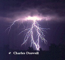
Image: lightning.gif Photo courtesy and (c) Charles Doswell

Yesterday morning, evening, and last night thunderstorms moved through the area where I live in the Blue Ridge Mountains; some of the storms last night were quite significant. These storms reminded me of the importance of a hiker or camper’s knowledge of weather and what to do in the event that you are caught in the outdoors during an electrical storm.

When hiking, always be on the lookout for the signs of an approaching thunderstorm. It’s wise to check the weather forecast before setting out on a hike. However, if you are on a long (several days) hike you may not have access to weather forecasts and, as we all know, you can’t always depend on a forecast being accurate. Even though thunderstorms are more prevalent in late afternoon than in the morning, you must always be alert to signs of approaching inclement weather.

Lighting can originate from 6 – 8 miles (10 - 13 km) away from its last derivation, so it is possible for lighting to strike on the edge of a storm; if you wait until you see lightning, it may already be too late to take action.

If you are caught in a thunderstorm in the outdoors there are a number of things you can do to help protect yourself, but remember, there is no completely safe way to survive outdoors in a lightning storm.

If you think a storm is approaching move out of open and exposed areas. Ridges, open fields, or nearby tall objects like solitary trees, communication antenna, or rock spires are a bad place to be. Ridges and open fields leave you exposed and as the tallest object around, solitary trees and rock spires serve as natural lightning rods. Stay away from lakes, rivers, beaches where you are in the open and exposed. You will not be safe underneath canopies, small picnic or rain shelters, outhouses, rock overhangs and shallow caves.


Photo right: Courtesy of NOAA, Lightning causes around 100 deaths in the U.S. annually (more than hurricanes and tornadoes combined). In the picture right, the young woman and her friends were severely injured by lightning just a few seconds after this picture was taken. Notice that no rain was falling, clearly illustrating that lightning can strike up to several miles away from the thunderstorm.


If you are hiking as a group spread out at least 20 feet (6 m) apart; lighting can jump as far as twenty feet and if you stay close together a lightning strike can injure a group of people.

Look for an area that is not exposed, an area with trees of uniform height or an area with low brush and bushes. Never seek shelter directly under a tree. If you cannot find any shelter at all, for example if you are above the tree line, go as low as you possibly can away from any ridges.

If you do get caught in the open and lightning is nearby, the safest position to be in is crouched down on the balls of your feet. A good bet is to crouch on top of a rock (not the highest one in the area) that is somewhat elevated or otherwise detached from the rocks underneath it. Do not allow your hands (or other body parts) to touch the ground, and keep your feet as close to one another as possible. The reason why you should hunker down on the balls of your feet is that when lightning strikes an object, the electricity of the lightning’s discharge does not necessarily go straight down into the ground. Often the electricity will travel along the surface of the ground for a significant distance. This is known as a "side flash". Many people who are "struck" by lightning are not hit directly by the main lightning channel, but are affected by the side flash as it travels along the surface of the ground (this can be especially true if the ground is wet). By keeping the surface area of your body, relative to the ground, to a minimum (that is, keep your feet together and do not allow any other part of your body to contact the ground), you can reduce the threat of a side flash from affecting you.

Alternatively if the above is difficult, sit on top of your pack, if you have one, with your feet together on the ground; crouched down with your eyes closed and your hands over your ears. Sight and hearing injuries are very common among lightning strike victims and near strike injuries. DO NOT lie flat on the ground, as this is not a safe position.

If you have metal gear like a metal hiking stick, lay it on the ground at least twenty feet (6m) away from you.

Stay away from sharp changes in terrain such as the edge of water, the edge of a forest, where rocks meet dirt, the top or bottom of a ravine etc; such areas are naturally more hazardous and lightning tends to follow down the slope.

If your hair stands on end, you feel a tingling sensation, or if the area around you appears electrified, lightning may be ready to strike. Keep your ears covered and your eyes closed and hold your breath; people have been seriously injured when they breathe in the superheated air that surrounds, and is expanding out, from a lightning bolt.

It’s best to wait at least 30 minutes after the lighting and thunder has stopped to move on and resume activity; be sure the storm has left the area.

If a member of your party gets hit by lightning start emergency treatment immediately. A person is not electrified after being hit by lighting and a full 80% of people that are hit by lightning recover. If a person has no pulse or heartbeat, start performing CPR. Treat electrical burns as you would any other, and as soon as possible, get the injured person professional help.

Technorati Tags:

Thursday, July 13, 2006

Appalachia: Traditional Music and Instruments


Image: Appalachian Dulcimer Library of Congress

Music has always been at the center of life in Southern Appalachia. The people that settled in this region are descendants of Scottish-Irish, English, Welsh, German, and French, as well as people of African American and Native American heritage. An oral musical tradition came with these people, many of whom were laborers, servants, and farmers. Primarily, because of isolation from the outside world, the people of Southern Appalachia have preserved and developed their style of music to a fine degree, which to this day, upholds the charter of the people, culture, and history that it is about.

The most frequently heard vocal form of music from this region is the ballad—a song that tells a story. Each singer sings a ballad in his or her own personal way. Sometimes new words are sung to an old melody. A ballad can be based on an event in history, a humorous situation, a tragedy, happiness, a religious topic, a heroic deed, or the supernatural. Because most of the original European settlers of Appalachia could not read, the stories contained in ballads were used to teach the history, ethics, and morality of the community.

The Southern Appalachians is known for its instrumental traditions, particularly the music of the mountain dulcimer, fiddle, banjo and the limberjack.

The mountain dulcimer is one of the earliest North American folk instruments. The body extends the length of the fingerboard and traditionally has an hourglass, teardrop, triangular, or elliptical shape (also called the galax). A courting dulcimer has two fretboards allowing two players to closely sit across from each other to perform duets, hence the name. The mountain dulcimer has three or four strings; contemporary versions of the instrument can have as many as twelve strings and six courses. The melody is played on the highest-pitched string, and the other strings are the drones.

The fiddle was brought to America by settlers from the British Isles. It was used as a solo instrument and to accompany dancing. The Appalachian fiddle is often held against the upper chest, not under the chin, and the bow is held a bit in from the end. It is known that rattlesnake rattles have been placed inside the body of the fiddle for a percussive effect.

The banjo typically has five strings, four full-length strings and a shorter fifth "thumb" string running to a tuning screw halfway up the neck. The banjo originated in Africa and was brought to America in the 17th century by black slaves. Early banjos had fretless necks, a varying number of strings, and, sometimes, gourd bodies. Adopted by white musicians in 19th-century minstrel-show troupes, the banjo gained frets and metal strings. The five-string banjo, plucked with the fingers, is common in folk music and commercial bluegrass bands.


Image Right: Limberjack by Keith Young


A unique percussion instrument of Southern Appalachia is the limberjack—a wooden doll-like figure attached to a stick on the back. The player sits on one end of a board and suspends the doll over the free end of the board. When the player hits the free end of the board it moves up and down, hitting the doll and causing it to bounce around. The sound made by the bouncing wooden doll is similar to that made by Appalachian clog dancers.

It is a fascinating journey through time when you take a look at the music of Southern Appalachia. You can experience a living oral tradition that in some ways has not changed at all from the time settlers came over from Europe.


The image of the limberjack is from Appalachian Dulcimers by Keith Young of Annandale, VA.


Technorati Tags:

Tuesday, July 11, 2006

The Chester Inn , Jonesborough Tennessee

Since 1797 the Chester Inn has stood proudly on 116 West Main Street in Jonesborough. Built by Dr. William P. Chester of Berlin, Pennsylvania, has earned a reputation as the first boarding house in eastern Tennessee. As the stage coach line developed on what became known as the "Great Stage Road", the inn was enlarged. The porch and front facade were rebuilt in 1883 in the Italianate style, and the structure has been continuously occupied as an inn, a hotel, and an apartment building. Many famous people have stayed at the inn, including United States Presidents Andrew Jackson, James K. Polk, and Andrew Johnson, and John Sevier, governor of the state of Franklin and Tennessee’s first governor. President Jackson held a reception for his friends on the porch of the inn during the summer of 1832, the year he was elected president for a second term. (photo above of vintage postcard labeled "Jonesboro Inn, Andrew Jackson's Headquarters")

Dr. Chester, as a physician in a small frontier town, found it necessary to supplement his income. It was here that Dr. Chester operated his apothecary shop in the late 1790s and early 1800s. Over the years, the cellar has been home to a variety of businesses and the Jonesborough public library. In 1797, the two rooms on the east side of the second floor were the parlor and the dining room. In the parlor, the Inn's guests sat around the fireplace and swapped stories. Breakfast, dinner, and supper were prepared in the nearby kitchen building and served to hungry travelers in the dining room. During the early days of the Chester Inn, beds lined the walls of the two large rooms on the third floor of the east side of the building. A weary traveler, eager for a good night's sleep, could rent a bed for himself or even share a bed with another guest for a lesser fee.
(photo above of Chester Inn after restoration)

The Inn, quite luxurious for the time, was the first inn on the Tennessee frontier to provide featherbeds. It was here that Andrew Jackson chose to spend many nights. In 1836, the Inn was doubled in size, adding private rooms on the second and third floors of the west side of the building. From the Inn's back porch, you will see two connected buildings. The original building from 1797, which housed the kitchen, is on the east side. The cooking was done in a separate building from the lodging rooms to reduce the chance that a kitchen fire would destroy the main part of the inn. The building on the west side is the "new" dining room built in 1836 to accommodate the expanded number of lodging rooms. A second floor was added to the new dining room in 1892 to provide four more lodging rooms.

The restoration of the inn began in the early 1990s after it was purchased by the State of Tennessee. A paint analysis showed 97 thick layers of paint on the outside of the building. After much discussion, the decision was made to restore the building to its 1890s appearance because of the Victorian porch.

During this time period, most paints were tinted with natural materials such as clay. The colors you see on the Inn today were used originally because it disguised the dirt which was splashed on the building by street traffic, which consisted of horses, wagons, and the Stagecoach.

The Inn, an honored historic site, has been restored and furnished in the spirit of the 1890's.


Monday, July 10, 2006

An Observation: Dialectical Prejudice


While dialectical prejudice used to be quite prevalent in the United States, I don’t see or hear of it quite so much anymore. I can remember the time when, as a southerner, I used to be faced with this form of narrow-mindedness and was ridiculed by those who practiced it.

I grew up on the coast of Virginia in a resort town, and, in a Navy family. People from all over the country ended up there, and of course as a child you deal with more of this form of mockery than as an adult; that is not say that I didn’t see adults participating in the same childish repartee.

In the Southern United States, some people think that all Northerners are rude as a result of the way they talk (their dialect). Conversely, in the Northern states some think that all
Southerners are ignorant for the same reason. Could it possibly be that it is plain “ole” everyday prejudice? Or, is there more to it?

Experience teaches us to associate certain accents and dialects with certain regions of our country, state, or even town. However accurate and innocuous this type of prediction might be, it can easily become a tool of discrimination. When someone’s place of origin is seemingly evident from the moment he open his mouth, prejudices against that area and its inhabitants may totally eclipse for the listener what the speaker is trying to communicate.

There are many things that can affect how people conceive other people to be. An attachment and loyalty felt within areas of a particular dialect could result in hate and prejudice for outsiders. This could be attributed to the past when groups of people were faced with conflict over insufficient natural resources, and in an environment of deficiency, individuals needed to band together in-groups to compete successfully with other groups for survival. Dialectical groups are bound communities of mutual trust and security; thus, psychologically they feel threatened by outsiders. The less that a dialectical group understands an outsider, the more threatened they feel by them, this promotes fear resulting in prejudice. Dialectical prejudice seems to be more prevalent between Northerners and Southerners; this could be, in part, due to the fact that prejudices of the Civil War era have been handed down form generation to generation.

As a Southerner, should one be distraught by the fact that some Northerners look at the southern states as being the proverbial harbor of ignorance? A good deal of the blame for this attitude could be attributed to entertainers on television, in theater, and movies portraying Southerners as being simpletons simply because the collective dialects of the south differ from those of the north.

One might believe he is impervious to this form of prejudice, and not allow it to affect them in a derogatory way; however, truth be told, deep down, it likely doesn’t set well with most, and some Southerners may take this form of prejudice personal in consequence of their heritage.

What it boils down to is that it is just human nature to ridicule, fear, or hate what we don’t understand. Some people are just so insecure or unhappy, that voicing their prejudices is the only way they can make or, better yet, fool themselves into feeling they are better than someone else. Maybe one day we’ll grow up and start behaving as though we are the superior beings of this planet that we profess to be; or maybe we have, to an extent.

Here is an interesting site: UnderstandingPrejudice.org

Image from, “The Civil War Explorer


Technorati Tags: