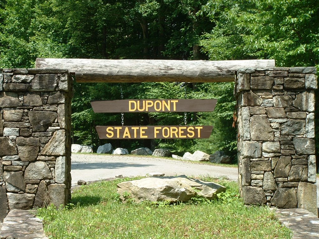
Dupont State Forest
If mountain biking is your thing, if hiking is your thing, if you like waterfalls, if you are looking for a place to take the family and enjoy a peaceful day in the mountains then the Dupont State Forest in Western North Carolina is the place for you (and me). The DuPont State Forest is located in the Blue Ridge Mountains between Hendersonville and Brevard, North Carolina. Its 10,400 acres of forest feature four major waterfalls on the Little River and several on Grassy Creek. (image below of Fawn Lake access area by author)
 Dupont is a true success story in a world of cut and slash development that has destroyed many mountain peaks and valleys in the Blue Ridge. The 10,400 acre tract of mountain land was set to be made into a high cost luxury housing development. This would have been the end of the road for some of the most beautiful pieces of mountain land that the southern Appalachians have to offer. The land has changed hands a few times and has been the cause of some bad blood between developers and conservationists over the years. Finally in 1996 and 1997 Dupont sold it's industrial operation and surrounding land holdings and North Carolina was able purchase 7,600 acres of the forest but not before the developers were able to come in with heavy equipment and carve roads into the land forever changing the face of the forest. The 2700 acres surrounding the industrial facility was sold to Sterling Diagnostic Imaging in 1996.
Dupont has several waterfalls on the property that are nothing short of spectacular. Bridal Veil Falls was used as the backdrop for scenes in the “Last of the Mohican's” starring Daniel Day Lewis. Since I am an avid mountain biker, I use that as an excuse to attack the trails that run through the forest and make my way over to Bridal Veil and hang out for a lunch break and to get cooled off by the mist coming up from the base of the falls. It's just the thing to give you the added kick needed to get up the other side of the mountain when leaving the falls area on the bike. The other major waterfalls include High falls, Triple Falls, Grassy Creek Falls and Hooker Falls all with easy walking access on wide well marked trails and roads.
The trail system inside Dupont is large and varied ranging from easy flat trails to steep and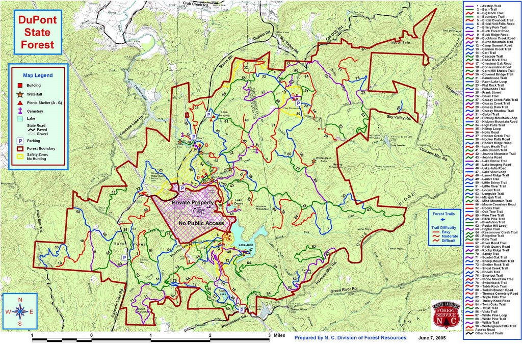 strenuous. Enough can not be said about the trail maintenance crews that give their time to make sure that all open trails are in good passable condition. The "Friends of the Dupont" do an outstanding job at organizing and doing trail maintenance. The trail system is so large that it can be confusing. Trails are marked well but maps are easy to come by and can be found at local outfitters for less than ten dollars. There is a free version of the same map available at some of the better outfitter shops but the trade off is that the free version is somewhat smaller making it harder to read. But if your eyes are good, go for the free copy. But if you are like me and have no shame and don't mind showing your age, cough up a few bucks and go for the bigger water resistant copy. The proceeds from the sale of the map go to support the forest. It's worth it! All major falls are marked on both maps. Study the map before entering the woods and always be cautious around water falls and slippery rocks that seem to congregate around streams and falls. (image of online version of Dupont trail system map)
When inside Dupont SF it becomes a little difficult to decide if it's all about the water or if it's all about the forest. Truth is....it's all about just simply being there. Once your boots hit the ground here and knowing the history behind the forest and how close it came to being just another high priced, high class gated community of the rich and famous, you (I) begin to imagine what could have been lost to the dozer. It's a shame how greed can take over the thought process and suddenly no life is sacred and power and money become the main objective.
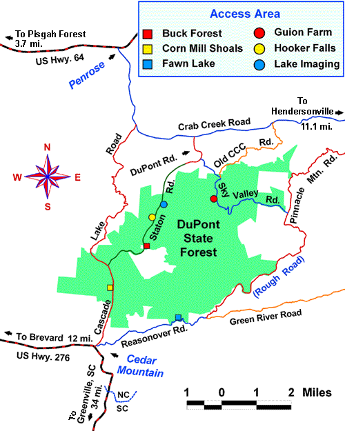 The DuPont State Forest can be accessed from Hendersonville via Kanuga/Crab Creek Rd, from Asheville/Brevard via US64 and Little River Rd, or from Greenville/Brevard via Cedar Mountain and Cascade Lake Rd. There are three major parking area for easy access to the forest with the Buck Forest parking area being the most used due to it's central location to the falls. The other parking areas are Corn Mill Shoals and Fawn Lake each of which offering it's advantages. Where you park should be largely dependant upon your activity for the day.(image of access and parking areas)
There will always be a struggle between conservationists and developers in this part of the country due to the ever growing housing market and the ever shrinking natural resources of the Blue Ridge. There is no easy answer to this issue that can satisfy all parties involved, so the battle will continue. But in the case of Dupont... We win!!
[Blue Ridge][Dupont State Forest][Fawn Lake][Hiking][Biking]
posted by Mark @ 7:41 PM
![]()


0 Comments:
Post a Comment
<< Home