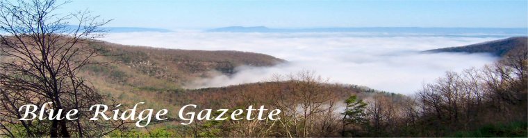
Shinning Rock Wilderness, Western North Carolina
 The United States Congress designated the Shining Rock Wilderness in 1964 and it now has a total of 18,483 acres. Named for a micaceous rock outcrop (quartzite), Shining Rock became one of the original components of the National Wilderness Preservation System in September 1964, a few months after receiving designation as a Wild area. It is now the largest Wilderness in North Carolina, separated by only a road from Middle Prong Wilderness to the southwest. Standing at an elevation of more than 5,000 feet and boasting five peaks exceeding 6,000 feet (three within the Wilderness boundaries), Shining Rock Ledge forms the backbone of this area
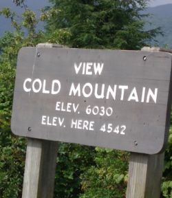
Here in this series of high ridges on the north slopes of Pisgah Ridge, you'll find extremely steep and rugged terrain ranging in elevation from 3,200 feet on the banks of the West Fork of Pigeon River, a major tributary of the Tennessee River, to 6,030 feet on Cold Mountain. Yes it is the real Cold Mountain. Located 35 miles from Asheville North Carolina, Cold Mountain has received notoriety from the best-selling Charles Frazier novel Cold Mountain and the acclaimed 2003 motion picture. The movie was filmed in Romania; however, the mountain scenery is very similar to the real Cold Mountain area. There is not an actual town of Cold Mountain. The mountain itself is part of the Shining Rock Wilderness area in Pisgah National Forest. Streams abound, cutting narrow passages through the mountains on their way to either the East or West Forks of the Pigeon River. Loggers cut down the forest between 1906 and 1926 and fires raged through the area in 1925 and 1942. These two factors account for Shining Rock's grassy "balds" and unique vegetation. A web cam of this area can be found here.
 Make no mistake, this is a true wilderness area and should considered only by experienced hikers. The hike to the summit of Cold Mountain is a difficult 10 mile one way trip (take lots of water) Almost all of the trails in the section of the Pisgah Forest are rated difficult however the length of the hikes can be tailored to suit your experience and goal for the day. You can enjoy beautiful views of the mountain from your car via the Blue Ridge Parkway or a shorter hike to the top of Mount Pisgah.
The “Balds” hike is of particular interest due to the mysterious nature and folk lore behind these types of mountains that dot the Blue Ridge. This hike can be as long or as short as you desire due to the many interconnecting trails that give opportunity to loop back to the parking area.
To call yourself a hiker and to have not ventured into the Shinning Rock Wilderness Area is a true injustice to yourself. Wilderness areas are what America once was from ened to end. We can find fault in many thaings that government does each day, but we can also be gald in the fact that measures were taken early to preserve wild areas like this for future generations to enjoy. The next time Uncle Sam gets under your skin, take a little day hike and walk it off and always plan ahead and be safe out there.
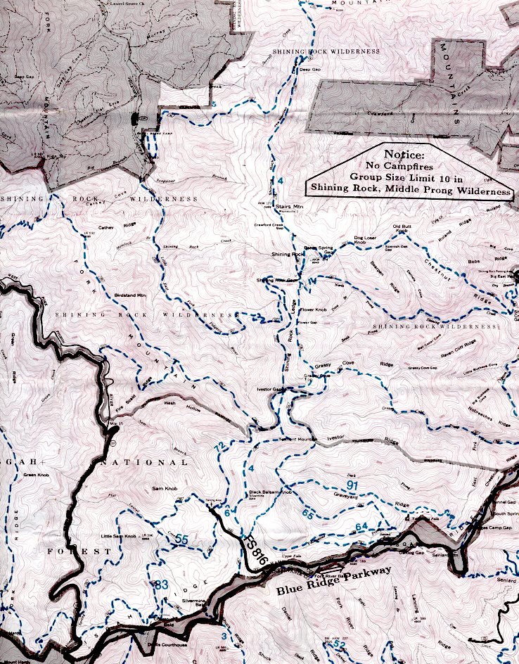
DIRECTIONS TO THE TRAILHEAD
To reach the trailhead to the Cold Mountain summit, drive through the Scout Camp. It begins on the left, just past the last building.
Directions from Asheville via I-40: (Approximately 35 miles) Take I-40 West to exit 33. Turn left on Newfound Road toward Canton. Go 1.6 miles, turn left at the stoplight in front of the big paper plant. Go a short distance and turn right on Church Street. Follow 19/23 south through downtown and turn left onto NC Highway 110. Go 5.3 miles, and Highway 110 will turn into NC Highway 215. Continue for 5 miles. Turn left onto Little East Fork Road. Go 3.8 miles to the Scout Camp.
Directions from Asheville via the Blue Ridge Parkway: (Approximately 53 miles) At Milepost 423.2, take NC Highway 215 and go 13 miles north. Turn right onto Little East Fork Road. Go 3.8 miles to the Scout Camp.
Cold Mountain Pisgah Charles Frazier Quartzite Wilderness
posted by Mark @ 9:48 PM
![]()


0 Comments:
Post a Comment
<< Home