Kephart Prong Trail
 For a lovely day hike in the Great Smokies National Park, try the Kephart Prong Trail.
This relatively easy, 2-mile trail follows the Kephart Prong of the Oconaluftee River. Oconaluftee comes from a Cherokee word meaning "by the river" and originally referred to small villages along the river which flowed from Newfound Gap through the present-day town of Cherokee and into the Tuckaseegee River. Later white settlers came along and mistook the word for name of the river itself.
The Kephart Prong flows south from Mt. Kephart to the Oconaluftee near its headwaters. The creek, mountain, and trail are name for Horace Kephart, a naturalist, librarian, and historian who came to the area in the early 1900s. Kephart loved the Smokies and made a great impact on the region. His book, Our Southern Highlanders, published in 1913, remains one of the best regional studies of Appalachian culture in existence. He was also a key figure in the establishment of the Great Smoky Mountains National Park, as well as the development of the Appalachian Trail through the park.

The trail begins about 7 miles north of the Oconaluftee Ranger Station, the GSMNP Visitor's Center (NC side), and the Mountain Farm Museum. There is parking along the side of Newfound Gap Road. Start by crossing the Oconaluftee River via a steel bridge, then follow an old roadbed for 2.1 miles and an elevation gain of no more than 830 feet.
Along the way you will pass the
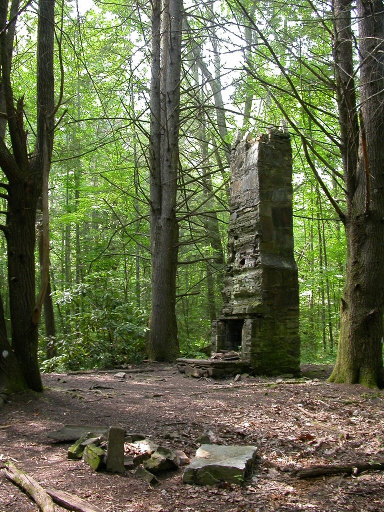 ruins of an old Civilian Conservation Corps camp (some rock walls, a large rock sign, and chimney are the most prominent) that was here between 1933-42. A little further and you will see old rails left by Champion Paper Company when they logged the area in the 1920s. It is rather heartening to see the forest reclaiming these areas so enthusiastically and covering such scars of human devastation.
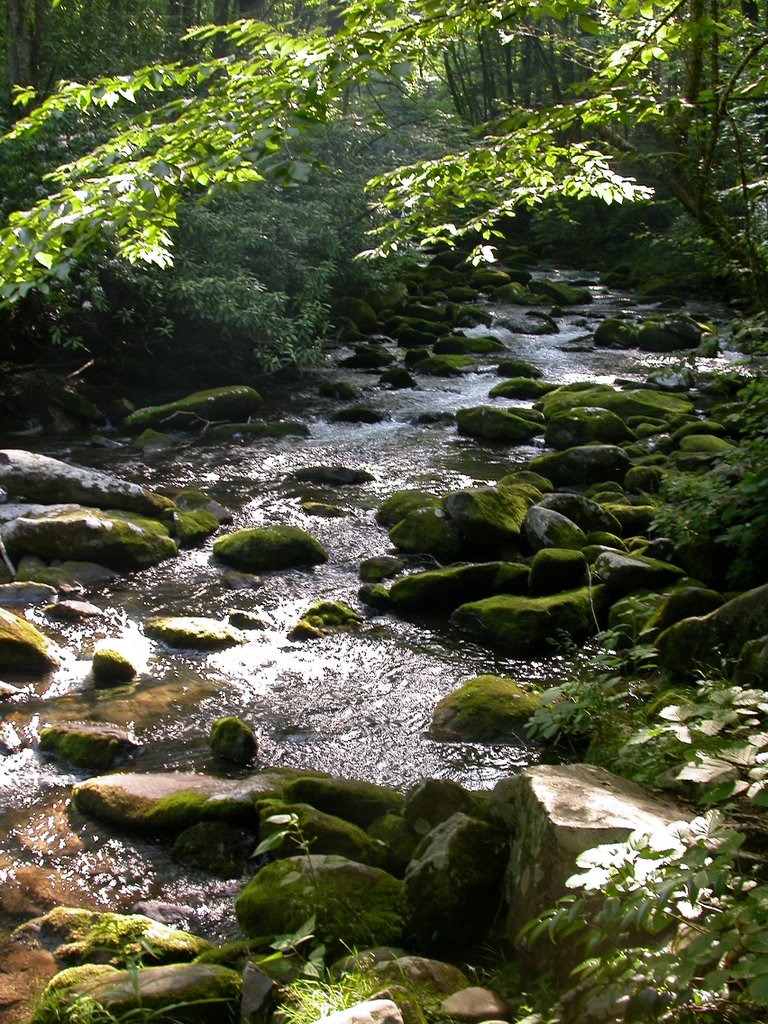
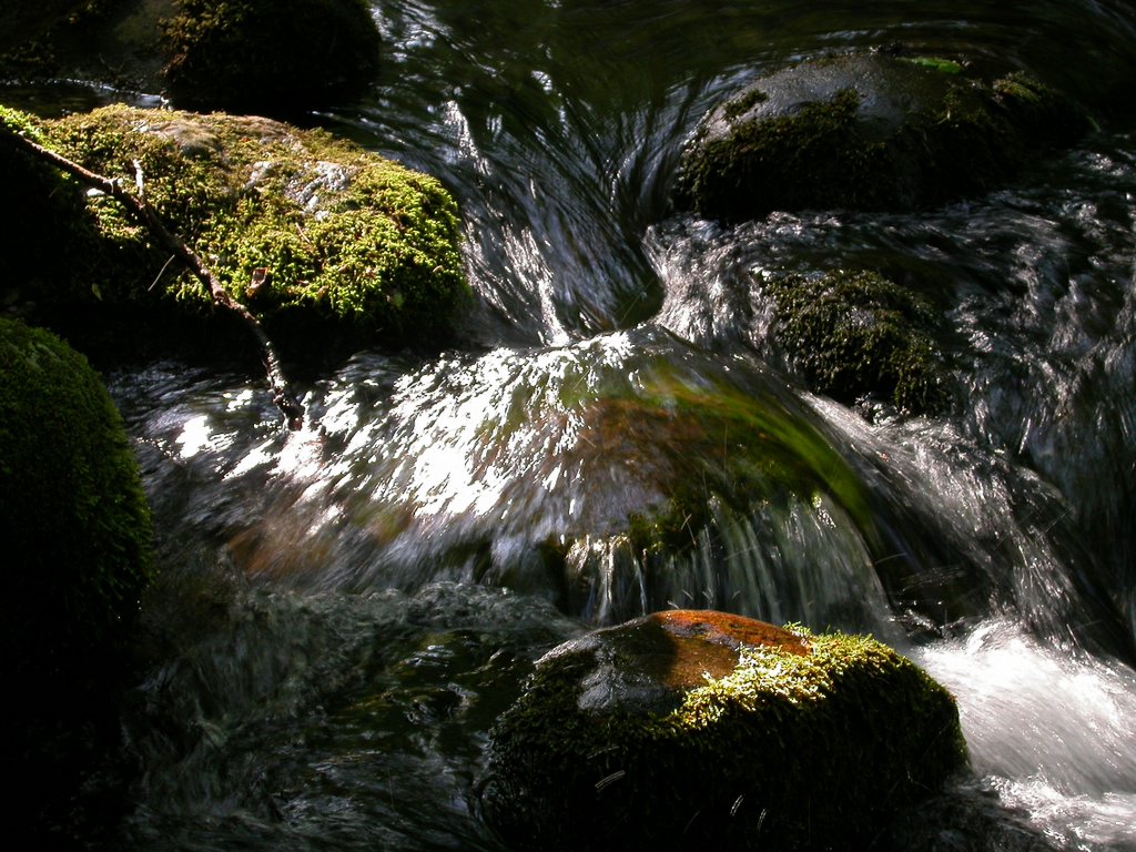
There are five log footbridges along the trail, affording many views of this stunningly beautiful creek. You will find numerous wading and bathing pools beckoning beneath the scattered sunlight. Wildflowers are abundant, as they are throughout the Park.
The trail ends at a backpacking shelter and several other trail heads. You will find the Kanati Fork Trail, Grassy Branch Trail, and Sweat Heifer Trails begin here. For the ambitious, try the Sweat Heifer Trail. With an elevation gain of 2,270 feet in 3.6 miles, it will surely make you perspire like a bovine, although the name most likely originates from and old-time practice of driving cattle up steep trails to graze at alpine pastures.
The Kephart Prong Trail can be crowded on summer weekends, but if you go, as we did, on a weekday evening, you will be rewarded with peace, quiet, and the most glorious light streaming through the trees and onto this beautiful creek.
It's well worth checking out.
(All images by Wesley J. Satterwhite)
posted by wesleyjeanne @ 1:08 PM
![]()


0 Comments:
Post a Comment
<< Home