The Photography of D L Ennis, and more!


Tuesday, August 29, 2006

Birds of the Mid-Atlantic #21: Young Birds

Late summer is a time of change for birds. By now, the breeding season has ended for most species, and the young birds are out of the nest. Fledglings are rapidly maturing. Adults are molting their old feathers for fresh ones. Many species have already begun their journey south to their wintering grounds, such as the yellowlegs I covered last week. All this poses special challenges for birdwatchers. In some ways, this may be the most challenging times of the year.

Fledglings

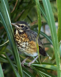
Fledgling plumage may or may not be covered by field guides. Even the big Sibley Guide, for example, shows the fledgling plumage for American Robins, but it illustrates fledgling plumage less frequently for less common species. Fledgling robins themselves are sometimes a cause of confusion because of their spots. Adult robins do not have spots, but sport a solid orange breast. Fledglings, on the other hand, do have spotted breasts, much like other members of the thrush family. See below for an example.

Baby American Robin / Photo by Sean Varner (USFWS)

Another example of juvenile plumage is the Black-crowned Night-Heron, pictured below. As with the robin, the juvenile plumage seems designed to make the night-heron less visible to predators while it is still maturing. Adult night-herons are much more conspicuous. Juvenile night-herons are not too difficult to identify, but the cryptic plumage could be confused with that of a juvenile Yellow-crowned Night-Heron or adult American Bittern.

Juvenile Black-crowned Night-Heron / Photo by Lee Karney (USFWS)

The key to identifying juveniles, especially recent fledglings, is to remember that they are fledglings, and look for the species that they most resemble in structure. Bill length and shape, tail and wing size, and overall posture will be helpful here. Look for an answer among the common species first, before considering other, rarer possibilities.

Molt

Juvenile Eastern Bluebird / Photo by Wendell Long (Texas Bluebird Society)

A different kind of challenge is posed by molting birds. Some birds keep more or less the same plumage year-round. Even if they do, they need to molt each feather at least once per year to make up for normal wear and tear and retain the feathers' usefulness for insulation, flight, and waterproofing. Birds that retain the same plumage patterns throughout the year will simply look a little scruffier while they undergo their yearly molt. You might observe feathers missing; this is most obvious in the flight feathers of the wings and tail.

In many cases, birds have more than one plumage. Most birds with multiple plumages have one for winter (basic) and one for the breeding season (alternate). The differences between them may be quite stark. While the plumage for the breeding season is bright and colorful, for the winter these species take on a plainer appearance to make themselves less conspicuous.

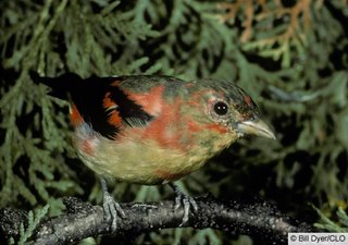
Differences between basic and alternate plumage can be hard enough to remember, but this time of year adds another dimension to the puzzle. Birds molt their feathers gradually; they lose just enough to replace the whole set in a relatively short time, but keep enough to remain fully functional. Therefore, in late summer one will often encounter birds that are in between their alternate and basic plumages, such as the Scarlet Tanager pictured below.

Scarlet Tanager / Photo by Bill Dyer (CLO)

With some birds, the molt may be so extreme that the bird will become bald for a short period of time. This seems to affect cardinals and blue jays most often, but other species will become bald occasionally. As with juveniles, the key is to focus on structural points and to consider the familiar possibilities first. Most of the time, a guess based on those criteria will be the correct one.

The following link is to a hunting website, but it has several waterfowl quizzes that might be of interest to you, including one on molting ducks. The photographs are worth a look.

None of the identification challenges presented here are insurmountable. Most birds that you see at this time of year can still be identified despite changing plumage and shifting populations. However, birding does require some more concentration and attention to detail now than at other times of year.

Crossposted at A DC Birding Blog.

Labels:

Sunday, August 27, 2006

Mills of Waterford Village, Virginia


Image of the Waterford Mill as it is today.

In 1733, a Quaker from Bucks County, Pennsylvania, Amos Janney, purchased 400 acres along Catoctin Creek in Loudoun Valley. He constructed a log mill on the creek not far from the site of the present mill. Janney was soon joined by others drawn to the rich farmland along the banks of Catoctin Creek. From this site, a little settlement grew rapidly until the mill was the hub of a thriving agricultural community. Known as Janney's Mill until the 1780s, this early commercial center became what is known today as the village of Waterford.

By 1762, the growing population of grain farmers had necessitated the building of a larger grist mill on the site of the present mill. An adjacent saw mill provided lumber to build houses and barns, and roads were constructed to facilitate travel to and from Janney's Mill. Reflecting the fertility of the surrounding farmland, the mill was again rebuilt and enlarged in the 1820s. This is the structure that exists today.

Image right: the Schooley Mill.

Two additional mills operated in the village; Schooley Mill, primarily a saw mill, also ground corn, limestone, and clover and another mill which functioned as a cloth manufactory, or fulling mill.

By 1835, the settlement had grown into a village and served as the commercial hub to the surrounding farms. In the 1850’s, thanks to the nearby Chesapeake and Ohio Canal, Waterford's mills were providing products for an even wider market. Barrels of flour were hauled to Point of Rocks, Maryland, ten miles north of Waterford, where they were loaded onto C&O Canal barges or the Baltimore and Ohio railroad to be taken to the lucrative markets of Washington, DC, Alexandria, and Winchester.

Even though the Civil War devastated Waterford's economy, the mills continued to operate. The Washington and Old Dominion Railroad was extended from Leesburg west in 1870, bypassing Waterford and depriving it of its once dominant trading position. The village never returned to its former commercial success because area farmers and village residents could now import machine-made goods. However, enterprises supporting agricultural needs such as blacksmiths, wagon builders, harness makers remained working in the village until the early 1900s. Waterford's mills continued to operate and export grain to markets made accessible by the railroad.

The Old Mill was the last of Waterford's mills to cease operation. In 1939, the mill stopped grinding, marking the end of the milling industry in Waterford. The Waterford Foundation purchased the Old Mill, and later the Schooley Mill, to ensure the preservation of these buildings which housed one of the main livelihoods of the village for over two centuries.

Information and images provided by the Waterford Foundation.

Thursday, August 24, 2006

The Vine that Ate the South

You’ve probably heard of the vine that ate the South—kudzu—but what else do you know about it? Called the mile-a-minute vine, foot-a-night vine, and the vine that ate the South kudzu is the most prolific vine growing in the South.

Kudzu was introduced to the United States in 1876 at the Centennial Exposition in Philadelphia, Pennsylvania. Countries were invited to build exhibits to celebrate the 100th birthday of the U.S. The Japanese government constructed a beautiful garden filled with plants from their country. The large leaves and sweet-smelling blooms of kudzu captured the imagination of American gardeners who used the plant for ornamental purposes.

Shofuso: The Japanese House and Garden is where kudzu was first planted on American soil. The Japanese garden dates to 1876, but the villa was added later.
Florida nursery operators, Charles and Lillie Pleas, discovered that animals would eat the plant and promoted its use for forage in the 1920s. Their Glen Arden Nursery in Chipley sold kudzu plants through the mail. A historical marker there proudly proclaims "Kudzu Developed Here."

During the Great Depression of the 1930s, the Soil Conservation Service promoted kudzu for erosion control. Hundreds of young men were given work planting kudzu through the Civilian Conservation Corps. Farmers were paid as much as eight dollars an acre as incentive to plant fields of the vines in the 1940s.

Kudzu's most vocal advocate was Channing Cope of Covington, Georgia who promoted use of the vine to control erosion. Cope wrote about kudzu in articles for the Atlanta Journal-Constitution and talked about its virtues frequently on his daily WSB-AM radio program broadcast from his front porch. During the 1940s, he traveled across the southeast starting Kudzu Clubs to honor what he called "the miracle vine."
Cope was very disappointed when the U.S. government stopped advocating the use of kudzu in 1953.

The problem with Kudzu is that it just grows too well! The climate of the Southeastern U.S. is perfect for kudzu. The vines grow as much as a foot per day during summer months, climbing trees, power poles, and anything else they contact. Under ideal conditions kudzu vines can grow sixty feet each year.

While they help prevent erosion, the vines can also destroy valuable forests by preventing trees from getting sunlight. This problem led Dr. James H. Miller of the U.S. Forest Service in Auburn, Alabama to research methods for killing kudzu. In eighteen years of research, he has found that one herbicide actually makes kudzu grow better while many have little effect. Miller recommends repeated herbicide treatments for at least four years, but some kudzu plants may take as long as ten years to kill, even with the most effective herbicides.

Dr. Errol G. Rhoden, along with other researchers at Tuskegee University, has successfully raised Angora goats in fields of kudzu which would otherwise be considered wasted land. The goats keep the kudzu from spreading further while producing profitable milk and wool products. Rhoden says constant grazing will eventually eradicate kudzu. If kudzu is to provide a continuing food source, animals must be removed from the fields occasionally to allow the vines time to grow.

Basket makers have found that the rubber-like vines are excellent for decorative and functional creations. Ruth Duncan of Greenville, Alabama makes over 200 kudzu baskets each year and says she doesn't mind that people call her the "Queen of Kudzu."

Current research may lead to new medicines made from kudzu, but for now only hamsters and mice can benefit from these drugs. Research with laboratory animals at Harvard Medical School has revealed that a drug extracted from kudzu root may help in the treatment of alcoholism. The drug is based on a 2,000 year old Chinese herbal medicine. Several years of testing may be required before the drug can be made available for human consumption.

In China and Japan, ground kudzu root (called kuzu) has been a common ingredient in foods and medications for centuries. Kudzu is respected and enjoyed there. It's far more versatile than say, turnips. But kudzu grows better in the South than it does in its native lands. Its natural insect enemies were not brought to the U.S. with it.
That's why visitors to the South are sometimes awe-struck by scenic vistas which reveal miles and miles of seemingly endless vines.

Southerners just close their windows at night to keep the kudzu out.

All images by D L Ennis

Monday, August 21, 2006

Signs in the Historic Districts of the Blue Ridge

Signs play an important role in promoting a business and in getting the attention of the public. Often times as we drive down the interstate we make decisions on where we are stopping and where we spend our money based on the attractiveness of the sign that is in front of the business. Small towns more often than not do not have the ability to erect large flashing neon signs to entice us in to lay down a few bucks.

Many times as with in the regions of the Blue Ridge there are historic districts and zoning laws governing exactly how a business can promote itself. In an age where bigger is better many downtown areas are forced to be creative in self promotion. With the various restrictions that are in place to preserve the historic beauty of an area, business owners more often seem to drift back to a time of simplicity in design. Enter the world of hand carved, hand created, artistic sign making. In the days of old these were often called “shingles” due to the fact that many shop owners usually made their own signs from wooden shingles that were found or split from a piece of hardwoood like oak or hickory. Wooden shingles were easy and simple to make and was the roofing material of choice to homesteaders.

Sign making has since graduated to be more more of a fine art than a simple way to promote your business and get noticed. Ranging from the simple to the creative and complex, wooden signs are adorning the historic ares of the Blue Ridge more and more. Below is a sampling of the many signs that can be seen in downtown Jonesborough Tennessee today. Crafted by gifted artists with modern tools and made to be reminiscent of days gone by, the pictures speak for themselves.


Saturday, August 19, 2006

Joe-Pye Weed—Queen of the Meadow


Image: by D L Ennis, Joe-Pye Weed (Eupatorium purpureum)

As you drive the Blue Ridge Parkway or the back roads of the Blue Ridge, keep an eye out for this beautiful herbaceous perennial plant.

Sometimes called “Queen of the Meadow,” Joe-Pye Weed (Eupatorium purpureum) is a beautiful stately plant, which dances on breezes throughout the Blue Ridge Mountains. In late summer or early fall, it's difficult not to admire the conspicuous plant as it blooms in fields, along roads, and on wood edges throughout the eastern half of the United States. It prefers sites in rich upland woods, though it's sometimes found in more open environments. Its tall, green stalks (often four feet or more in height) support feathery domes of dusty pink or lilac flowers. Its leaves emerge, like those of lilies, in whorls at stately intervals along the stalk. When crushed, this species often emits a distinct odor of vanilla, a quality apparent even in the dried flower heads.

The common name of Eupatorium purpureum , Joe-Pye weed, is so distinctive that if there were not some tale already devised to explain its origin, we'd probably have to invent one. As it turns out, Joe Pye is said to be the name of an Indian herb doctor who used the plant to treat an outbreak of typhus afflicting the colonists of Massachusetts Bay. The cure was successful, the herb was included in the Europeans' pharmacopoeia, and Joe Pye was thus immortalized.

The tale does seem believable. Joe-Pye weed was a popular Native American medicament, and the colonists almost certainly learned of its use from the Indians. One might even argue that an extract of the herb would have made a relatively effective treatment for typhus, given the limited medical offerings of the day: The sweat-producing, or diaphoretic, properties of the drug could at least have moderated the dangerously high fevers.


Image: by D L Ennis, Joe-Pye Weed reflecting on Otter Lake on the Blue Ridge Parkway in Virginia

Still, it was as a diuretic and treatment for urinary disorders that Joe-Pye enjoyed continued use—hence the common names of gravelroot and kidney root. A tea made from the root was drunk to prevent or dissolve kidney stones, and even to treat gout and rheumatism, both of which are associated with excess uric acid.

Native Americans promoted these uses of the plant, and many more. The Fox Indians left no doubt as to their preferred prescription when they gave the plant a name that means "love medicine to be nibbled when speaking to women when they are in the wooing mood." Other tribes used it as a wash for inflamed joints, or in children's baths, where it was variously believed to impart strength or induce sleep.


Technorati Tags:

Wednesday, August 16, 2006

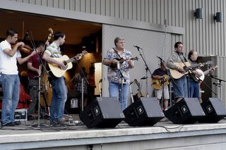
A Coming Together of Cultures through Music


In the Appalachians, you’ll find many adaptations of the ancient fiddle and banjo music of Virginia and North Carolina. This music can be traced to the meeting of the African banjo and the European fiddle in the Tidewater region before the US was a nation. You’ll also find older ballads and religious music that reach deeply into the American past.

The Blue Ridge Music Center honors these arts by facilitating their presentation with emphasis on local artists, artists who can best demonstrate this history. The museum houses permanent exhibits that trace the history of this music through local artists, back to the creation of the music generations ago by persons from Europe and West Africa, and will illustrates how it has been kept in America.

The museum also demonstrates how the first American ensemble, the fiddle and the banjo, are symbolic of the meeting of European and African cultures in the New World, how the nation has drawn vigor from these diverse roots, and how many blends of folk and popular music have grown from these roots.

History shows that the coming together of the fiddle and banjo to be the root beginning of much of America’s music. Unassuming and prevailing, ancient and contemporary, these instruments are still contributing to America, and the Blue Ridge Music Center is a great place to hear them as well as learn more about them.

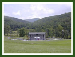
Established by the U.S. Congress in 1985, the site includes an outdoor amphitheater and indoor interpretive center used to highlight an important strand of American musical culture, which is still alive and thriving in the region. The site is operated through a partnership between the National Park Service and the National Council for the Traditional Arts.

The Blue Ridge Music Center, located on the Blue Ridge Parkway (mile post 213) outside Galax, VA and will feature a 16-week summer music concert series beginning in early June, 2006.

Jam Sessions are welcome anytime in the Plaza area.

Visitor Center & Museum is open 7 days a week from 9 am to 5 pm.

Note to Musicians:

If you’re interested in performing at the Blue Ridge Music Center please send a short bio, press materials (including news clips), a recording (CD or cassette), and contact information to:

Blue Ridge Music Center
C/O NCTA
1320 Fenwick Lane, Suite 200
Silver Spring, MD 20910

Images: from the Blue Ridge Music Center website.


Technorati Tags:

Tuesday, August 15, 2006

Birds of the Mid-Atlantic #20: Yellowlegs

Fall migration is already upon us. In fact, it has been upon us for about a month now. Like spring migration, fall migration proceeds in a series of stages, with certain species or families dominating each stage. In contrast to spring migration, fall migration is less compressed, occurring over a period of about five months, as opposed to the three months of spring migration.

August is the time for shorebirds to move through the Mid-Atlantic region. The best way to experience shorebird migration is to visit one of the many large refuges along the Atlantic coast, as I did on Saturday. If you are stuck inland, there are still opportunities to see shorebirds as they pass through the area. (See, for example, this list of Maryland shorebird sites.) While species diversity is more limited, inland sites often provide an opportunity to study birds up close, without the need for a spotting scope. Shorebirds that commonly occur inland include the subjects of today's essay, greater and lesser yellowlegs.

Yellowlegs are the graceful counterparts to the many squat or chunky members of the sandpiper family. Unlike most other shorebirds, they have long yellow legs and elegantly-shaped head and neck. Their long legs allow them to wade out into deeper water where other shorebirds cannot go. There they hunt for insects and crustaceans, as well as an occasional small fish.

Greater Yellowlegs / Photo by USFWS

Greater and lesser yellowlegs have almost identical plumage, so a birder needs to pay attention to structural characteristics to make an identification. When the two species are next to each other, the size difference is apparent. On average, the greater yellowlegs is 3-4 inches larger than the lesser. With a single bird, or single-species flock, this is not so useful. Luckily, the bill can help answer the question. A lesser yellowlegs has a bill that is slightly longer than the head (minus the bill). Greater yellowlegs have bills that are 1.5-2 times longer than the head; their bills are also thicker and slightly upturned. Calls are another clue; the greater yellowlegs tends to give three-note calls (dew-dew-dew) while lesser yellowlegs whistle once or twice (tu-tu).

Lesser Yellowlegs / Photo by USFWS

Both yellowlegs species winter primarily in Central and South America. However, at least a few of each species winter in the southern United States and along the Atlantic coast.

To find shorebirds away from the coast, look for wet fields, pond and lake edges, and mudflats. Other common shorebirds that may occur at inland sites include killdeer, semipalmated plover, spotted sandpiper, solitary sandpiper, least sandpiper, semipalmated sandpiper, and western sandpiper. In Washington, DC, the best shorebird sites are the parks along the Anacostia River; nearby, there are good spots at Hunting Creek and Cameron Run in Virginia.

Crossposted at A DC Birding Blog.

Labels:

Sunday, August 13, 2006

Campgrounds on the Blue Ridge Parkway

Image by D L Ennis, the Blue Ridge Parkway near Otter Creek.


Otter Creek
Open
Opens May 12
Phone
(434) 299 5941
Details
Located at Milepost 61 at the lowest Parkway elevation near Virginia's James River


Peaks of Otter
Open
Opens May 12
Phone
(540) 586 4357
Details
Located at Milepost 86 and near the Peaks of Otter Lodge, Abbott Lake, the restored 1930s Johnson Farm, and a magnificent trail system.


Roanoke Mountain
Open
Opens May 12
Phone
(540) 767 2492
Details
Located at Milepost 120.4 with easy access to Virginia's Explore Park and the largest city along the Parkway corridor.

Rocky Knob
Open
Opens May 12
Phone
(540) 745 9660
Details
Located at Milepost 167 with easy access to Rockcastle Gorge and just nine miles from Mabry Mill.

Image by D L Ennis, the James River as seen from the Blue Ridge Parkway

Crabtree Meadows
Open
Opens May 12
Phone
(828)765 6082
Details
Located at Milepost 339.5 near the Crabtree Meadows Restaurant and within fifteen miles of Mt. Mitchell State Park.


Doughton Park
Open
Opens May 12
Phone
(336) 372 8568
Details
Located at Milepost 241.1 near Basin Cove, Bluffs Lodge, and an extensive trail system.

Julian Price Park
Open
Opens May 12
Phone
(828) 963-5911
Details
Located at Milepost 297 near Boone and Blowing Rock, North Carolina and close to the Moses Cone Estate. This is the Parkway's largest campground. Reservations can be made for portions of this campgound on-line at RESERVEUSA.com or by calling 1-877-444 6777.

Linville Falls
Open
Opens March 31
Phone
828-765-6082
Details
Located at Milepost 316 on the Linville River and with access to the trail system into Linville Gorge Wilderness Area. Reservations can be made for portions of this campgound on-line at RESERVEUSA.com or by calling 1-877-444 6777.

Mt. Pisgah

Open
Opens May 12
Phone
(828) 648 2644
Details
Located at Milepost 408, Pisgah is the highest Parkway campground at almost 5,000 feet elevation. Formerly part of the Vanderbilt Estate and near the US Forest Service's Cradle of Forestry site.Reservations can be made for portions of this campgound on-line at RESERVEUSA.com or by calling 1-877-444 6777.


Image by D L Ennis, Mabry Mill on the Blue Ridge Parkway

ACTIVITY FEES

Camping
Fees
$16.00-18.00 - Day
Details
Camping fees on the Blue Ridge Parkway are $16.00 per night at all campgrounds. In addition, a small fee is charged for advanced reservations at selected campgrounds. Reservations can be made for portions of the campgrounds at Linville Falls, Price Park, and Mount Pisgah. Contact reserveUSA.com for on-line reservations or call 1-877-444-6777. All other campsites are on a first come and first served basis.


LODGING

Bluffs Lodge
Open
Opens in May 2006
Phone
(336) 372 4499
Details
Bluffs Lodge is located at Milepost 240 on the Blue Ridge Parkway in North Carolina at Doughton Park, one of the largest developed areas on the Parkway. The lodge is open from early May through October. Blueridgeresort.com is the website.

Peaks of Otter Lodge
Reservations
Online
Phone
(540) 586 1081
Details
The Peaks of Otter Lodge is located twenty miles north of Roanoke, VA on the Blue Ridge Parkway at Milepost 86. It is the only year-round lodging on the Parkway. Lodging, dining, trails, fishing and seasonal interpretive programs at the park amphitheatre. The web site is http://www.peaksofotter.com.

Pisgah Inn
Open
Opens in April 2006
Reservations
Online
Phone
(828) 235 8228
Details
Located south of Asheville, NC at Milepost 408.6, Pisgah Inn is the highest elevation lodging on the Blue Ridge Parkway at over 5,000 feet. The lodge is open from early Spring through the fall leaf season. Their web site is http://www.pisgahinn.com

Rocky Knob Cabins
Open
Opens in May, 2006
Phone
(540) 593-3503
Details
The Rocky Knob Cabins, at Milepost 174 near Meadows of Dan, Va, are small, rustic cabins built by the Civilian Conservation Corps during the early days of Parkway construction. Blueridgeresort.com is the website.


Technorati Tags:

Friday, August 11, 2006

Beginning in early September—Autumn Hawk Migration in the Blue Ridge Mountains


Image: by D L Ennis, Redtail Hawk

Beginning in early September extending through November, hawks and other birds of prey can be seen migrating from the northeast to the southwest to winter in Mexico, Central America, and South America.

Using the Appalachian Mountains and, to a lesser degree, the Allegheny Mountain range as their flyway offering all who wish to view these magnificent birds a visual experience to be savored. The mountains also ease the long journey by providing updrafts that the birds use so efficiently that it’s possible for them travel hundreds of miles without a single beat of their wings—as witnessed by the late (1899-1980) naturalist, Edwin Way Teale.

Eagles, kestrels, ospreys, peregrine falcons, vultures can also be seen, but for the most part you’ll view broad-winged, red-tailed, and red-shouldered hawks (genus Buteo lineatus) and the smaller, Cooper's and sharp-shinned hawks (genus Accipiter cooperii.)

The number of migrating hawks that travel the mountain flyway can, on a lucky day for the observer, can be enormous. On September 15th 1985 spectators estimated that upwards of 10,000 broad-winged hawks passed by Rockfish Gap at milepost 0 on the Blue Ridge Parkway. In a single day, during the third week of September, birders counted more than 17,000 broad-wings passing by Linden Fire Tower in northern Virginia.

Though picking a day for viewing is guess work you can increase your odds of seeing great numbers of hawks by being in place from 10 a.m. to noon and 2 p.m. to 4 p.m.—after the sun warms the air currents. Also the week of September 15 is normally the peak of the migration, and the week of October 1 offering the most variety.

The Blue Ridge Parkway and Skyline Drive offer many excellent viewing areas from overlooks. Below is a list of some of the best viewing areas in the Blue Ridge Mountains along the Parkway in Virginia and North Carolina

Premier Viewing Spots along the Blue Ridge Parkway

Starting in Virginia
Rockfish Gap (Milepost 0)
Afton Overlook (MP .2)
Ravens Roost (MP 10.7)

In Shanendoah National Park
Hawksbill (requires hiking)
Stony Man (requires hiking)
Mary's Rock (requires hiking)
Calf Mountain Overlook
Irish Creek OL (MP 42.4)
Buena Vista OL (MP 45.6)
Peaks of Otter
Especially Harvey's Knob OL (MP 95.3)
Mill's Gap (MP 91.9)
Purgatory Mtn. (MP 92.2)
Sharptop (MP 92.4)
Montvale (MP 95.9)
Great Valley (MP 99.6)
Saddle Parking OL (MP 168)
Near Rocky Knob Visitor Center (MP 169)
Cumberland Knob (Park at MP 219)
Mahogany Rock, and nearby Scott Ridge (MP 235)
Jumpin' Off Rock (MP 260)
Thunderhill OL (MP 290.5)
Grandfather Mtn./ Ship Rock (MP 302.8)
Table Rock Mtn. at Linville Gorge
Three Knobs OL (MP 338.8)
Black Mtns. (MP 342.2)
Licklog Ridge (MP 349.9)
Fire Tower on Green Knob (360 degree views, MP 350.4)
Mt. Mitchell Summit (MP 355.4)
Craggy Pinnacle OL (MP 364.1)
Craggy Gardens Visitor Center (MP 364.6)
Mills Valley OL (MP 404.5)
Devils' Courthouse (MP 422.4)

Here are a few other places for birders interested in the migration…

Viewing at other spots

In Pennsylvania Hawk Mountain- This is the center of the universe for Hawk watchers in the eastern U.S., bringing on average more than 24,000 raptors of 16 species over it's North Lookout. The Visitor Center has a museum on birds of prey, art gallery and gift shop.

Their address is;
Hawk Mountain Sanctuary
Kempton, Pa. 19529-9449
(610) 756-6961.

Wildcat Rocks at South Mountain In Maryland
Washington Monument State Park
Catoctin Mountain Park at Blue Ridge Summit Vista and Hog Rock

In North Carolina Chimney Rock Park
In South Carolina Ceasar's Head State Park (Last year over 7000 Broadwinged Hawks were spotted here on Sept. 29)

Maps of the Blue Ridge Parkway
Map of the Skyline Drive

Thursday, August 10, 2006

Stone Mountain State Park, North Carolina


Designated as a National Natural Landmark in 1975, this 13,747 acre park is located in Wilkes and Allegheny Counties of North Carolina and is bordered on the North by the Blue Ridge Parkway and the West by the Thurmon Chatham Game Lands.

The most remarkable feature of the park is, of course, Stone Mountain itself, a 600-foot granite dome rising from the meadow below and surrounded by cool forest and numerous creeks.

From the Park Service:
This magnificent feature is part of a 25 square-mile platon, an igneous rock
formed beneath the earth's surface by molten lava. Over time, wind, water, and
other forces gradually eroded the softer layers of rock atop the granite block
and exposed the outcrop we see today. Wet weather springs continually carve
troughs in the granite as water runs down the sloping face.


With over 16 miles of trails, 17 miles of designated trout waters, a historical homestead, camping, climbing, and a great deal of wildlife, this park has something for everyone.

By far the most popular trail is the Stone Mountain Loop Trail. This strenuous trail takes you 3/4 mile to the summit with its stunning views, then another 1 1/4 miles to the top of Stone Mountain Falls. A series of stairs leads you down the side of the Falls to the bottom. From here the trail leads you another 2 miles to the meadow at the base of the mountain for views back to the top.

Here you will find the Hutchinson Homestead, built in the mid-19th century and representative of the settlements that where here in the early days when English, German, French, Irish, and Scotch-Irish immigrants built farm communities. The homestead contains a log cabin, barn, blacksmith shop, corncrib, meat house, and original furnishings.

Other great trails include:

The Cedar Rock Trail, a mile-long trail that leads to a rock outcropping with views of Stone Mtn.
Wolf Rock, a 1 1/2-mile trail with views of the Blue Ridge Mountain Escarpment. You can also see the ridges that divide the three watersheds in the park--Garden Creek, Widow's Creek, and Bullhead Creek.

Black Jack Ridge Trail, a strenuous 1 1/2 mile trail along an old road bed to excellent views of the face of the mountain.

Middle Falls/Lower Falls Trail, a 1/2 mile trail along Big Sandy Creek to Middle Falls and then on to Lower Falls.

Widow's Creek Trail, 2 1/2 miles to back country camping sites along Widow's Creek and access to Widow's Creek Falls.

There is also a five-mile horse trail through the park.

Camping is available in the family campground and at backcountry sites along Widow's Creek. The family campground has 90 sites (some with hook-ups for RVs) and a wash house with hot showers.

With more than 17 miles of designated trout waters in the park, fishing is popular here. You will largely find rainbow and brown trout in the lower streams and brook trout in the higher areas. Garden Creek, Widow's Creek, and Big Sandy Creek are designated Wild Trout Waters, meaning only single hook artificial lures can be used. The East Prong of Roaring River is a stocked stream designated as delayed harvest, meaning that for eight months of the year, the stream is catch-and-release (no trout can be harvested) and only single hook artificial lures may be used.

Of course, rock climbing is a popular activity in the park. I have never been here that climbers were not scaling this dome. As climbing is dangerous, it is allowed only in designated areas with a permit and is not recommended for beginners here.

For more information, please visit the park website here.

Directions to Stone Mountain State Park:
From the East and I-77, turn West onto US 21. Veer left onto Traphill Road (SR1002) and follow it to the John P. Frank Parkway. Turn Right and follow the Parkway to the Park.

From the West, take NC 18 North and turn right onto Traphill Road (SR1002) and follow it to the John P. Frank Parkway. Turn Left and follow the Parkway to the Park.

All images by Wesley J. Satterwhite

Wednesday, August 09, 2006

Birds of the Mid-Atlantic #19: Eastern Kingbird

While some birds are known for their beautiful plumage or songs, others are known for their behavioral traits. One such bird is the eastern kingbird, whose prime behavioral characteristic is its aggressiveness. During the breeding season when pairs are establishing territories, this aggression will be directed against other kingbirds. Two males will engage in a flurry of posturing and calling (a call described as the sound of electrical wires being crossed). At other times it will be directed against other, larger, bird species and animals. I once observed a kingbird chase a crow across a river. The kingbird dove and pecked at the crow's back the entire way across. Hawks and other large birds perceived as threats have received the same treatment.

Eastern Kingbird / Photo by Laura Erickson

In comparison to other flycatchers, eastern kingbirds are larger, bulkier, have larger bills, and have more contrast between their black topsides and white undersides. The most prominent characteristic setting apart eastern kingbirds is the white band at the tip of the tail. This feature is easily noted even at a distance or in poor lighting. Kingbirds will sometimes flex this band in their territorial displays.

Kingbirds prefer open fields and grasslands. There they can sit out on a wire or branch and make sallies to catch insects. Yet these common birds can be found in less bucolic settings, even in urban areas. Kingbirds regularly spend the summer on the National Mall near the U.S. Capitol. One summer a pair nested in a tree on my downtown street, hardly ideal kingbird habitat!

When an eastern kingbird is sitting out in the open, it looks every part its name - kingbird in English and Tyrannus tyrannus in scientific terminology. The plumage is crisp and bold like a business suit while the bird's posture conveys that it is the boss of its territory. Attacks on other birds exhibit the bullying insinuated in its name. It is a common complaint of birders that some bird names mischaracterize the bird, but in the case of the kingbird, the name is apt.

Labels:

Tuesday, August 08, 2006

The Northern Flying Squirrel—Endangered


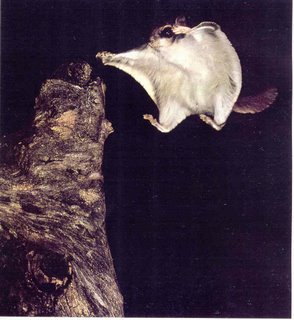
Image: A northern flying squirrel as it lands from a glide. (National Geographic Society 1979)

The Northern Flying Squirrel (Glaucomys sabrinus) is one of two species of the genus Glaucomys, the only flying squirrels found in North America (the other is the somewhat smaller Southern Flying Squirrel, G. volans). Two subspecies are found in the southern Appalachians, the Carolina Northern Flying Squirrel, G. s. coloratus, and the Virginia Northern Flying Squirrel G. s. fuscus, both of which are endangered.

These squirrels are small nocturnal creatures that spend most of its time in trees. They have large black eyes, rounded ears, and long whiskers. Their soft fur varies in shades of gray and brown, and their belly is mostly white but lead colored at the base. The northern flying squirrel has a flight membrane called a patagium that extends from their hands to their feet. Their patagium is elastic and retractable, allowing them to be nimble when they are running or climbing. When they glide, they stretch out their limbs so their patagium looks like a sail, and then they jump off the branch and use their body to maneuver themselves in the air. So they don’t fly the way a bird does, but they can glide well over 100ft. or about 30m. The northern flying squirrel has a flattened tail that is 40 percent of their total body length. The fur on their tails is very short on the top and bottom and long and flattened on the sides. Their tails acts like a stabilizer and a rudder when they are gliding which also aids them in landing.

Northern flying squirrels molt once a year in autumn. They are clean animals and spend part of their day grooming. Their active period is pretty short, just a couple of hours after sunset and the last hour or so before sunrise. They have a call that is typical for squirrels a “chuck-chuck,” but sometimes they chirp notes like a bird. Their main predator is the Great Horned Owl, but the bobcat, fox, and hawk are also predators of concern for them.

They are found mainly in coniferous forests, but can also be found in deciduous and mixed coniferous and deciduous forests. Common nests for the squirrels are abandoned woodpecker nests or a hollow of a tree. They may insulate their nests first with leaves, dried grass, and then add shredded vegetation, feathers, fur, dried grass, or lichen.

The northern flying squirrel has a typical squirrel diet, which consists of a variety of foods such as seeds, nuts, berries, some leaves, buds, mushrooms, acorns, flowers, fruits, fungi, lichen, sap, insects and sometimes bird’s eggs. Unlike regular squirrels, lichen and fungi makes up a large portion of the flying squirrels’ diet. Northern flying squirrels have been known to hoard food for the winter months, although they do not hibernate.

The mating season starts at the end of March and the beginning of April. It is common for the male to be driven off by their mate before their young are born, but usually they stay near their family by having a nest close by. The female northern flying squirrel is territorial, whereas the male is not. At night the adults may feed and play together, but there is no evidence that the males ever get to be with their offspring. The squirrels give birth in late April to June, and one litter is born a year. The average litter size is three, but the range is from as little as one to as many as six. The gestation period is 37-42 days, and the newborns are deaf, blind, and hairless and weigh about 5-6 grams. In about a month they have grown some fur, and may weigh four times as much as when they were born. At about nine weeks they are weaned becoming more independent. By the twelfth week they try gliding. At four months they become good gliders and are able to take care of themselves. The northern flying squirrels survival rate is less than thirty percent for juveniles and fifty percent for adults. The average life span is about 3-4 years but some in captivity may live as long as 10 years. There is little known about the squirrels’ social structure, courtship, mating and reproductive behavior since they are nocturnal and may be hard to spot.


Technorati Tags:

Saturday, August 05, 2006

Appreciating Wildflowers


The first step in appreciating wildflowers is to explore the public lands. Wildflowers are easy to spot and nearly all natural areas have guidebooks for beginners. You can also call local botanical gardens and arboreta. Educational materials include plant identification books, coloring books, and trail guides to highlight the best ways to learn about and enjoy the wonders of our native wildflowers. Numerous guided walks, displays, and presentations are available from federal agencies and private organizations in order to aid you in your appreciation and understanding of the values of the wildflowers right under your nose! Please, don't pick the wildflowers.

Plants and plant communities are critically important to humans and their environment. Usually taken for granted, the role they play in our lives ranges from subtle to obvious.

Plants have great aesthetic value. How many of us would be willing to live without the plants beautifying the world around us? From the forests, woodlands, and grasslands surrounding our towns and cities to the wildflower gardens and natural landscaping in backyards, native plants provide a spiritual link between nature and our Nation's diverse cultural history. Many of the plants grown by gardeners are domesticated versions of wild plants. Many other gorgeous looking native plants have yet to be chosen for use in horticultural cultivation.

The oxygen in the air we breathe produced by the photosynthesis of plants. Not only is the air produced by plants, but the quality of the air can be greatly influenced by plants as well. Vegetation can restrict the movement of dust and pollutants, and plants, through their intake of carbon dioxide, can moderate the greenhouse effect resulting from the burning of fossil fuels.

Regional climates are influenced by plant cover. Forests and marshes, for example, can greatly moderate local climates. Natural disasters, such as drought, have been attributed to the destruction of forests and other critically important plant communities.

Diverse plant communities are extremely important for sustaining healthy ecosystems. When considering the complex interactions, such as the food web, that are found in ecosystems, you realize that every species counts! Plant habitats must be protected before species become critically endangered. With your support, we can conserve the more than 660 threatened and endangered U.S. plants and the 4,500 other U.S. plant species which are at risk of extinction.
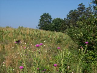
Plants and plant communities provide the habitat necessary to sustain wildlife and fish populations. Plant communities are the basis for virtually all terrestrial animal life because they provide the vital components of survival, food and shelter. The wildflowers you gaze upon aren't only beautiful, but useful as well, serving as animals' meals and homes. Without the appropriate habitat to support them, birds and animals of all kinds are in danger of extinction.

Although some 3,000 species of plants have been used by humans for food, 90 percent of the world's food comes from only 20 plant species. Three grass species in particular, rice, wheat, and corn, are by far the most important food plants in the world. If a new unmanageable disease or pest were to suddenly attack one of those species, an agricultural disaster could take place as a major food crop is destroyed. Luckily, the basis for stopping that kind of a disaster exists in the form of a genetic gold mine found in wild plants.

Native plants have great untapped potential as sources of improved genetic traits such as disease resistance, drought tolerance, and improved nutritional value. Have you ever admired the bright yellow or orange head of a sunflower? Breeding with wild species of sunflowers has produced the disease-resistant and highly productive hybrids used as the basis of the sunflower industry which provides seeds, oil and other products. So be sure to look with appreciation because the wild flower before you may have been one of the founding species of the $400 million sunflower industry.

Because they are food for animals, plants are the real source of animal products we consume - beef, chicken, and fish. Even dairy products such as milk and ice cream would not exist if dairy cows did not have grass and other plants to eat.

Plants are immensely important for the consumer goods they provide. Look around you. Fibers from plants provide clothing. The paper for documents, the cardboard in boxes, and the wood used to build our homes and offices depends on plants as well. From the spearmint in your toothpaste to the jojoba oil in your shampoo to floral perfume, plants have contributed to the things you find in your bathroom. Beyond the more obvious plant derived products surrounding you, it might surprise you that even future fuel needs may also be met by plants. Possible fuel sources include hydrocarbons derived from species like gopher plant or alcohols derived from corn and sugar cane. While many of the most important industrial products come from relatively common plants, rare and uncommon plants have provided exotic substances ranging from insect repellent to lubricants. Use as industrial products is yet another barely examined potential of plants.

Throughout history, plants have been of paramount importance to medicine. You may not know it, but 80 percent of all medicinal drugs originate from wild plants. In fact, 25 percent of all prescriptions written annually in the United States contain chemicals from plants! In spite of the technological and medical advances in recent years, only 2 percent of the world's plant species have been analyzed for even one group of plant chemicals, the alkaloids. Any one of those plant chemicals could be useful. Take for example the pink flower, Madagascar periwinkle, from which vincristine is derived. Vincristine has increased the survival rate of children with leukemia from 20 percent to 80 percent. Another extremely promising drug is taxol, derived from the Pacific Yew, which has worked against a broad range of cancers, including ovarian cancer. As most plants remain untested for medicinal potential, many more such drugs remain to be found.

Plant communities form the basis for many important recreational activities, including hiking, fishing, and hunting, photography, and nature observation. Could you imagine fishing in a pool surrounded by concrete or photographing animals and birds in an asphalt parking lot? Without the plants creating the habitat as the backdrop for those activities, recreation simply would not be as enjoyable and aesthetically pleasing.

The delicate wildflowers and other plants that dot the hillsides through spring, summer, and fall protect the soil from rampaging rains as they have done for thousands of years. Without adequate plant cover and root systems holding it in place, wind or water will carry away the thin mantle of soil upon which our existence depends.

Plants are extremely important to the quality of the water we use. A diverse cover of plants aids in maintaining healthy watersheds, streams, and lakes by holding soil in place on the banks, regulating stream flows, and filtering sediments from water by slowing it down.

Conservation and Etiquette - The Dos and Don'ts of Wildflower Appreciation

Wildflowers are the jewels of the public lands. Like any treasure, they must be protected for all to enjoy. You can join the Forest Service, Bureau of Land Management, Fish and Wildlife Service, and the National Park Service in the stewardship of these priceless resources.

• Take a hike and stop to smell the fragrant wild roses.
• Take only photographs and memories when you leave.
• Please, don't pick the flowers.
• Tread lightly and stay on the trail.
• Don't be afraid to ask for information on wildflowers.
• Get involved! Explore volunteer opportunities on your public lands.

There is still time to enjoy the wildflowers of the Blue Ridge!

Parkway bloom times
The time frame references the usual dates a particular flower is in peak bloom.

• Angelica Aug-Sept
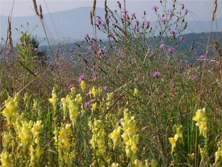
• Bellflower July-Sept
• Bergamot Beebalm July-Aug
• Bladder Campion May-Aug
• Blazing Star Aug-Sept
• Boneset Aug
• Bull Thistle late June-frost
• Butter and Eggs June-Aug
• Cardinal Flower Aug
• Coreopsis June-Aug
• Deptford Pink June-Aug
• False Hellebore June-Aug
• Gentian late Aug-frost
• Ironweed Aug
• Jewel Weed Aug
• Joe-Pye-Weed Aug
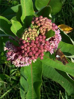
• Milkweed July-Aug
• Mullein June-Sept
• Nodding Lady Tresses Aug-frost
• Oswego Tea July-Aug
• Pokeberry Aug
• Queen Anne's Lace May-Sept
• Starry Campion July-Sept
• Tall Coneflower July-Aug
• Tree of Heaven June, (Berries July-Oct)
• Turkscap Lily June-Aug
• Virgins Bower Aug


All images taken on the Blue Ridge Parkway, August, 2006 by D L Ennis

Friday, August 04, 2006

A Concise History of Settlement in Maryland’s Catoctin Mountains


Image: from the National Park Service

For centuries before the arrival of European whites, Maryland’s Catoctin mountain area remained largely uninhabited, with the exception of occasional groups of nomadic Native Americans, attracted by the rich natural resources of the area. Even as white colonists settled other areas of Maryland, the western part of the state remained sparsely populated. However, in the 1740s, whites began arriving in greater numbers.

Early settlers were mostly Germans, seeking a life away from the political and religious turmoil of Europe. They carried with them an intense religious attachment and skill in farming. As you can imagine, life for the early pioneers could be hard, even terrifying when war broke out, nevertheless the availability of large, plentiful tracts of land offered genuine rewards. As the revolution approached, eastern elites, largely of English origin, also began to take notice of the rich resources of the Catoctin region. Among them were Thomas Johnson, future governor of Maryland, and his partners who planned to build an iron furnace at the foot of the mountain.

In the 1680s, Dutch explorer Jasper Danckaerts (1679-1680) traveled through Maryland and was impressed by the growing colony, but he sensed that something was missing. "There are few Indians," noted the Dutchman, "in comparison with the extent of the country." He blamed the English for having "almost exterminated" the native population. The relative scarceness of Indians in Maryland actually was a permanent feature of the region and predated the arrival of the English by centuries. In this region no area had a smaller Indian population than western Maryland, which reflected the general trend of sparse inhabitation found in the northern and central Appalachian region.

Nevertheless, the absence of hostile Indians, did not lead to an immediate European settlement of Western Maryland. To be sure, the first whites to come to the mid-Atlantic region (arriving in 1607) remained primarily in the Chesapeake area for almost a century. The appeal of the Tidewater region rested on the profitability of tobacco. By the late seventeenth century--while western Maryland remained largely uninhabited--thriving plantations, a self-indulgent gentry, and an African slave-based labor system had sprung up in the Chesapeake. Since good tobacco could not be cultivated in the western reaches of the colony, there existed little interest in exploration and development. The absence of a navigable river in central western Maryland, the threat of Indian raids, and an ongoing border dispute between Maryland and Pennsylvania also worked to discourage settlement of the region. While eastern Maryland thrived, western Maryland sat virtually vacant of white settlers.

By the early-eighteenth century, the market for tobacco had softened and the colonies began to diversify their economies. Like the Native Americans whom they had displaced from the Tidewater region, European settlers began to look west in hope of exploiting the rich natural resources of the region. Trappers, traders, and missionaries were frequent visitors to the area by the early part of the century. In 1712, Swiss explorer, Baron Christoph de Graffenried climbed Sugar Loaf Mountain and recorded: "We discovered from this height three chains of mountains, the last higher then the one before, somewhat distant and a very fine valley between the first ranges." Soon squatters and a few other hearty souls began setting up permanent homes in the region.

The Chesapeake gentry, seeking investment opportunities, also grew interested. In 1727, a Chesapeake planter, Benjamin Tasker acquired a patent for 7,000 acres, west of the Monocacy, roughly twelve miles up the Potomac. The investor called his purchase "Tasker's Chance," as if to underscore the still risky nature of western ventures. Maryland's colonial government--seeking to encourage settlement of the backcountry--issued a proclamation in 1732 waiving the usual 40 shillings Sterling per 100 acre fee to anyone who would settle land in the western holdings of the colony.

Image: from the National Park Service

However settlement was hindered by a harsh debate over the exact boundaries of Maryland. Pennsylvania claimed much of the land west of the Susquehanna, and Maryland's interest in populating the area had everything to do with efforts to bolster its claims against Pennsylvania. The dispute swiftly turned violent, and a bitter war broke out in the 1730s. English-born pioneer Thomas Cresap--a robust Daniel Boone-type character--was Maryland's chief supporter. His wife, known to sport a gun, two pistols, a scalping knife, and a tomahawk, was no less committed to the cause. To Cresap, area farmers loyal to Pennsylvania were "poachers." When captured by Pennsylvania authorities in 1736 and brought to Philadelphia to stand trial, Cresap infuriated his captors by declaring Penn's city, "one of the Prettyst [sic] Towns in Maryland."

The bitter conflict slowed settlement of the Monocacy Valley region; even as immigrants began passing through the region and noting its potential. Fleeing religious persecution and dwindling economic opportunity, Germans, especially from the Palatinate region of the Rhine, began migrating in large numbers to Pennsylvania in the 1730s. By 1750, the population of Pennsylvania was one half-German. Seeking inexpensive but fertile land, some Germans moved southwest from Pennsylvania, along the Monocacy Road or "Great Wagon Road." Most likely a product of the old Indian trail through the region, the Monocacy route began in Pennsylvania on the west side of the Susquehanna at Wrightsville, and then proceeded through York and Hanover counties to Taneytown, Maryland. From there, the road moved into the future Frederick County and the future Williamsport, then southwesterly across the Monocacy and Potomac. Germans traveling the road might have been tempted to join the smattering of settlers already in western Maryland, but, despite the promises of Maryland's leaders, they feared paying double taxes or getting caught in the violent cross fire between warring colonies; therefore, most pressed onward to the Shenandoah Valley.

By the 1740s, the conflict had settled somewhat, although it would fester for another thirty years. By that time Benjamin Tasker's son-in-law, Daniel Dulany, was ready to take the initiative in settling the area. Acquiring his father-in-law's land in 1744, Dulany hired Thomas Cresap to conduct a survey of western Maryland. Cresap reported that land in the Monocacy Valley equaled if not surpassed "any in America for natural Advantages." Encouraged, Dulany patented other land in the area, and subdivided Tasker's Chance, initially offering plots at bargain prices. Although a member of the Chesapeake gentry, Dulany actively sought to attract Germans to his holdings. With a reputation as solid, industrious farmers, Dulany thought them to be the perfect pioneers to tame his land, and he offered them land sometimes at below cost.

Many Germans took up Dulaney's offer. The 7,000 acres that made up Tasker's original chancy purchase soon became the site of a thriving city named for Lord Baltimore's son, Frederick. Many others, having accumulated enough money to purchase land themselves, took up residence to the north of Tasker's Chance, along the Monocacy River, near the Catoctin Mountains. The area had real appeal to German immigrants. The attractions, according to historian Elizabeth Kessel, included a "large measure of civil and religious freedom and unprecedented opportunity of owning . . . and accumulating large amounts of land . . . for a simple fee and only a minor obligation of a quitrent (annual tax), and land could be passed on to heirs with full force of law."

Technorati Tags:

Wednesday, August 02, 2006

Cantilevered Barns of East Tennessee

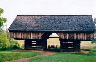
A curious nineteenth century American structure, the cantilevered barn is unique to the Southern Appalachian region where over 300 have been discovered. found principally in two East Tennessee counties, Sevier and Blount, the cantilever barn differs from an ordinary barn in that the second floor loft oversails or cantilevers out from the ground level supporting cribs. A cantilever is a horizontal projection, in this case a beam, without external bracing that appears to be self-supporting. In fact, the horizontal projection extends beneath or into the mass it supports and is kept in place by the downward force created by the mass resting on it.

In studies of mountain buildings made in the early 1960s, Henry Glassie identified these barns as characteristic of the southern highlands, indicating that they were found in North Carolina, Kentucky, and West Virginia. In the 1980s fieldwork by Marian Moffett and Lawrence Wodehouse found only six cantilever barns in Virginia and another three in North Carolina. By contrast, 316 cantilever barns were located in East Tennessee, with 183 in Sevier County, 106 in Blount County, and the remaining twenty-seven scattered from Johnson to Bradley Counties.

Documentary evidence on these barns is very scarce. Most seem to have been built from 1870 to about 1915, by second- or third-generation settlers. Cantilever barns were constructed on self-sufficient farms, where accommodations for seed corn, feed, livestock, and equipment were basic needs. The unusual design may derive from German forebay barns in Pennsylvania, built into the hillside with an overhang along the out-facing side. Pioneer blockhouses in East Tennessee and elsewhere had modest overhangs on all four sides of the upper story, and these may have inspired the shape of later barns. Experts agree that these pioneers based their designs on the timber construction techniques of their ancestors.

Tennessee farmers soon discovered that the European constructions, and even techniques brought from New England and the nearby Mid-Atlantic states, had to be modified to survive in the unique climate of eastern Tennessee. Cantilevered barns in drier northern climates often had one side built directly into the side of a hill- - to facilitate the moving of farm machinery and livestock in and out of the structure. This technique proved disastrous in the Tennessee mountains because of rain and termites. The higher elevations of eastern Tennessee receive up to eighty inches of rain annually and are warm enough to support two types of termites that thrive in the soggy soil. Barns adjacent to damp, infested ground lasted only a few years.

The most accessible cantilever barns are preserved at the Cable Mill and Tipton Homeplace in Cades Cove of the Great Smoky Mountains National Park. Two others are owned by the Museum of Appalachia in Norris.

Birds of the Mid-Atlantic #18: Ruby-throated Hummingbird

A characteristic bird of summer in the Mid-Atlanic region is the ruby-throated hummingbird. These unique birds are the smallest in eastern North America and have distinctively-shaped bodies. Though hard to spot, they are easy to identify because of their squat body shape and long, needle-like bills. Ruby-throated hummingbirds have iridescent green heads and backs with white breasts and bellies. Males have a red throat that females lack.

Ruby-throated Hummingbird / Photo by USDA (via Wikimedia)

Hummingbird flight varies between fast and direct for forward flight and hovering at a near standstill for foraging. The flight of hummingbirds is so insect-like that many beginning birders and non-birders are surprised to learn that they are birds when they first see them. This insect-like flight is itself a useful field mark for identifying hummingbirds from other creatures. Look for something larger than an insect that flies like one.

Their flight is adapted for its foraging techniques, which center on two types of food. A hummingbird gains energy by drinking the nectar from flowers of various plants and trees. As a supplement, it may use a feeder if one is available. In either case, a hummer will hover and the food source and drink. Further nourishment is derived from catching small insects in midair. Sometimes one will see a hummingbird hover to glean insects and spiders from tree limbs.

Here is a video of some ruby-throated hummingbirds in action, mostly around a feeder. Both male and female are shown, with the frames slowed down to show wing action. It also includes a short clip of a sphinx moth, which may be confused with a hummingbird. The last shot of this video shows a characteristic feature of hummingbird plumage, namely its ability to change apparent color depending on the angle of the light. The head and throat feathers may at times appear black, only to flash red when hit directly by sunlight, as happens here. Here is a normal-speed video of feeding ruby-throated hummingbirds.

For most of the year, the ruby-throated hummingbird is the only hummingbird that is likely to be found in the Mid-Atlantic, or in eastern North America generally. It is our only breeding hummingbird. In the late fall and early winter, some western hummingbirds pass through this area and may even spend the winter if food is available. The most likely to appear is the rufous hummingbird. Other western hummingbirds that have been recorded in D.C. and Maryland include .... A few years ago, black-chinned and rufous hummingbirds at the Smithsonian Arts and Industries Building caused quite a stir among DC birders. Most western hummingbirds that winter along the east coast are immatures that took too much of an easterly route on their flight south, so identification of winter hummingbirds can be tricky.

You can attract hummingbirds to your yard with appropriate plantings and hummingbird feeders. Many types of flowers will attract hummingbirds, including salvia, cardinal flower, foxglove, jewelweed, and trumpet creeper. Plantings to attract hummingbirds will draw many butterfly species as well. A longer list of flowers is here.

Commercial feeders are available online and in nature stores. Fill these with a solution of one part sugar to four parts water. Clean feeders and refresh the solution regularly to prevent the spread of disease. Leave the feeders up in November and December if you would like to try to attract a migrating rufous hummingbird or other western species. For recommendations on maintaining feeders, see Hummingbirds.net and Rubythroat.org. For more information on winter hummingbirds, see Trochilids.com.

A hummingbird at a feeder or other food source may act aggressively towards other hummingbirds. For an example, see this video of two hummingbirds fighting over a single feeder. If you turn up the volume you can hear their chattering. For such small animals they are very feisty.

Labels:

Tuesday, August 01, 2006

Covered Bridges of Virginia


Bob White covered bridge, Patrick County, Virginia; 80', 1920, closed to motor traffic.

In my lifetime, covered bridges have been seen largely as romantic structures of a more quixotic time. However, nowadays I believe by all but the oldest third of our population they are thought of only as historical landmarks, but what was the original purpose of covering bridges? Many reasons have been suggested over the years for why bridges were covered, and even though most were practical or romantic, not all of these ideas were correct from a truly practical stand point. One explanation was that "the spans were built to resemble barns so farm animals would feel more at home and not stampede as they were driven across the rushing waters." Other explanations included: to keep snow off the bridge, "to keep the oiled planks of the roadbed from becoming dangerously slippery in the rain," to cover up the unsightly trusses, to provide shelter to travelers caught in a storm, and to provide a place to court your lady and secretly give her a kiss.

Covered bridges did serve many of these purposes other than simply providing a way to cross a river. Weddings, political rallies, National Guard drills, religious meetings, a night’s sleep for tramps, town meetings, poker parties, election headquarters, sweethearts’ rendezvous, drunken revels, bond rallies, fights and dances, and rainy-day luncheons took place in covered bridges. They also served as good landmarks and advertisement billboards.

However, one real reason for covering bridges was to protect the trusses from the weather because the environment caused bridges to fail sooner. Bridge engineers pointed out that a housed timber truss span has a life expectancy at least three times greater than one un-housed. Another important consideration was that the housing provided a kind of insulation for the timber, shading it from the sun and maintaining it under more uniform temperature conditions.

Covered bridges can be dated back two thousand years to a time when they were being built in China and even earlier in ancient Babylon (780 B.C.). But the first covered bridge built in America was built in 1804 by Theodore Burr of Connecticut. This bridge spanned the Hudson River in New York and was called the Waterford Bridge, lasting for 105 years.

In Virginia, covered bridges began to dot the countryside nearly two centuries ago. Spanning rivers and streams, their number grew to the hundreds. However, relatively few of Virginia’s covered bridges survived into the early years of the 20th century. Here are a few:

Bob White Bridge
The Bob White Bridge in Patrick County is an 80-foot truss over the Smith River near Route 8 south of Woolwine. Built in 1921, it served principally as a connection between Route 8 and a church on the south side of the river. Although it has been replaced with a modern bridge, visitors can still walk up to the Bob White Bridge, which was retained for its landmark value.
It can be reached from Woolwine by traveling 1.5 miles south on Route 8, east one mile on Route 618 to Route 869, then south one-tenth of a mile.

Jack's Creek Bridge
Jack's Creek Bridge crosses the Smith River in Patrick County on Route 615 just west of Route 8 about two miles south of Woolwine. The 48-foot span, built in 1914, has been replaced by a modern bridge but is being retained in the county.
It can be seen from Route 8 at its intersection with Route 615, or it can be reached by turning west two-tenths of a mile on Route 615.

Humpback Bridge
In terms of seniority, the venerable Humpback Bridge lays claim to being the oldest of Virginia's remaining covered bridges. Located in Alleghany County, just west of Covington, it was built in 1857. It was part of the James River & Kanawha Turnpike (JR&KT) and it succeeds three other bridges at the site. It stretches over Dunlap Creek, which is a tributary of the Jackson River that joins the Cowpasture River, near Iron Gate to form the James River. The first structure was built in the 1820s and was washed away by a flood on May 12, 1837. The second fell victim to the flood of July 13, 1842 and the third, as the annual report of the JR&KT company put it, "gave way" in 1856.

The 100-foot-long, single-span structure is four feet higher at its center than it is at either end, thus the name, "Humpback". Traffic across the bridge ceased in 1929 when it was replaced with a "modern" steel truss bridge. It stood derelict (and was even used by a nearby farmer to store hay) until 1954. That year, thanks to the fund-raising efforts of the Business and Professional Women's Club of Covington and the Covington Chamber of Commerce, it was restored and preserved as part of Alleghany County's history.
It can be reached from I-64 by taking exit 10 to Route 60 and traveling one-half mile east, or by taking Route 60 west from Covington.

Sinking Creek Bridge
In Giles County north of Route 460 are two circa 1916, modified Howe trusses built over Sinking Creek.

Sinking Creek Bridge (also known as Clover Hollow Bridge), a 70-foot span currently maintained by Giles County, was left in place for the property owner when a new bridge was built in 1949. It is located just off Route 601 between Route 42 and Route 700. A 55-foot span, known as Link's Farm (Bradley) Bridge, stands on private property nearby.
Also in Giles County is the C.K. Reynolds Covered Bridge, which still remains on private property. The Biedler Farm Bridge in Rockingham County, also remains on private property.

Meem's Bottom Bridge
One of the best-known covered bridges is the 204-foot single-span Burr arch truss known as Meem's Bottom in Shenandoah County. Here it is possible to step back into the past, while less than a half-mile away the hum of modern-day traffic can be heard on I-81.

The site takes its name from the Meem family that owned large landholdings in the area. This long span over the North Fork of the river carried traffic for more than 80 years before being burned by vandals on Halloween 1976.

After salvaging the original timbers, the bridge was reconstructed and eventually undergirded with steel beams and concrete piers.

Succeeding several earlier bridges, the Meem's Bottom Bridge was built in 1894 from materials cut and quarried nearby for the massive arch supports and stone abutments, which extended 10 feet below the riverbed. Records show that previous bridges were washed away in the floods of 1870 and 1877. The next bridge, built in 1878, stood until replaced by the present bridge.
The bridge is reached easily from I-81 at exit 269 between New Market and Mount Jackson, following Route 730 from the interchange four-tenths of a mile to Route 11, then north on Route 11 nine-tenths of a mile to Route 720 and west a short distance to the river. It also can be reached on Route 11 four miles north of New Market and about two miles south of Mount Jackson.

Today in Virginia, only eight covered bridges are known to still stand. Five have been preserved as landmarks and three are on private property.

C.K. Reynolds Covered Bridge, Giles County.
Biedler Farm Bridge, Rockingham County.
Links Farm Bridge, Giles County.

For more information on Virginia’s covered bridges click here.

Images: from, Virginia Department of Transportation

Technorati Tags: