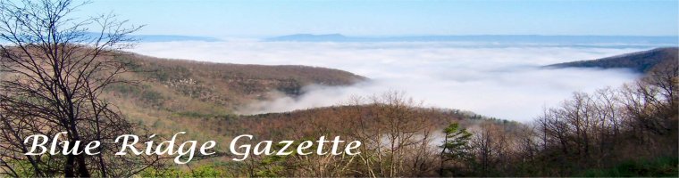
A Brief History of Settlement in Maryland’s Catoctin Mountains
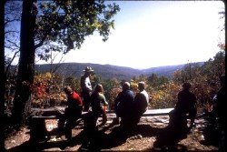
Image: from the National Park Service
For centuries before the arrival of European whites, Maryland’s Catoctin mountain area remained largely uninhabited, with the exception of occasional groups of nomadic Native Americans, attracted by the rich natural resources of the area. Even as white colonists settled other areas of Maryland, the western part of the state remained sparsely populated. However, in the 1740s, whites began arriving in greater numbers.
Early settlers were mostly Germans, seeking a life away from the political and religious turmoil of Europe. They carried with them an intense religious attachment and skill in farming. As you can imagine, life for the early pioneers could be hard, even terrifying when war broke out, nevertheless the availability of large, plentiful tracts of land offered genuine rewards. As the revolution approached, eastern elites, largely of English origin, also began to take notice of the rich resources of the Catoctin region. Among them were Thomas Johnson, future governor of Maryland, and his partners who planned to build an iron furnace at the foot of the mountain.
In the 1680s, Dutch explorer Jasper Danckaerts (1679-1680) traveled through Maryland and was impressed by the growing colony, but he sensed that something was missing. "There are few Indians," noted the Dutchman, "in comparison with the extent of the country." He blamed the English for having "almost exterminated" the native population. The relative scarceness of Indians in Maryland actually was a permanent feature of the region and predated the arrival of the English by centuries. In this region no area had a smaller Indian population than western Maryland, which reflected the general trend of sparse inhabitation found in the northern and central Appalachian region.
Nevertheless, the absence of hostile Indians, did not lead to an immediate European settlement of Western Maryland. To be sure, the first whites to come to the mid-Atlantic region (arriving in 1607) remained primarily in the Chesapeake area for almost a century. The appeal of the Tidewater region rested on the profitability of tobacco. By the late seventeenth century--while western Maryland remained largely uninhabited--thriving plantations, a self-indulgent gentry, and an African slave-based labor system had sprung up in the Chesapeake. Since good tobacco could not be cultivated in the western reaches of the colony, there existed little interest in exploration and development. The absence of a navigable river in central western Maryland, the threat of Indian raids, and an ongoing border dispute between Maryland and Pennsylvania also worked to discourage settlement of the region. While eastern Maryland thrived, western Maryland sat virtually vacant of white settlers.
By the early-eighteenth century, the market for tobacco had softened and the colonies began to diversify their economies. Like the Native Americans whom they had displaced from the Tidewater region, European settlers began to look west in hope of exploiting the rich natural resources of the region. Trappers, traders, and missionaries were frequent visitors to the area by the early part of the century. In 1712, Swiss explorer, Baron Christoph de Graffenried climbed Sugar Loaf Mountain and recorded: "We discovered from this height three chains of mountains, the last higher then the one before, somewhat distant and a very fine valley between the first ranges." Soon squatters and a few other hearty souls began setting up permanent homes in the region.
The Chesapeake gentry, seeking investment opportunities, also grew interested. In 1727, a Chesapeake planter, Benjamin Tasker acquired a patent for 7,000 acres, west of the Monocacy, roughly twelve miles up the Potomac. The investor called his purchase "Tasker's Chance," as if to underscore the still risky nature of western ventures. Maryland's colonial government--seeking to encourage settlement of the backcountry--issued a proclamation in 1732 waiving the usual 40 shillings Sterling per 100 acre fee to anyone who would settle land in the western holdings of the colony.
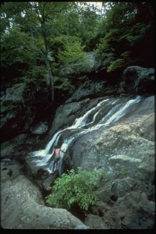
Image: from the National Park Service
However settlement was hindered by a harsh debate over the exact boundaries of Maryland. Pennsylvania claimed much of the land west of the Susquehanna, and Maryland's interest in populating the area had everything to do with efforts to bolster its claims against Pennsylvania. The dispute swiftly turned violent, and a bitter war broke out in the 1730s. English-born pioneer Thomas Cresap--a robust Daniel Boone-type character--was Maryland's chief supporter. His wife, known to sport a gun, two pistols, a scalping knife, and a tomahawk, was no less committed to the cause. To Cresap, area farmers loyal to Pennsylvania were "poachers." When captured by Pennsylvania authorities in 1736 and brought to Philadelphia to stand trial, Cresap infuriated his captors by declaring Penn's city, "one of the Prettyst [sic] Towns in Maryland."
The bitter conflict slowed settlement of the Monocacy Valley region; even as immigrants began passing through the region and noting its potential. Fleeing religious persecution and dwindling economic opportunity, Germans, especially from the Palatinate region of the Rhine, began migrating in large numbers to Pennsylvania in the 1730s. By 1750, the population of Pennsylvania was one half-German. Seeking inexpensive but fertile land, some Germans moved southwest from Pennsylvania, along the Monocacy Road or "Great Wagon Road." Most likely a product of the old Indian trail through the region, the Monocacy route began in Pennsylvania on the west side of the Susquehanna at Wrightsville, and then proceeded through York and Hanover counties to Taneytown, Maryland. From there, the road moved into the future Frederick County and the future Williamsport, then southwesterly across the Monocacy and Potomac. Germans traveling the road might have been tempted to join the smattering of settlers already in western Maryland, but, despite the promises of Maryland's leaders, they feared paying double taxes or getting caught in the violent cross fire between warring colonies; therefore, most pressed onward to the Shenandoah Valley.
By the 1740s, the conflict had settled somewhat, although it would fester for another thirty years. By that time Benjamin Tasker's son-in-law, Daniel Dulany, was ready to take the initiative in settling the area. Acquiring his father-in-law's land in 1744, Dulany hired Thomas Cresap to conduct a survey of western Maryland. Cresap reported that land in the Monocacy Valley equaled if not surpassed "any in America for natural Advantages." Encouraged, Dulany patented other land in the area, and subdivided Tasker's Chance, initially offering plots at bargain prices. Although a member of the Chesapeake gentry, Dulany actively sought to attract Germans to his holdings. With a reputation as solid, industrious farmers, Dulany thought them to be the perfect pioneers to tame his land, and he offered them land sometimes at below cost.
Many Germans took up Dulaney's offer. The 7,000 acres that made up Tasker's original chancy purchase soon became the site of a thriving city named for Lord Baltimore's son, Frederick. Many others, having accumulated enough money to purchase land themselves, took up residence to the north of Tasker's Chance, along the Monocacy River, near the Catoctin Mountains. The area had real appeal to German immigrants. The attractions, according to historian Elizabeth Kessel, included a "large measure of civil and religious freedom and unprecedented opportunity of owning . . . and accumulating large amounts of land . . . for a simple fee and only a minor obligation of a quitrent (annual tax), and land could be passed on to heirs with full force of law."
Technorati Tags: [Maryland][Catoctin Mountains][National Park Service]
posted by D L Ennis @ 2:12 PM
![]()


0 Comments:
Post a Comment
<< Home