The Photography of D L Ennis, and more!


Thursday, June 29, 2006

The Early Settlers of Appalachia

Image by, D L Ennis

Part I – Starting a New Life

The people who settled the Appalachians were generally of three ethnic origins: Scots-Irish, English, and German .Primarily farmers and skilled craftsmen, they were used to hard work and not intimidated by the intense labor that was mountain life.

Many Ulster-Scots left the British Isles and came to America in the early 18th century. They came to Maryland and Pennsylvania but found the lands along the Delaware and the Chesapeake taken by earlier settlers from England; therefore, they moved west following the Great Appalachian Valley, moving southward into the piedmont and mountains of Virginia, North Carolina, and Tennessee.

These early settlers were descendents of hardy Scots who had survived many years of struggle against invaders who, time after time, had pushed them back into the hill country of Scotland but had never conquered them. Over the centuries of struggles they became great warriors with more of a love of liberty than life. Forced to live in the mountainous lands of the Scotland, they were sustained only through hard work and frugal living.

Many English immigrants migrated from the Tidewater regions of Virginia and North Carolina and were the sons and grandsons of original settlers; or were late comers who found most of the best land taken and prices for existing homesteads ever increasing. Some were also of dissenting faiths, such as Baptists, Presbyterians, and Quakers, and were leaving eastern Virginia and North Carolina in order to escape discrimination, persecution, and taxes levied to support the Anglican Church.

As had the Scots, these English settlers brought with them an intense devotion to the legitimate principles of liberty, law, and justice. In their heritage was the story of a long struggle for individual rights against centuries of oppressors.

German families made homes throughout the Piedmont and Appalachians of Virginia and North Carolina also. They were a peace-loving and industrious people and became, by and large, recognized as the best farmers in America, and many of them were also skilled craftsmen.

Wednesday, June 28, 2006

Crafts in the Meadows - July 1 & 2


If you are looking for something to do this weekend, head to Meadows of Dan and the “Crafts in the Meadows ” festival!

Here is some of what you find there along with great fun and good people:

*Craft demonstrations throughout the weekend
*Locally grown fruits and vegetables available
*Food, fun and musical entertainment

No Admission
Bring your lawn chairs


Over the Rainbow - Kettle Popcorn and Bottled Water

Funnel Cake

Designs by Rach

Fried Pies, apple, peach, strawberry and more!

Lazy-R-Country Crafts

Mada Vemi Alpacas

Sterling Silver Jewelry by Jeanna Azar

Lisa Hollandsworth - Fibercrafts

Beautiful hand painted mail boxes by Ladybug Creations

Greenberry House

Locally Made Fudge and candy!

Mountain Meadow Crafts

Hungry Hillbilly Sandwiches!

Hunter's Bees' Nest

Hand Dipped Ice Cream!

Sodas, juices, fresh coffee!

Clinton Compton & Friends, performing Saturday, 1:00 - 3:00 PM

DorNel Pratt, Back by Popular Demand, Performing Sunday, 3:30 - 5:00 PM

Where:
Mountain Meadow Farm and Craft Market
Located in Meadows of Dan, Virginia
On Concord Road
Just 150 yards off the Blue Ridge Parkway
and 50 yards from Business 58

For more information visit Mountain Meadow Farm and Craft Market online!

Tuesday, June 27, 2006

Birds of the Mid-Atlantic #14: Veery

Deep in the woods of the mid-Atlantic Piedmont and the forests of the Appalachians, one may find a veery, a member of the thrush family. Slightly smaller than a robin, the veery has a rufous-brown back, white belly, and light rufous spotting at the top of the breast. In the dark, moist understory preferred by this species, individuals can be hard to spot. A veery will scurry along the forest floor from one inconspicuous place to another, all the while keeping a close eye on passers-by. Luckily, sight is not the only way to enjoy this species.

At right: Veery / Photo by NPS via Wikimedia

Despite its plain appearance, the veery is a prodigious songster. In fact, it sings my favorite bird song. The notes are resonant and cascade downward in a long stream. Even over cheap computer speakers, the song is beautiful; in a forest, the song has a wild and unearthly quality. Like other thrush songs, the veery's song is well suited to reproduction in standard musical notation. Here is one attempt to transcribe veery songs. While the instrumental version can match the pitch and rhythm of the song, it cannot match the beauty of the veery's performance.

Apparently I am not alone in my liking for the veery's song. Here is The Veery, a poem by Henry Van Dyke (text courtesy of Bartleby.com):

THE MOONBEAMS over Arno’s vale in silver flood were pouring,
When first I heard the nightingale a long-lost love deploring.
So passionate, so full of pain, it sounded strange and eerie;
I longed to hear a simpler strain,—the wood-notes of the veery.

The laverock sings a bonny lay above the Scottish heather; 5
It sprinkles down from far away like light and love together;
He drops the golden notes to greet his brooding mate, his dearie;
I only know one song more sweet,—the vespers of the veery.

In English gardens, green and bright and full of fruity treasure,
I heard the blackbird with delight repeat his merry measure: 10
The ballad was a pleasant one, the tune was loud and cheery,
And yet, with every setting sun, I listened for the veery.

But far away, and far away, the tawny thrush is singing;
New England woods, at close of day, with that clear chant are ringing:
And when my light of life is low, and heart and flesh are weary, 15
I fain would hear, before I go, the wood-notes of the veery.

The nightengale, laverock (sky lark), and blackbird are all European birds whose songs were celebrated by British poets. We have The Blackbird by Alfred Lord Tennyson, The Lover's Morning Salute to his Mistress by Robert Burns, and Ode to a Nightengale by John Keats. (One can certainly find more examples for each bird.) As the poet suggests, the veery deserves its place alongside these renowned songsters.

Links for recordings of veeries:
If you want to look for breeding veeries in Washington, DC, check in Rock Creek Park and Archbold-Glover Park. In migration, veeries may appear at either of those sites or at the National Arboretum. In the Blue Ridge, check the forests at higher elevations of the Blue Ridge Parkway.

Cross-posted at Blue Ridge Gazette and A DC Birding Blog.

Tags:

Labels:

Monday, June 26, 2006

When in Black Bear Country


Image: Black Bear (Ursus americanus) courtesy of the National Park Service

Seeing a black bear while camping or hiking in the wilderness can be an exciting or catastrophic experience, the outcome depends upon the circumstances and your “bear” knowledge.

Bears can seem almost human at times, partly because of their high intelligence and partly because they can stand and sit like we do. This can contribute to getting people into “bear” trouble. Most campers never see a bear, especially in years when natural food is abundant. But when natural crops fail, bears sometimes become less cautious of humans.

The best way to avoid trouble is to avoid the bears, which is usually not a problem when hiking because they will usually go out of their way to avoid people. Where the real problem starts is when you stop to camp; you settle down and everything gets quiet but, you have food in camp. So, you need to take precautions to prevent bears from grocery shopping in your camp.

To accomplish this, start by by-passing campsites with bear tracks, fecal droppings, and scattered garbage; bears are regular visitors there and if you must camp at such a site, keep a clean camp. The less food odor in your camp the less chance the bears will linger when they make their rounds. Wash dishes immediately and dump the water away from the camp. Completely and safely burn any edible garbage, including grease, rather than burying it or throwing it in a latrine. Non-burnable garbage should also be hung out of a bears reach and should be packed out when you leave.

Bear-proof food lockers and portable bear-proof containers provide the best protection for your food and are far superior to any alternative. Bear-proof food containers are lightweight and their price is competitive with canvas packs.

If you are camping near your automobile, the next best thing to a bear-proof food container is to store food in the trunk or in sealed plastic bags suspended from a line between two trees. Hang food bags at least 10 feet from the nearest tree trunk, and at least 12 feet above the ground. Bears have been known to leap from tree trunks to snatch food bags, and large black bears can reach up nearly 9 feet without jumping. Hanging the bag over a branch is less effective because bears can break small branches and climb out on large ones. If a branch must be used, put the bag far out on the tip of a branch larger than 4 inches in base diameter. Bears sometimes chew through ropes to get hanging food bags, so it is best to counterbalance the bag with a second one, slinging it over a branch, to avoid tying the rope where a bear can bite it.

Most black bears will not enter a tent with people in it, but it happens and it is still a good idea to keep food and food odors out of tents and sleeping bags. To be on the safe side, wash food from your face and hands before going to bed and hang clothing beyond reach of bears if it has food or cooking grease on it. Perfume may mask human odor, preventing bears from knowing a person is in the tent.

When you hike and (or) camp in bear country be smart and stay safe, and as always, when you go into our National Forest and National Parks leave nothing but footprints and take nothing but what you bring with you, photos, and memories.


Also see: Black Bear in the Blue Ridge Mountains


Technorati Tags:

Sunday, June 25, 2006

Writers Wanted

We are looking for writers! The Blue Ridge Gazette blog is a not for profit venture so currently we can't pay for articles that appear on the blog. However, we have put together an online magazine (zine) and our readership continues to grow, both on the blog and the zine!

Here is what we want: We want writers who are able and willing to post at least once a week, on the blog, on the subject of the Blue Ridge Mountains; the best articles from the blog are selected each month to appear in the following month's zine. If you are able to do this and stay with it long enough for the zine to start producing some income then you will be paid, in accordance with that income, for your articles which appear in the zine.

We are trying to build something and it takes time and dedicated people to make it work!

If you would be interested in getting in on the ground floor of this project and are able to help by working hard, within reason, and can be patient you could and hopefully will start earning an income from your writing!

If interested, you can email us here.

Let me just add: Each contributor retains all rights to what they write; we have no desire to copyright your material!

Saturday, June 24, 2006

New Family Traditions Created Through Vacations


Image: Me (I’m the little guy) my older brother and two younger sisters. Taken on the Blue Ridge Parkway near Rocky Knob in the summer of 1961.

As a child, my parents started something that has stayed with me and my siblings through the years, and even though my wife and I have no children, we have helped my brother and sisters and their children keep the vacation traditions that my parents started alive.

What my parents did was simple; they took us to the mountains on camping trips. We would travel the Blue Ridge Parkway and Skyline Drive and stop at favorite campgrounds. We had campfires at night where we would sit around telling stories, singing and roasting marshmallows and hotdogs. As children it was easy to make friends in the campgrounds, and my parents made life long friends who would all meet at a favorite campground every year for a vacation get together.

We often have certain things we always do, or traditions, epically during the holidays. Most families probably have traditions that take place throughout the year; but how about vacations? You can help to build wonderful memories and traditions, which your children will be thrilled to share with their children through vacations. Research shows that these traditions are important in building strong family relationships between generations.

Traditions are stories, beliefs, rituals and customs that are passed from one generation to the next. Keeping traditions for the holidays as well as the ordinary days help teach children the things their family values. These traditions help fill the individual's need to belong. Being a part of the special things our family does, helps us to have that sense of belonging.

Research shows us that routines and traditions are part of healthy families. Traditions give security to young people, providing a sense of continuity and routine that they can depend on year after year. Such activities help promote healthy relationships between the generations when they are enjoyed and anticipated by everyone. Children will remember the special experiences of family traditions more than toys and gifts.

To make family traditions more memorable, take the time to talk about the special things your family does and why it is important to you. Include the children in planning and carrying out the special activities. This will give them a feeling of pride and belonging to actually be a part of the traditions. It also helps them to understand why your family does these special things. If traditions are a part of your religious or cultural heritage, it gives the young people a sense of their family history.

Sometimes, as our families change, our traditions change with us, and that is all right. For example, you can still have the family all get together for a time of sharing and a special meal, but the place or the menu might change over the years. Or, perhaps now you use disposable dishes instead of Grandma's china. The important thing is that you get together as a family to share memories and pass on the family traditions and values.

Traditions help to bind us together as a family. Make it a point this year to include your children in family traditions that will provide them with a sense of belonging and build memories for their future.

Take them camping; bring them to the mountains and build vacation memories and traditions with your children!


Technorati Tags:

Tuesday, June 20, 2006

Birds of the Mid-Atlantic #13: Golden-winged Warbler

In the Birds of the Mid-Atlantic series so far I have covered only birds that I have seen myself. One eastern bird that I have not seen but would very much like to see is the golden-winged warbler. Golden-winged warblers breed in a wide band across the upper midwest and southern Canada (see BBS map). In the mid-Atlantic region, one is most likely to find them breeding in the middle and higher elevations of the ridge and valley province. During spring and fall migration the birds may be seen over a much wider area.

Males have a bold black and white facial pattern with a yellow cap and yellow wing coverts. Females have the yellow coverts but without as bold of a facial pattern. Golden-winged warblers behave much like chickadees, as they forage energetically and occasionally hang upside-down. The golden-winged song resembles that of the blue-winged warbler, but with a repeated second syllable.

Golden-winged Warbler / Photo by Ron Austing (NPS)

Like cerulean warblers, golden-winged warblers are in steep decline, enough to get the species red-listed on the Audubon Watch List. The causes for this warbler's decline are similar to those of other eastern songbirds, with habitat loss leading the list. Golden-winged warblers favor early successional habitats, which are associated with human disturbance such as old fields and power line cuts. As old fields grow into mature woodland, the lost habitats are often not being replaced by new old fields due to land use changes.

Some of the decline is attributable to other bird species. Birds nesting in edge and early successional habitats are especially vulnerable to brown-headed cowbirds, and the golden-winged warbler is no exception: about 30% of this species's nests receive cowbird eggs. Hybridization and competition with blue-winged warblers (yellow-listed on the Audubon Watch List) may also contribute. Blue-winged warblers are steadily invading the golden-winged's former range. Where the two species overlap, hybrids are common. A first-generation hybrid (i.e., blue-winged X golden-winged) is known as a Brewster's warbler; second generation backcrosses result in the Lawrence's warbler, which is much rarer. As blue-winged warblers enter the territories of golden-winged warblers, the latter slowly are pushed further north.

How can birders help? One way is to report sightings and participate in research programs that will guide conservation efforts. The Cornell Lab of Ornithology is conducting a multi-year Golden-winged Warbler Atlas Project to determine the breeding distribution and habitat requirements for the species. This year's project is drawing to a close, but the opportunity to participate will probably be open again in future years. Many local bird clubs, ornithological societies, and government agencies may also be able to use sighting information. (West Virginia, for example, asks for reports.) If you have seen either blue-winged or golden-winged warblers outside of the United States and Canada, you can send this information to the Alianza Alas Doradas.

Crossposted at the A DC Birding Blog.

Labels:

Monday, June 19, 2006

Father of the Ecology Movement, John Muir


In God's wildness lies the hope of the world - the great fresh unblighted, unredeemed wilderness. The galling harness of civilization drops off, and wounds heal ere we are aware. –John Muir (1838-1914)

In1892, John Muir wrote to the editor of Century Magazine, "Let us do something to make the mountains glad." So they founded the Sierra Club, the first major organization in the world dedicated to using and "preserving" wild nature. It is from this act that the modern Ecology Movement was born.

Throughout his life, Muir was concerned with the protection of nature both for the spiritual advancement of humans and, as he said so often, for Nature itself. This dual vision still informs the ecology movement and inspires millions to reform their thought and minds, to orient themselves as part of nature. Though the arguments in favor of ecological thinking are often couched in scientific terms, the basic impetus remains as Muir stated it: "When we try to pick out anything by itself, we find it hitched to everything in the universe."

John Muir- A Brief Biography.


Technorati Tags:

Sunday, June 18, 2006

The Mills of Waterford Village, Virginia


Image of the Waterford Mill as it is today.

In 1733, a Quaker from Bucks County, Pennsylvania, Amos Janney, purchased 400 acres along Catoctin Creek in Loudoun Valley. He constructed a log mill on the creek not far from the site of the present mill. Janney was soon joined by others drawn to the rich farmland along the banks of Catoctin Creek. From this site, a little settlement grew rapidly until the mill was the hub of a thriving agricultural community. Known as Janney's Mill until the 1780s, this early commercial center became what is known today as the village of Waterford.

By 1762, the growing population of grain farmers had necessitated the building of a larger grist mill on the site of the present mill. An adjacent saw mill provided lumber to build houses and barns, and roads were constructed to facilitate travel to and from Janney's Mill. Reflecting the fertility of the surrounding farmland, the mill was again rebuilt and enlarged in the 1820s. This is the structure that exists today.

Image right: the Schooley Mill.

Two additional mills operated in the village; Schooley Mill, primarily a saw mill, also ground corn, limestone, and clover and another mill which functioned as a cloth manufactory, or fulling mill.

By 1835, the settlement had grown into a village and served as the commercial hub to the surrounding farms. In the 1850’s, thanks to the nearby Chesapeake and Ohio Canal, Waterford's mills were providing products for an even wider market. Barrels of flour were hauled to Point of Rocks, Maryland, ten miles north of Waterford, where they were loaded onto C&O Canal barges or the Baltimore and Ohio railroad to be taken to the lucrative markets of Washington, DC, Alexandria, and Winchester.

Even though the Civil War devastated Waterford's economy, the mills continued to operate. The Washington and Old Dominion Railroad was extended from Leesburg west in 1870, bypassing Waterford and depriving it of its once dominant trading position. The village never returned to its former commercial success because area farmers and village residents could now import machine-made goods. However, enterprises supporting agricultural needs such as blacksmiths, wagon builders, harness makers remained working in the village until the early 1900s. Waterford's mills continued to operate and export grain to markets made accessible by the railroad.

The Old Mill was the last of Waterford's mills to cease operation. In 1939, the mill stopped grinding, marking the end of the milling industry in Waterford. The Waterford Foundation purchased the Old Mill, and later the Schooley Mill, to ensure the preservation of these buildings which housed one of the main livelihoods of the village for over two centuries.

Information and images provided by the Waterford Foundation.

Saturday, June 17, 2006

The Mountains of the Southern Appalachians


Image by, D L Ennis, from the Blue Ridge Parkway in Virginia.

The forests of the Southern Appalachian Mountains are among the oldest and most biologically diverse forests in the world. Sheathing some of the most ancient mountain ranges on earth, the forests of the Southern Appalachian Mountains have served as the heart of evolution for many of North America’s plant and animal species. The geologic and climatic stability of the region over the past 65 million years has afforded sanctuary during extraordinary climate changes, permitting species to weather ice ages and then repopulate in the wake of receding glaciers. The forests of the Southern Appalachian Mountains are currently home to more than 20,000 species of plants and animals.

There are 4.6 million acres of National Forests in the Southern Appalachian Mountains ranging from Virginia to northwest Alabama, offering recreational opportunities, within a day’s drive, to over half of the population of the United States. The wild and magnificent mountainous Monongahela National Forest in West Virginia adds another 900,000 acres of public lands to the network. Southern Appalachian National Forests also include the Thomas Jefferson and George Washington National Forests in Virginia, Pisgah and Nantahala National Forests in North Carolina, the Cherokee National Forest in Tennessee, the Francis Marion and Sumter National Forest in South Carolina, Chattahoochee-Oconee National Forest in Georgia and the Bankhead and Talladega National Forests in Alabama.

The Southern Appalachian National Forests contain 728,487 acres of road-less wilderness which provides refuge to an extraordinary natural legacy: more tree species than in all of Europe; hundreds of native vertebrates, from the mighty black bear to the petite, endangered blue shiner; over half the flowering plants and ferns in North America; abundant migratory songbirds; numerous salamanders; and, one of the greatest intensity of aquatic diversity in the world.

However, as stunning, rare and valuable as the Southern Appalachian National Forests are they still face numerous threats from the Bush Administration’s corporate welfare policies, including increased commercial logging, continued conversion of native forest to pine plantation, oil and gas development, and the negative impacts of illegal motorized vehicle recreation on the forests.


Technorati Tags:

Friday, June 16, 2006

Remnants of American Indian Life in the Blue Ridge


Spring is on its way out and summer is almost here, and as you travel the Blue Ridge Parkway this summer, look for the remnants of our Native American friends. The Blue Ridge Parkway extends nearly 500 miles along the crest of the Blue Ridge Mountains through North Carolina and Virginia; it encompasses some of the oldest settlements of pre-historic Native Americans.

The Cherokee Indians of North Carolina, and the Monacan and the now extinct, Saponi, and Tutelo Indians of western Virginia, were among the earliest inhabitants of the Blue Ridge, leaving artifacts and changes in the landscape as evidence of their existence.

Many of the fields that are still visible at the base of the mountains date back centuries, to ancient American Indian agricultural methods of burning and deadening the trees and underbrush to provide needed grazing and crop land. Mountain and river names along the Parkway also reflect the American Indian influence.

One of the best places to learn about the pre-history of the Appalachian chain in Virginia, is at the Peaks of Otter Visitor Center museum (milepost 85.9). Arrowheads and early tools found in the Peaks area are exhibited.

In North Carolina, the Parkway enters the Cherokee Indian Reservation at milepost 457.7 and features an informational display on the reservation at the Lickstone Overlook (milepost 458.9).

Images: by D L Ennis, Dancers at a Monacan Powwow


Technorati Tags:

Thursday, June 15, 2006

Go Bird Watching in the Blue Ridge


Image by, D L Ennis, an immature Cedar Waxwing not long out of the nest.

Bird watching is a fascinating pastime and hobby as well as an entertaining and educational way to spend time with your children. Too many young people are completely out of touch with nature these days, and this needs to change if our wild lands and wildlife are to be preserved for future generations.

In the Blue Ridge Mountains we have an incredible array of birds; some are year round residents, like the Chickadee and the Carolina Wren while others are seasonal residents like the Ruby-throated Hummingbird and Wood Thrush.

There is a wonderful loop trail in the Blue Ridge Highlands that affords an opportunity to see many of our wild birds as well as wildlife and historical sites.

Most of the sites on this loop are in and around Carroll County in the Blue Ridge Highlands. Loop sites span from the New River along the Blue Ridge Parkway to Major J.E.B. Stuart’s Birthplace, and end at two wildlife management areas near the City of Galax. The drive between each site is scenic and can provide extensive wildlife watching opportunities from the road (be careful, drivers!). White-tailed deer are abundant throughout this area, as are woodchuck and eastern chipmunk. Some of these sites, such as Major J.E.B. Stuart’s Birthplace and the Shot Tower Historical State Park, offer a rich historical experience as well. Other sites, such as Devil’s Den Nature Preserve, relay their ancient histories through their fascinating geological characteristics.

Click here for an enlarged, print-quality map (PDF)
NOTE: This file is very large and may take several minutes to download, depending on your connection.

For an interesting site on Bird Watching, I recommend A DC Birding Blog.


Technorati Tags:

Tuesday, June 13, 2006

The Seminole Trail


Image: by D L Ennis, Mother and Daughter dance at a Monacan Powwow in Amherst County, Virginia.

How did the “Seminole Trail" along US Route 29 in Virginia, get its name? Good question and it will likely remain a mystery forever. We know that in 1928, Virginia's General Assembly voted to name route 29 the Seminole Trail. “Ann L. Miller, a Virginia Department of Transportation historian, said the act -- Senate Bill 64 -- gives no clue why they picked that name or who initiated the proposal.”

The Answer Man, as he’s called, of the Washington Post says,


Many early roads followed old Indian trails, so you might expect that to be the case here. There's just one hitch: The Seminoles aren't a Virginia tribe. They never have been. They're mostly connected to Florida, where they were born from the fragments of earlier tribes that had sparred with colonists as well as runaway slaves who were looking for freedom.


He’s right that, “Many early roads followed old Indian trails…” He is also right that, “The Seminoles aren't a Virginia tribe.” However, is has been argued by, Joseph Opala, an anthropologist at James Madison University in Virginia, (who has studied the Seminole since the 1970s) that the Seminoles were a multiethnic tribe from their beginning. This is to say that the Seminoles are a permutation of various tribes as well as runaway slaves.

The Seminole were originally part of the Creek, and they began to migrate from Southern Georgia to Northern Florida in the later half of the eighteenth century. Other tribes that mixed with the Seminole were the Timuquan, Calusan, and Muskhogean. Other tribes in the area were the Choctaw, Chickasaw, Cherokee, Yuchi, Yamassee and Apalachicola and it is likely that members of these tribes also came to be with the Seminole.

Now back to the fact that the Seminole were never a Virginia tribe and speculation as to why route 29 in Virginia would be named the Seminole Trail.

Though the Seminole were never a Virginia tribe there are some things that connect them to Virginia. The first, and probably most obvious, would be the Cherokee. The Cherokee originally inhabited most of the southeast of the United States, including Virginia, Georgia, and Florida.

The next connecting factor would be the runaway slaves who runaway and took shelter with people who accepted them, the Seminole. It is known to be fact that slaves from as far north as Virginia fled and joined the Seminole some even intermarried with the Seminole. There is some speculation that the Seminole actually enslaved the runaway black slaves themselves at first, but I could not find enough proof in my research to see this as fact.

The most important connection between Virginia Indian tribes and the Seminole, I found very interesting and to me shows an element of proof that there was a definite substantial connection at some point in their history. This all important connection is language.

The Monacan tribe of Amherst County, Virginia spoke a form of Siouan. The Seminole spoke Hokan-Siouan. The fact that a Virginia tribe, the Monacan, and tribes from Georgia who we know became part of the Seminole, such as the Muskogean, both spoke a form of the Siouan language is an unarguable connection.

The Answer Man, of the Washington Post says,


So why name a Virginia road after them? Though historians aren't certain, it appears it was an act of 1920s boosterism. Officials wanted to remind people that Route 29 wasn't just for getting from Culpeper to Ruckersville -- it was also the road that leads all the way to the sun and fun of Florida, the Seminole state.
I don’t think that the Answer Mans theory of boosterism carries as much weight as the other connections that I have shown here. During the 1920’s roads were few and of low quality, not to mention that travel was still relatively slow, so people would not likely travel far out of their way to use one road as opposed to another. I think that boosterism in this case would have been a ridiculous reason for naming route 29 The Seminole Trail. Instead, I think that the most reasonable reason for the name would be the fact that Indians, runaway slaves and others used the same trail for ease of travel and that The Seminole Trail earned its name long before the need for modern numbered roads.

The Seminole Trail was a road to some semblance of a free life for many, through the turbulent times of America’s the 18th and 19th centuries, leading to the Seminole. Let’s give credit to those who forged the trail in question for the suffering they endured in doing so.


Technorati Tags:

Wayah Bald

Located in Macon County just west of Franklin, North Carolina, Wayah Bald surprises visitors with stunning panoramic views of the Great Smoky and Unicoi Mountains above the Nantahala and Little Tennessee River valleys. On a clear day, you can see to Greenville, SC and into Georgia and Tennessee from this awesome vantage.

At 5,342 feet above sea level, this peak in the Nantahala National Forest has been a favorite of visitors for centuries. Legend has it that a Cherokee man climbed this mountain, called wa 'ya meaning wolf, to glean wisdom from the stars and return to teach his grandson. Hernando de Soto is said to have passed through the area in 1540 searching for gold. Naturalist William Bartram traveled through in 1776, and today, hikers following the both the Bartram Trail and the Appalachian Trail are rewarded at the summit with a cool breeze and gorgeous views. During the 1800's and early 1900's locals from Franklin and their city guests gathered here often in the summer to camp, at times numbering so many that Sunday worship services were held.

In 1927, the Forest Service erected a wooden fire tower on the bald. In 1935 the Civilian Conservation Corps (CCC) began construction on a new, 53-foot tower built of quarry stone and oak shakes. After several years of service as a fire tower and public observation deck, the structure suffered water damage and was closed in 1945. The top two stories were removed, and in 1983 a new hemlock-beam and cedar-shake roof structure was added and the tower reopened to the public.

Wayah Bald is considered a heath bald, covered mostly in flowering shrubs and wildflowers. In May and June, the summit provides a breathtaking display of orange, pink, and white azaleas. There is much debate as to what created balds such as this in the Appalachians. Many have offered theories, including fire, drought, overgrazing, and/or insects. Cherokee stories and legends suggest that some balds have existed for a very long time, although many historians and naturalists argue that most were cleared by white settlers for grazing. Today, the Forest Service maintains the bald by selective cutting, allowing azaleas, laurel, rhododendron, and other wildflowers to predominate.

To get to Wayah Bald: From Franklin, drive west on US64 for 3 miles. Turn right onto Old Murphy Road (Old US64) at the Wayah Bald sign and go .2 miles to Wayah Road (State Road 1310). Turn left and continue for 9 miles along Wayah Creek to Wayah Gap and Forest Road 69. Wayah Crest Picnic Area will be on your left. Turn right onto FR 69 and drive 4.4 miles to the Wayah Bald parking area.

FR 69 is gravel and curvy, but well-maintained. At about 1.3 miles, you may want to stop and view the Wilson Lick Ranger Station. Built in 1913, this was the first ranger station in the Nantahala National Forest.

At the Wayah Bald parking area, there are pit toilets and a paved path to the obseration tower, as well as a small picnic area.

Be sure to bring your camera.


All photos by Wesley J. Satterwhite

Monday, June 12, 2006

The Importance of Bridges to Wildlife


Image: by D L Ennis, bridge on the Blue Ridge Parkway crossing the James River

Bridges obviously serve a very important role in our ability to traverse over lakes, streams, rivers, roads, railroads, and a multitude of other obstacles. In our travels we typically drive across bridges and give little thought to what might be residing beneath them. But did you know that bridges are important for wildlife too? Some of you may be familiar with the highly publicized Congress Avenue Bridge in Austin, Texas where 1.5 million Mexican free-tailed bats and their young roost. Or perhaps you have seen osprey or gulls nesting on bridges along the coast. But you may be surprised to know that there are a number of different species that have adopted bridges as a place to rest, feed, or raise their young.

Because bridges have become an important habitat structure used by wildlife, the Virginia Department of Game and Inland Fisheries have begun documenting where and how wildlife is using bridges in Virginia. What started out as "opportunistic sightings" has turned into a full-scale "Wildlife and Bridges" project. VDGIF is working with Dr. Bill McShea of the Wildlife Conservation Society and the Virginia Department of Transportation to better understand the types of bridges and associated habitats that draw wildlife to them.

Research done by members of the "Wildlife and Bridges" project has revealed, thus far, that seven species of birds, eight species of mammals, and one reptile use bridges. The birds include barn swallow (Hirundo rustica), northern rough-winged swallow (Stelgidopteryx serripennis), and cliff swallows (Petrochelidon pyrrhonota); rock dove or domestic pigeon (Columba livia); eastern phoebe (Sayornis phoebe); osprey (Pandion haliaetus); and peregrine falcon (Falco peregrinus). The mammals include rafinesque's big-eared bat (Plecotus rafinesquii), little brown bat (Myotis lucifugus), big brown bat (Eptesicus fuscus), eastern pipistrelle bat (Pipistrellus subflavus), gray bat (Myotis grisescens), and northern long-eared bat (Myotis septentrionalis); woodrats (Neotoma floridana); and gray fox (Urocyon cinereoargenteus). The only reptile that has been found so far was a black rat snake (Elaphe obsoleta obsolete) that was feeding on a bat. That is a total of 16 different species of wildlife that have been found utilizing bridges so far. It is expected that as the project progresses it will be found that more species use bridges.

Image: by D L Ennis, cliff swallows nests under the bridge in the above image

While Virginia doesn't have a situation like that at the Congress Avenue Bridge in Austin, we do have bridges that contain sizable wildlife populations. The actual number of individuals varies depending on the species. Peregrine falcons, for example, are highly territorial and will not tolerate another pair in their vicinity. Therefore, you could only expect one pair of peregrines at a bridge. However, bats and swallows are communal breeders; finding 20 to 50 cliff swallow nests or 100's or even 1,000's of breeding bats would not be unusual. With viewable wildlife becoming a popular pastime, through this project, it is hoped to be able to identify bridges that would be of interest to the naturalist.

The study has looked at bridges throughout the state and found that wildlife uses bridges across all of Virginia. However, when they looked at bridge use in the three major physiographic regions (coastal plain, piedmont, and mountains); some differences in bridge use were found among these regions. The coastal plain has shown the least amount of use so far with only 18.4% of the bridges being occupied by four species of birds and one species of mammal. The mountain region follows with 34.8% of the bridges being occupied by five species of birds and seven species of mammals. In the Piedmont Region of the state 50% of the bridges are being occupied by five species of birds, three species of mammals, and one reptile. These are preliminary data and as additional bridges in each of the physiographic regions are examined these numbers will likely change.

An understanding of the types of bridges and surrounding habitats being used by wildlife will help the state to better manage the wildlife of Virginia. There may be situations where it would be beneficial to either enhance or discourage bridge use by wildlife. By understanding the structural components of the bridge or surrounding habitat that attract or discourage wildlife management strategies can be developed for individual bridges or groups of bridges over larger areas. In a few cases the study has found rare or endangered or threatened wildlife using bridges. The use of this artificial habitat may be a key component in helping to promote some rare species and add to their recovery. As the human population grows our need to understand human-wildlife interactions becomes more important in the use of our natural resources. This project is focused on adding to our knowledge and understanding of Virginia's wildlife and how we can coexist.

Sunday, June 11, 2006

Birds of the Mid-Atlantic #12: Black-crowned Night-heron

So far in this series I have mostly written about diurnal birds - those that can be seen during the day. Most North American birds are in fact diurnal species, since birds tend to encounter the world through sight and sound, much like humans. But aside from the diurnal species there is a world of crepuscular and nocturnal birds, some of which are rarely encountered, and others that are more often seen than heard.

Two such species are the night-herons - the yellow-crowned night-heron and the black-crowned night-heron. These two species emerge in the evening as shadows lengthen and return to their roosting spots at sunrise, after a full night of hunting fish and invertebrates. Since night-herons are colonial breeders, the best bet for seeing them during the day is to visit a known nesting or roosting site.

One local spot where seeing black-crowned night-herons is virtually guaranteed (in the proper season) is the National Zoo in Washington, DC. A colony has been nesting over the outdoor flight cages near the bird house for several decades. At this time of year, one can see adults like the above bird perched in the trees around the bird house. Later in the summer, once this year's chicks fledge, immature night-herons will frequently patrol the duck ponds, and do not flee closely-approaching humans. Yes, these are wild birds, despite their nesting location and despite their tameness.

If you enlarge the photograph and look closely, you can see that this individual has been banded. These two photographs show the key identification points for adult black-crowned night-herons. Night-herons have a stocky, hunched appearance, even when not preening, and have a thick, heavy bill. Adult black-crowned night-herons have an obvious black crown, as well as a black back. (Note that the yellow crown of yellow-crowned night-herons is not always apparent.) Like great blue herons, black-crowned night-herons sport long breeding plumes at the backs of their heads.

While black-crowned night-herons are widespread across North America, they are particular about their habitats, and in particular they much prefer the lower elevations of the coastal plain and prairies to mountain ranges.

This entry is crossposted in A DC Birding Blog. Images are by the author.

Labels:

Take a Hike on Cold Mountain


View of Cold Mountain, Shining Rock Wilderness Pisgah National Forest, North Carolina


On bookshelves around the world you will find Cold Mountain, a best-selling novel by Charles Frazier, whose lyrical prose makes you feel as if you have been to the summit. In the book, Inman, a wounded Confederate solider, leaves his hospital bed and heads home, on foot, to Cold Mountain.


An excerpt from Cold Mountain--

Inman can see west for scores of miles. Crests and scarp and crags stacked and grey to the long horizon. Catalucci, the Cherokee word was, meaning waves and mountains and fading roads, this day the waves could hardly be different from the raw winter sky that were barred and marbled and same-shades of gray only. The outlook stretched high and low like a great slab of streaked meat…it was to Cold Mountain he looked. He had achieved a vista of what for him was homeland.


You can find the real Cold Mountain in North Carolina’s Shining Rock Wilderness, which was originally part of the Cherokee Nation until white settlers with a land grant from the state began migrating here in 1796. At 6,030 feet, it is the tallest peak in the wilderness area. Located in the Pisgah National Forest, Cold Mountain hasn’t changed much since the Civil War in which the book is set.

At milepost 412.2 on the parkway, about 30 miles from Asheville, is where you’ll get your first glimpse of the peak. The best views of the mountain’s south face are from the Wagon Gap Road parking area. Thousands of travelers have had their pictures taken beside the Cold Mountain sign with the peak in the background.

If you want an up-close and personal encounter with Cold Mountain, strap on your best hiking boots and pack and plenty of food and water for the invigorating 10.6-mile hike. Hikers gain 2,800 feet in altitude as they leave the Art Loeb trailhead at the Daniel Boone Scout Camp, heading for Cold Mountain’s summit. You’ll reach plummeting Sorrell Creek about two miles into the hike, a cold, clear mountain stream that passes by some excellent campsites.

The trail ascends to marvelously forested Shining Rock Ledge, past Deep Gap and up the final 1.5 miles to the summit. A tangle of rhododendron can make reaching the top a challenge. Only experienced hikers who have maps and a compass should try this hike since this is a wilderness area with no signs or trail markers.

There is no town named Cold Mountain here at the peak, only the wildlife, the forest, the coves and creeks that Frazier described so vividly in his novel. But on a clear, cool North Carolina autumn afternoon, what could be better than this place of quiet contemplation?

Directions too reach the trailhead to the Cold Mountain summit, drive through the Scout Camp. It begins on the left, just past the last building.

Directions from Asheville via I-40: (Approximately 35 miles) Take I-40 West to exit 33. Turn left on Newfound Road toward Canton. Go 1.6 miles, turn left at the stoplight in front of the big paper plant. Go a short distance and turn right on Church Street. Follow 19/23 south through downtown and turn left onto NC Highway 110. Go 5.3 miles, and Highway 110 will turn into NC Highway 215. Continue for 5 miles. Turn left onto Little East Fork Road. Go 3.8 miles to the Scout Camp.

Directions from Asheville via the Blue Ridge Parkway: (Approximately 53 miles) At Milepost 423.2, take NC Highway 215 and go 13 miles north. Turn right onto Little East Fork Road. Go 3.8 miles to the Scout Camp.
There is also a Scenic Driving Loop

This approximately 85-mile loop drive combines the two below routes for the beginning of the Cold Mountain hiking trail. It is a beautiful, hilly, curvy drive through a very rural mountain area. Allow 3-4 hours. This section of the Blue Ridge Parkway is closed for much of the winter.

*Travel south on the Blue Ridge Parkway. For the best view of Cold Mountain, stop to hike Mt. Pisgah at Milepost 407. Continue south on the Blue Ridge Parkway, stopping at Cold Mountain overlook at Milepost 411.9. (See above "Best Places to View.")
*At Milepost 423.2, take NC Highway 215 north for 13 miles.
*If you want to drive an extra 8 miles roundtrip to go to the base of the hiking trail, turn right onto Little East Fork Road. Views of the mountain are limited.
*Continue for 5 miles. NC Highway 215 will turn into Highway 110. Continue 5.3 miles.
*In Canton, turn right onto Highway 19/23 north.
*Turn left onto Church Street, and right on Newfound Road.
*Go 1.6 miles to I-40 East to return to Asheville.


Technorati Tags:

Saturday, June 10, 2006

Mabry Mill on the Blue Ridge Parkway


Image: by D L Ennis, milepost 176.1 Mabry Mill - Most photographed site in the National Park System.

Ed and Lizzy Mabry built this mill and ground corn for their neighbors for roughly 30 years, ending in the mid-1930s. A short paved walkway leads to the mill and adjoining exhibits that look at rural life in the Blue Ridge Mountains including weaving, spinning, blacksmithing, woodworking, moonshining and sorghum making. You will also see old farm implements, millstones, lumbering equipment and tanning operations. Surrounding the mill are extensive wooden flumes to direct water from nearby streams to power the waterwheel at the Mabry Mill.

The mill is open May-October. Grain is ground during occasional demonstrations, and you can purchase stone-ground flour from a nearby restaurant and gift shop. Drop in on the living history demonstrations offered in summer and early fall at the nearby blacksmith shop and Matthews Cabin. Matthews Cabin is a 19th-century cabin that was moved in 1956 from near Galax to the Mabry Mill site. In fact, the mill and the blacksmith shop from another part of Mabry's land came with the site. Everything else was moved in from other places.

On early fall weekends, demonstrators make apple butter the old fashioned way – in a fire-heated kettle that gives a wonderful aroma. Old-time and bluegrass music fills the air on Sunday afternoons in summer and fall. Bring a lawn chair and, if the spirit moves you, join in flat-footing on the informally arranged dance boards. If you work up an appetite, the adjacent restaurant offers a good selection, and its buckwheat pancakes and country ham are legendary.

Parking is available at the nearby restaurant and gift shop, with alternate parking off the unpaved country road which circles behind the site.

Friday, June 09, 2006

Harpers Ferry National Historical Park


Click on the map for a larger view.

Harpers Ferry National Historical Park is located at the confluence of the Potomac and Shenandoah rivers in the states of West Virginia, Virginia, and Maryland. George Washington, Thomas Jefferson, Meriwether Lewis, John Brown, "Stonewall" Jackson, and Frederick Douglass are just a few of the prominent individuals who left their mark on this place.

The story of Harpers Ferry is more than one event, one date, or one individual. It involves a diverse number of people and events that influenced the course of our nation's history. Harpers Ferry witnessed the first successful application of interchangeable manufacture, the arrival of the first successful American railroad, John Brown's attack on slavery, the largest surrender of Federal troops during the Civil War, and the education of former slaves in one of the earliest integrated schools in the United States.

Start your visit at the Visitor Center, located on Cavalier Heights about one mile west of the Shenandoah River bridge just off U.S. Route 340. The Visitor Center is open every day except Thanksgiving, Christmas, and New Year's Day. Hours of operation are from 8:00 a.m. to 5:00 p.m.

Entrance Fees

Your park entrance fees support park preservation, education, and maintenance. They are valid for three consecutive days, beginning on date of purchase, at Harpers Ferry National Historical Park.

Entrance passes are required in all park areas and fees are payable at Cavalier Heights Entrance Station, Bolivar Heights, Maryland Heights, Harpers Ferry Train Station, and River Access Parking Lot. Credit cards are accepted only at Cavalier Heights.

Vehicle Pass - $6.00 per single, private vehicle (excludes group tours and 7+ passenger vans –group fees

Individual Pass - $4.00 per person arriving on foot, bicycle, or motorcycle (or $5.00 per immediate family).


Technorati Tags:

Thursday, June 08, 2006

Blue Ridge Parkway Trails: Near Virginia Rt. 60


Image: by D L Ennis, taken near the entrance of the Whetstone Ridge Trail.

These trails are a short drive from Lexington, Buena Vista and the Rockbridge area, Amherst and Lynchburg.

• Whetstone Ridge Trail - Milepost 29 on the Parkway. A 12 mile US Forest Service managed trail starting at Whetstone Ridge Visitor Center. Trail runs directly along the spine of the ridge for 8 miles of breathtaking views. Moderate.

• Boston Knob - Milepost 38.8 on the Parkway. A leg stretching walk only .10 mile in length. Easy.

• Otter Creek - Milepost 63.1 on the Parkway. A pleasant 0.8 mile loop trail through the forest overlooking Otter Lake. Easy.

• Yankee Horse Trail - Milepost 34.4 on the Parkway. A short 0.2 mile walk to a small waterfall overlooking a reconstructed logging railroad from the early 1900's. Moderate.

• Indian Rocks - Milepost 47.5 on the Parkway. A 0.3 mile walk through the woods to spectacular rock formations. Good choice for children because of the short walk and rocks to climb on. Moderate.

• White Oak Flats - Milepost 55.2 on the Parkway. Length is 0.1 mile. Easy.

Enjoy and remember; leave nothing but footprints and take nothing but pictures and memories.


Technorati Tags:

Wednesday, June 07, 2006

Montebello: "Beautiful Mountain"


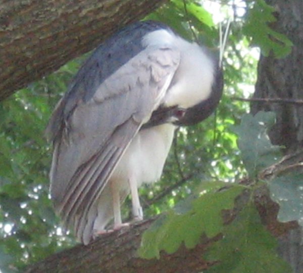
Image: by D. L. Ennis

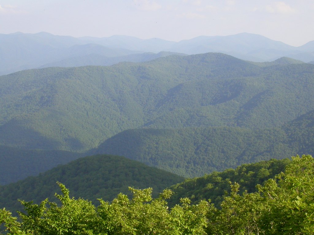
Montebello means “beautiful mountain” and is, still today, a small community inhabited by the typical hardy immigrants who settled the Blue Ridge Mountains in the late 1700’s. The community, located in Nelson County, Virginia, is nestled within the scenic beauty that is indisputable in this region of the United States.

In the mid to late 1970’s I spent quite a bit of time in the Montebello area, living among the area's native people and the many “gypsy” like construction workers (back then they were called hippies) who had come to the area to work at the new Wintergreen Resort that was being built nearby.

This quaint little community has changed very little since my time there with the exception of the post office, which in the Seventies resembled an outhouse, but is now an approximant 15’x20’ brick building. Still, as it has been since the 1800s, the most important man made structure in Montebello is the country store.

The country store is now at the center of the Montebello Camping & Fishing Resort. In the 1800s the country store was the Montebello mercantile owned and operated by Richard and Dolly Cash Seaman. The Seaman’s daughter Flora married Handsford Grant of Irish Creek, (just across the mountain in Rockbridge County) a farmer and timber man.

Flora and Handsford had five children and lived in the Irish Creek area for a while in a large white house. Flora was an enterprising lady of many talents. She not only delivered babies but delivered mail by horseback at Irish Creek.

In the thirties, Hansford and Flora bought the store and the two-story white house next door from her parents, Richard and Dolly Seaman. Flora, as a second generation, mostly ran the store but when she taught school at Fork Mountain, Handsford and her Uncle, Sam Cash, took over.
The late Henry Campbell said he remembered how good Flora was to the mountain people. She helped them to read and write their correspondence, advised them when they had to go to court, etc. Madeline Grant, her daughter-in-law, said Flora kept a running account for the mountain people who needed it during the depression. Most of them paid her when they could but some never did.

Flora was the more social one of the couple. She kept abreast of what was going on the community. Social activities often were centered on the vicinity of the store; like Sunday afternoon ball games and tent revivals.

After Flora and Hansford died the store was closed for a period. When Wilson, their son, retired from the Blue Ridge Parkway Service, he and Madeline, Wilson’s wife, moved back to Montebello to be near their children.

Wilson and Madeline helped their son, Charles open the Montebello Campground and more space was added to the original Grant store. They welcomed campers and served neighbors for over 20 years. When Wilson’s health deteriorated, Charles and his wife, Vicki, took over the store again and remodeled. Madeline still helps in the store which is a wonderful coming together of old and new. Montebello has been richer for having four generations of the Grant and Seaman family live and serve in Nelson County.
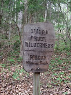
Things to do:

There is plenty for visitors to do in the Montebello area of Nelson County. One of the most visited and also billed as the tallest, waterfalls is in the area. Crabtree Falls, the highest vertical-drop cascading waterfall east of the Mississippi River features a series of five major cascades and a number of smaller ones that fall a total distance of 1,200 feet (The name "Crabtree" is thought to have come from William Crabtree, who settled in the area in 1777.)

The land at the base of the falls was almost developed as a resort area in the late 1960s, but the residents of Nelson County encouraged the Forest Service to acquire the falls so it could be enjoyed freely by future generations. Money was secured from Congress to purchase the land and improve the safety and accessibility of the area around the falls.

The nearby Wintergreen Resort offers a host of year around activities from winter skiing and snowboarding to tennis and golf year round.

The 
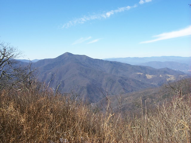
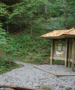
Appalachian Trail runs through Montebello and from there you can take a 1.3 mile moderately strenuous hike from the Montebello Fish Hatchery up to the Appalachian Trail and to Spy Rock; which probably offers the best viewpoint in the central Blue Ridge. The rock outcrop, at 3,980 feet elevation, provides a 360 degree panoramic view of numerous mountain summits. There is a small parking lot, for hikers, available beyond the hatchery buildings.

There are many historical attractions all within an easy driving distance of Montebello. You may want to visit Ash Lawn; the home of James Monroe; or Monticello; home of Thomas Jefferson. The Oak Ridge Estate is the largest private estate in Virginia and there is 
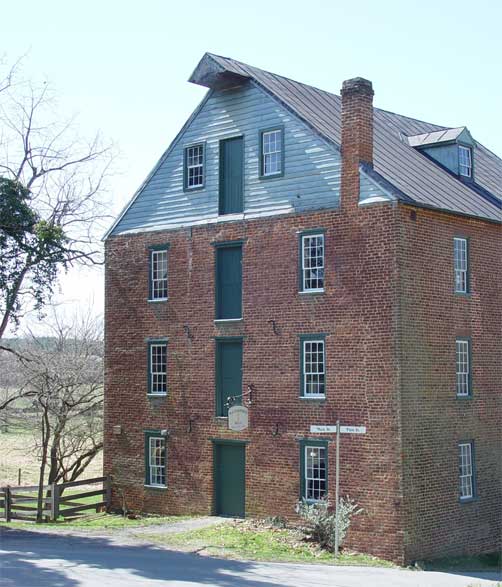
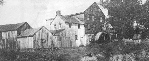
Wades' Mill; a working flour mill, c. 1750. Also, you can visit Walton's Mountain Museum; located in the old Schuyler Elementary School across the street from the boyhood home of Earl Hamner.

You can pick your own fresh fruit in season at Dickie Brothers Orchard, Drumheller's Orchard or Fitzgerald's Orchard, all family owned orchards.

If you like visiting wineries there is Afton Mountain Vineyards where you can taste award-winning wines, tour the cave and experience the beauty of the Blue Ridge and, they have gourmet picnic foods and picnic facilities available. Hill Top Berry Farm & Winery is a small family farm & winery featuring "true to the fruit" Virginia wines.

Mountain Cove Vineyards and Winegarden is Virginia's oldest continuously operating winery. There is Rockbridge Vineyard which is located in the historic and beautiful countryside of Rockbridge County and produces fine Virginia wines, which have won many awards in national and state competitions. Veritas Winery is nestled in the foothills of the Blue Ridge Mountains with a recently planted 20-acre vineyard that is ideally located on southeast facing slopes. Then there is the Wintergreen Winery, where you can experience renowned hospitality and award-winning wines while soaking in panoramic mountain views at this family owned and operated winery and vineyards.

Places to stay:

If you are a camper you can stay right in the heart of Montebello at Montebello Camping & Fishing Resort. Their campground has sites available for tent camping as well as campers, RVs and trailers needing full hook-ups. They also have cabins for rent featuring beautiful views of the mountains on their private lake. They have a pavilion that can be used for church retreats, family reunions or other group events. The Country Store has a full line of groceries including ice, gas and camping supplies. The lake has several fishing docks and a beach area where campers can swim. They also have paddle boats and kayaks for rent on the lake. Each campsite has a picnic table and fire ring. Pets are welcome, but must be kept on a leash. Located in Montebello, Virginia 24464 (540) 377-2650

If it is a Bed and Breakfast that you prefer there are many in the area all offering an experience, unique to the area. The Dutch Haus is one B&B and is a log house combining Dutch and Pennsylvania German cultures. They are located just 3 miles from the Blue Ridge Parkway at milepost 27, 2.5 miles from the Appalachian Trail and are surrounded by the George Washington National Forest. Here you can relax in comfort and quiet seclusion and as the weather turns cooler, curl up by the stone fireplace in the living room with its open beam ceiling and large picture window. You will enjoy their glass enclosed porch and dining area overlooking the forest while watching the squirrels, chipmunks, hummingbirds, and other wildlife. On their front porch swing or rocking chairs, you will see rabbits or deer as evening approaches and after a mountain sunset view the brilliant night sky, unaffected by light pollution.

Another B&B you may enjoy is Humming Frog Lodge in Montebello, just off the Blue Ridge Parkway, the Humming Frog Lodge offers 5 acres of scenic grounds including four ponds, a grand flagstone fireplace, hot tub, and more. It is cozy enough for that romantic getaway, yet sleeps 8 people for the family gathering.

Montebello resides in a beautiful and historic area with many other things to do, nearby places to visit, and other wonderful places to stay. If you are looking for a getaway in the Blue Ridge Mountains of Virginia make Montebello one of your stops!

Montebello is located on Route 56 in Nelson County, Virginia, not far from the Blue Ridge Parkway.

Tuesday, June 06, 2006

Lynchburg, Virginia in 1816

This article appeared in the Lynchburg Press on 6 August 1816. The following description of Lynchburg was submitted to the publishers of an American gazetteer in Baltimore.


Gentlemen:

Lynchburg is situated on the South bank of the James River, about twenty miles below the great falls, over which the said river majestically rushes in it[s] descent thro the lofty mountains of the Blue Ridge; lays 37º, 30, 26 North Latitude, 2º, 20, West Longitude, from the meridian of Washington; happily enjoying by means of batteau, a navigable communication with the waters of the ocean itself. It was established by an act of the General Assembly of Virginia, in 1786; incorporated in 1805; its present extent is nearly about a mile square; lays in the 6th climate; the state of weather is frequently very variable; its longest days are about 14 hours and 20 minutes.

In the vicinity are four mineral springs; the face of the surrounding country appears hilly, and mountainous; abounding in fertile valleys, rich pasturage; in many places at no great depth under the surface, plenty of iron ore is to be found. Its present population is estimated at 3,100, with about 344 principal dwelling houses, as also a vast number of other houses of inferior grade, of all descriptions, enjoying the benefits of two regular established chartered banks, or monied institutions; one being a branch of the Farmers Bank, the other a branch of the Virginia Bank; with a regular established line of public stages between it and the Capital of the State, twice a week; one Friends' Meeting-house, in the vicinity, of more than 60 years standing, one Methodist Church, one Presbyterian Church, one Baptist Society, one Court-house, in which are held a branch of the high court of Chancery, and the Corporation Court, one prison, one large Market-house, one fire engine, one Mason's Hall, one toll bridge over the James River, adjacent to the town, 630 feet in length, 24 in width, erected on eleven stone pillars, exclusive of the abutments, 32 feet by 16 base, 50 by 12 at the top, 22 high at low water, producing weekly, upon an average, about $100. 7 public tobacco warehouses, in which have usually inspected, from 10 to 12,000 hogsheads of tobacco, per annum; three flour manufacturing mills, in the vicinity, upon large and extensive scales; one paper mill, one carding machine, three cotton & woolen manufactories, the neighboring counties of Campbell, Amherst and Bedford; about 6 miles east by south near the south bank of the James River, is situated that valuable and extensive Oxford Iron Works establishment, the property of David Ross, Esq.

There are in the town at present:
34 dry good stores
22 groceries
4 commission merchants
4 apothecary shops
4 saddler's shops
3 cabinet makers' shops
3 chair makers' shops
3 wheel-wrights' shops
10 milliners' and mantua makers' shops
3 curriers' shops
5 black smiths' shops
4 silversmiths' shops
2 tinners' shops
4 tailors' shops
3 shoe and bootmakers' shops
2 tallow chandlers' shops
3 tanyards
a number of weaving looms
1 vendue [auction] office
1 postoffice
2 printing presses, which issue a weekly and the other two weekly newspapers 2 bookstores
1 circulating library
2 hatters' shops

besides a vast number of carpenters, stone masons, and brick layers. Of these tradesmen, upwards of 1,100 of them, including their attendants, were employed in erecting buildings last year

6 taverns, besides a number of private places of entertainment
2 tobacco manufactories
5 coppers' shops
1 public female academy of considerable grade; 3 others of lesser note
1 Lancasterian school
3 other literary institutions, in which the classics, the sciences, and natural philosophy, etc., are taught.

In the vicinity, some excellent marble quarries have lately been discovered; as also one of black lead. Water is collected from a variety of springs, brought from a considerable distance, and conveyed through the town in wooden pipes of several miles in length, for the use of the fire engine and such of the inhabitants as choose to prefer it.

The commercial intercourse between Lynchburg and the adjacent counties, back settlements of Virginia, and the states Western of it, are carried on in the following articles, viz., tobacco, wheat, flour, hemp, butter, peach and apple brandy, whiskey, cider, bar iron, lead in pigs and bars; large quantities of hempen linen, linseed oil, tar, turpentine, and a considerable number of beef cattle, from the back counties, a very respectable amount in the way of raw cotton, from the Carolinas; vast quantities of live hogs, brought in the fall of the year, from Ohio, Kentucky, Tennessee, Carolina, and the back counties of Virginia; and all the other valuable productions, of a fertile & extensive back country, inhabited by an ingenious, industrious, and independent race of men. Richmond is the depot of all the rich and extensive products passing from Lynchburg for foreign markets, chiefly in consequence of their batteau, descending the river no further; the merchants of Lynchburg trade chiefly to and from New York, Philadelphia, Baltimore, Norfolk, and Richmond.

Source: Lynchburg Historic Foundation

Hugh MacRae Morton


A few weeks ago I posted a story of the highest peak in the Blue Ridge otherwise known as Grandfather Mountain near Linville North Carolina. Sadly, the owner of this wonderful treasure has passed away after a six month battle with cancer. This truly has left a deep hole in my heart and I know in the hearts of many who knew him.

Hugh Morton Morton built the Mile High Swinging Bridge and opened the Western North Carolina travel attraction in 1952 after inheriting the Mountain from his grandfather. Morton was instrumental in opening the eyes of many to the natural world by preserving the mountain and not allowing development and poor planning to consume the beauty that is Grandfather Mountain. He was one of the few people to ever fight the Federal Government and won when engineers wanted to build the Blue Ridge Parkway across Grandfather Mountain at 5,000 feet above sea level with a tunnel at the highest point, Morton forced a compromise that resulted in the building of the Linn Cove Viaduct. As a conservationist Morton donated 1766 acres of scenic easements to the North Carolina Nature Conservancy which protected Grandfather Mountain's wilderness backcountry for posterity. The Conservancy now owns or manages more than 4,000 acres of Grandfather Mountain. (above photo from GFM website)

You may also find photos of my wife and I on one of our many adventures to this mountain on our website.

Morton will also be remembered as a world class photographer. His photos were first published in Time magazine 70 years ago and he has been published in every major national magazine since. In 2004 Morton published a book of his photographs titled Hugh Morton's North Carolina. A second book is due out this fall.

As mentioned in the previous article, Grandfather is the home of the Highland Games as well as several other events and workshops that are held throughout the year. If you have one ounce of Scottish or Irish blood in you and have not yet been to this festival, I only have one thing to say to you....What are you waiting for? Make this the year that you go to the games and enjoy a weekend filled with music, traditional foods and laughter. No more excuses! Go!

Morton's many other accomomplishments include chairing Western North Carolina Tomorrow from 1981 to 1983. This the same mountain leadership organization that secured passage of the Ridge Law to protect the state's highest peaks. In 1995-1996 the North Carolina Year of the Mountains Commission, with Morton as Chair, launched the ongoing effort to protect the scenic view-shed of the Blue Ridge Parkway by purchasing or negotiating scenic easements from landholders whose property borders the parkway.

The photo's that Hugh MacRae Morton shot over his lifetime will forever be thought of as frozen treasures that hold a moment in the lifetime of a man who loved nature and knew how to keep it preserved in both print form and real life. The photo to the right is the last shot taken by Morton on May 20th 2006 from our friends at the GFM.

Thank you Hugh MacRae Morton for showing us all how to respect, preserve, share and love this wonderful region of the Blue Ridge Mountains. I wish I could repay you for all you have done for the preservation of culture, heritage and nature. You will be missed.