In the Black Mountains, Celo Knob
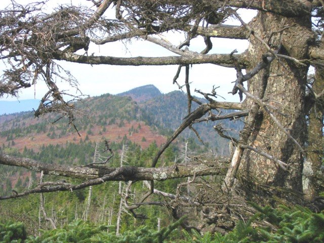
Image: by, Bob Smith, Gibbs Mountain and Celo Knob (most prominent) from Winter Star.
Located in the Black Mountains area of Pisgah National Forest, just north of Mount Mitchell State Park, North Carolina, Celo Knob is a great example of a high-elevation mountain forest. Elevations vary from 3,200 feet to 6,327-foot Celo Knob, a local landmark. Because of its rugged topography, much of Celo Knob is inaccessible. This area contains old-growth boreal forest, northern hardwood and cove hardwood forest, dry ridges and heath balds, and one of the most extensive examples of red spruce/Fraser fir forest in the southern Appalachians. If you visit Celo Knob, you will notice that some of the spruce-fir forest has been damaged by the deadly duo of air pollution and the balsam woolly adelgid, an exotic invasive pest.
This range is home to many plant species that are endangered or rare in the state, including mountain paper birch, fir clubmoss (Threatened and Endangered), Carolina saxifrage, Core’s starwort, red raspberry, and roseroot. Some of the uncommon fauna that inhabit the area are the Carolina northern flying squirrel, northern saw-whet owl, brown creeper, common raven, golden-crowned kinglet, red-breasted nuthatch, and New England cottontail. Several rugged trails run through the area. While hiking you may see remnants of mica mines in various stages of recovery.
The Nature Conservancy purchased this tract from the Briggs family in 1978 and transferred it to the U.S. Forest Service.
DIRECTIONS:
Head south from Burnsville on Low Gap Road (SR 1109) about two miles. Forest Road 5578 turns left at Bowlens Creek. This rough road leads up to an approximately 5-mile trail to Celo Knob. This trail continues by following the ridgetop south to Horse Rock Ridge and Mount Mitchell, about 12 miles from the Bowlens Creek parking area.
Technorati Tags: [Blue Ridge][Celo Knob][Black Mountains][Pisgah National Forest][Mount Mitchell State Park][North Carolina]
posted by D L Ennis @ 8:43 AM
![]()


0 Comments:
Post a Comment
<< Home